Butrint National Park
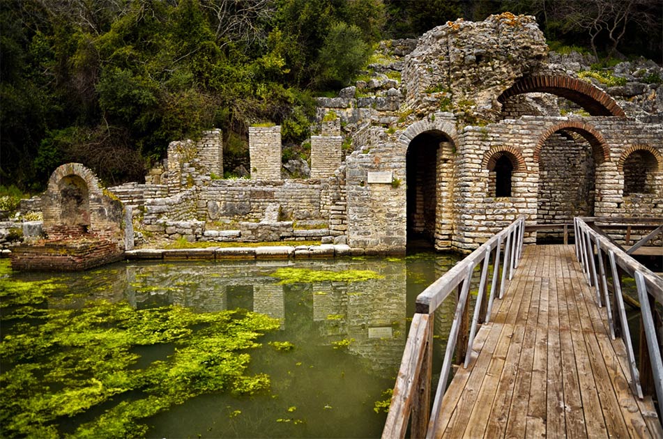
- Butrint National Park is one of the most important areas of our cultural, archaeological, environmental and tourist heritage of the country. The heart of the National Park is the Ancient City of Butrint, whose existence continued uninterrupted, from the prehistoric period to the Middle Ages, thus offering a variety of cultures and historical periods. Due to its high historical and cultural values, the ancient city of Butrint was initially selected as a Cultural Monument in 1948, in the law of Cultural Monuments of Albania. Whereas, in 1981 the Butrint forest was described by Albanian laws in conservation for the importance of the environment. In 1992, Butrint was recognized as the first archaeological site of the Republic of Albania in the UNESCO World Heritage List. Due to the civil unrest of 1997, the World Heritage Committee in December this year included Butrint on the World Heritage List at Risk. In July 1999, the Ministry of Culture applied to UNESCO for the expansion of the site, which was approved at the end of the year by the World Heritage Committee, which includes Butrint Bay. In 2000 Butrint was declared a National Park in state protection of the Butrint archeological site and UNESCO officially expanded the area from 20 ha which had previously been to 29 km². After a long and evaluative work by the Park and its collaborators in August 2005 the World Heritage Committee decided to remove Butrint from the World Heritage List at Risk. In November 2005 the Council of Ministers decided to expand Butrint National Park to 86 km². The boundaries of the Butrint National Park are: North: The connecting line Berdenesh-Kallmit-Qenuri, which passes through the agricultural lands of Vurg; East: Qenuri-Xarrë connecting line, passing through the ridge of Miles mountain; South: Xarrë-Shëndëlli-Vrinë connecting line, up to Stillo; To the West: The connecting line from Berdenesh to the state border with the Hellenic Republic, including the Ksamil Islands.
For more: http://cultureticketsalbania.al/tour-item/parku-kombetar-i-butrintit/
Apolonia Archaeological Park
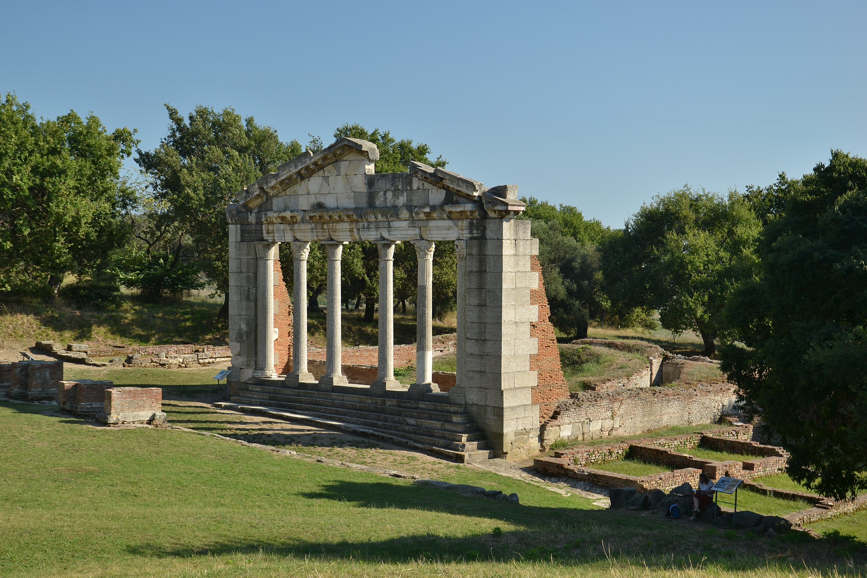
- Apollonia is located 12 kilometers away from the city of Fier. Apollonia as a city was founded in the early seventh century BC in the lands of the Illyrian Taulantians by Greek colonizers coming from Corinth. The first records of their presence are documented around 620 BC. The city was named after the god Apollo. Among the 24 cities throughout the Mediterranean that bore this name in Antiquity, Apollonia of Illyria was the most important and played a major role as a trade intermediary between the Hellenes and the Illyrians. Apollonia was at that time a large and important city near the river Aoos (Vjosa). It is estimated that the city had about 60,000 inhabitants, a record figure for Antiquity! Apollonia retained its grandeur even in the Roman period. The Apollonian School of Fine Arts was famous throughout the ancient world. At the time when Julius Caesar was assassinated in Rome during a plot in the Senate, his nephew Octavian Augustus was studying oratory in Apollo. Roman chronicles show how, upon hearing the news of Caesar’s murder, he set sail from Apollonia, and when, after some time, Octavian himself became Emperor, he retained gratitude for the city where he had studied, freeing Apollonia from all taxes. After an earthquake in the century. III B.C the river Aoos changes bed by separating the city from the sea. The blow proved fatal in an era where all commercial activity took place in relation to the sea. The city gradually lost its economic importance by becoming a simple religious center. But the gradual and non-violent extinction of civic life as well as the transformation of the surrounding area into a swamp, reclaimed only after 1945, made the archaeological site quite well preserved. Archaeologists call Apollonia Pompeii of Albania, as only 10% of the territory of the former city has been discovered to date. The large territory covered with monuments, wonderful panoramas and landscapes over the plain of Myzeqe and the Adriatic Sea, the road in very good condition, the favorable geographical position near the main cities and the southern beaches make the Apollonia Archaeological Park a privileged destination for cultural tourism in Albania.
For more: http://cultureticketsalbania.al/tour-item/parku-arkeologjik-apolloni/
Bylis Archaeological Park
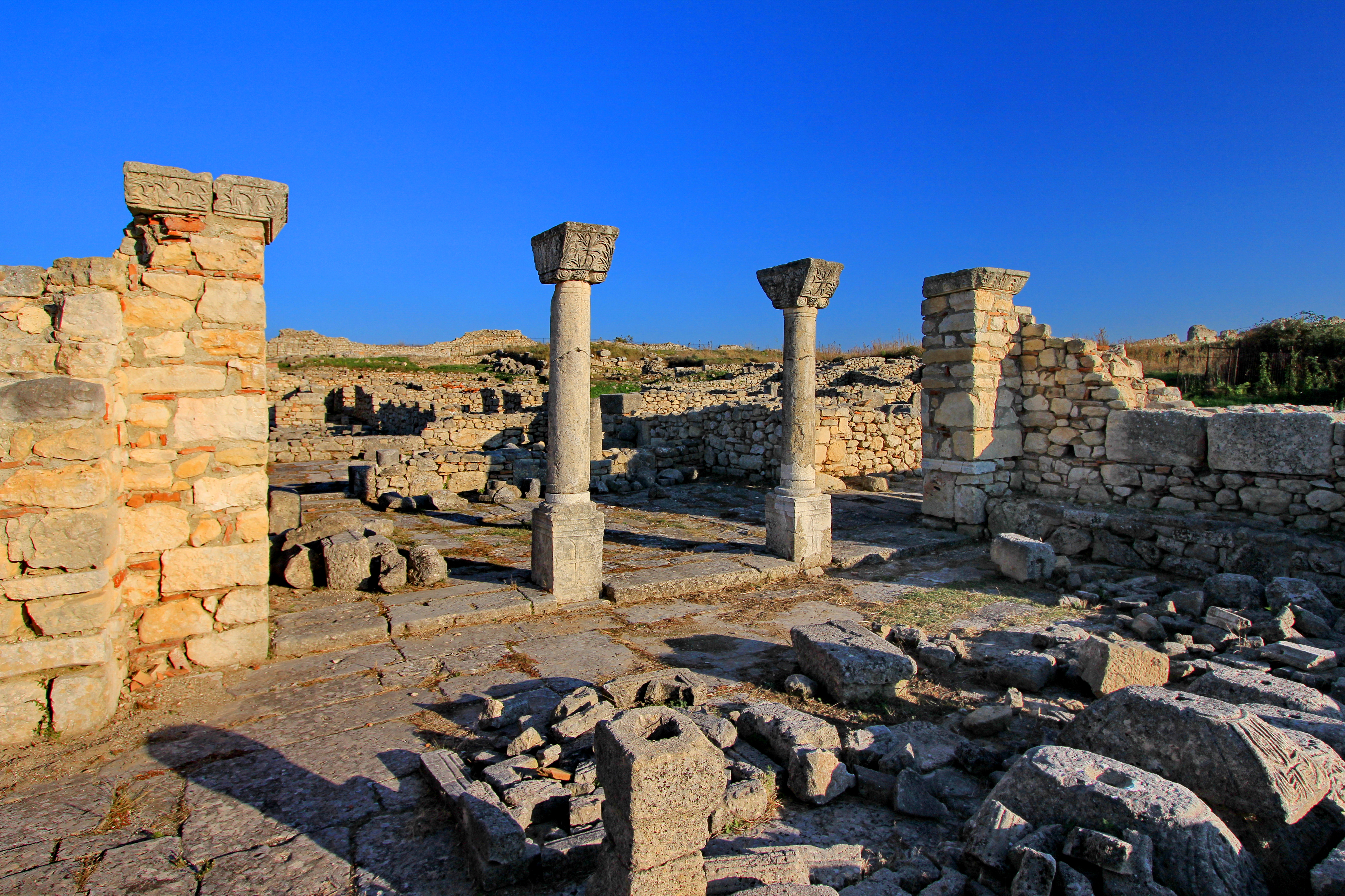
- Bylis Archaeological Park is one of the unique sites in Albania, for the high density of mosaic monuments. The archeological park has published several photos, among them the mosaic of late antiquity IV – V century AD. The Illyrian town of Bylis, located on a plateau near the present-day village of Hekal, once lay on an area of 30 ha, which was protected by a perimeter wall 2.2 km long, 3.5 m wide and 8-9 m high, which is still today it is relatively well preserved. The perimeter wall was equipped with numerous entrances and defensive towers. From the 4th century BC (which is also considered the period of foundation) until a century later, some of the most magnificent works of the city were built, which mention the theater, stadium, water tank, various dwellings, the ruins of which can be we encounter them even today. The old Bylis was divided into three zones, and was built according to the architectural plan of Hippodamn. From that splendor of the past, the ruins of the 7500-seat theater stand out, which enable a beautiful journey into the history and architecture of the city. The theater consisted of 40 steps, and today you can still see some stone seats, the retaining walls of the theater or the plinth of the orchestra. The theater is the most important monument of Bylis of the ancient period. Together with the large stoa and the stadium, he defined the architectural composition of the agora around the middle of the 3rd century BC. The southeast corner of the agora was chosen for the construction of the theater, where the immediate elevation of the terrain provided the opportunity to use the slope for the construction of stairs. Even from the stadium of Bylis we can see 19 stone stairs, which make after Amantias the second most maintained stadium from antiquity in Albania. In addition to important public facilities, the city had its own pottery, construction, sculpture, metalworking workshops as well as its own coin-cutting workshop. During the 5th century AD, several churches began to be built, the ruins of which today constitute some of the most important early Christian evidence in Albania. To date, several have been discovered, both inside and outside the city walls.
Shkodra Archaeological Park

- Shkodra Archaeological Park has an area of about 70 ha. “Rozafa” Castle, with an area of 3.6 ha and a perimeter of surrounding walls of 881 m, is the most important building of the Park. It dominates on a rocky hill between the rivers Drin and Buna, at the southeastern entrance of the city of Shkodra. The history of the construction of Rozafa Castle has gone through several stages. Its ancient traces, the technique of walls with polygonal blocks, are preserved near the main entrance and date back to the 15th century. IV B.C. The castle had an important role as an Illyrian fortified center during the period of King Ilir Genti in the middle of the century. II B.C. The Roman historian Titus Livy called Shkodra the most fortified place of the Illyrian tribe of Labeates. In the Middle Ages the castle is known as Rozafa, which must have taken there in the middle of the century. V-VIs. Among the most prominent monumental and historical objects of the castle we single out: Barbakan at the entrance of the Castle (XV century), the Church of St. Stephen built in the century. XIII which after the Ottoman conquest was transformed into a mosque, as well as the Captaincy of the Venetian period that today serves as the Museum of the Castle. The castle was eventually abandoned in 1865 by the city administration. In 2010 a re-evaluation of the archaeological area was made and 2 areas were identified, A and B, according to importance which were approved together with the relevant regulation by DCM No. 429, dt. 28.4.2010 “On the proclamation of the Archaeological Zone” A “and” B “of the city of Shkodra and the approval of the administration regulation”. The administration regulation clearly gives the forms of cooperation and the roles of the institutions in charge of protection, restoration and good administration of the values of this area.
Lezha Archaeological Park

- Lezha Archaeological Park is located in the eastern part of the city of the same name. Lisi (Ancient Lezha), built on a hill, had a strategic position that controlled the Drini valley up to the Bay of St. Gjin in the Adriatic Sea. It testifies to the traces of an ancient prehistoric civilization as early as the 19th century. IV B.C. and was the most fortified city of Illyria, with a large number of defensive towers. The castle of the ancient city of Lezha is surrounded by walls of different periods that follow from antiquity IV century BC. These are strong walls with large stone blocks. The first reconstruction of the castle dates back to the century. I B.C. Later in the century. XI-XII in the part of the acropolis of the city is built the medieval castle of Lezha – Elission, with small carved stones and mortar. This fortress was fortified to withstand the invasions of the first Slavic states coming from the north. In the century. III BC, Lisi becomes the starting point of the attacks of the military fleet of the Illyrian queen Teuta. Later Lisi was conquered by Philip V of Macedonia, by the Byzantine Romans. With the dissolution of the Byzantine Empire, Lezha is the city of the principality of Arbër and in 1281 it is the capital of the Dukagjini family. Later, the Venetians, taking the city of Lezha, rebuilt the fortifications of the city. On March 2, 1444 Gjergj Kastrioti Skënderbeu organized in Lezha the assembly of Albanian princes, known as the “Covenant of Lezha”. After the death of Gj. Kastriot Skanderbeg on January 17, 1468, who was buried in the church of Shënkol (today his memorial), Lezha falls under Venetian rule and later, Ottoman. Lezha, this ancient city that reflects all the stages of development, rise and fall of the empires that have ruled this region, with the medieval castle that dominates the entire area up to the Adriatic Sea and numerous archeological sites, cult monuments and historical evidence, is a destination attractive for cultural tourism.
Amantia Archaeological Park
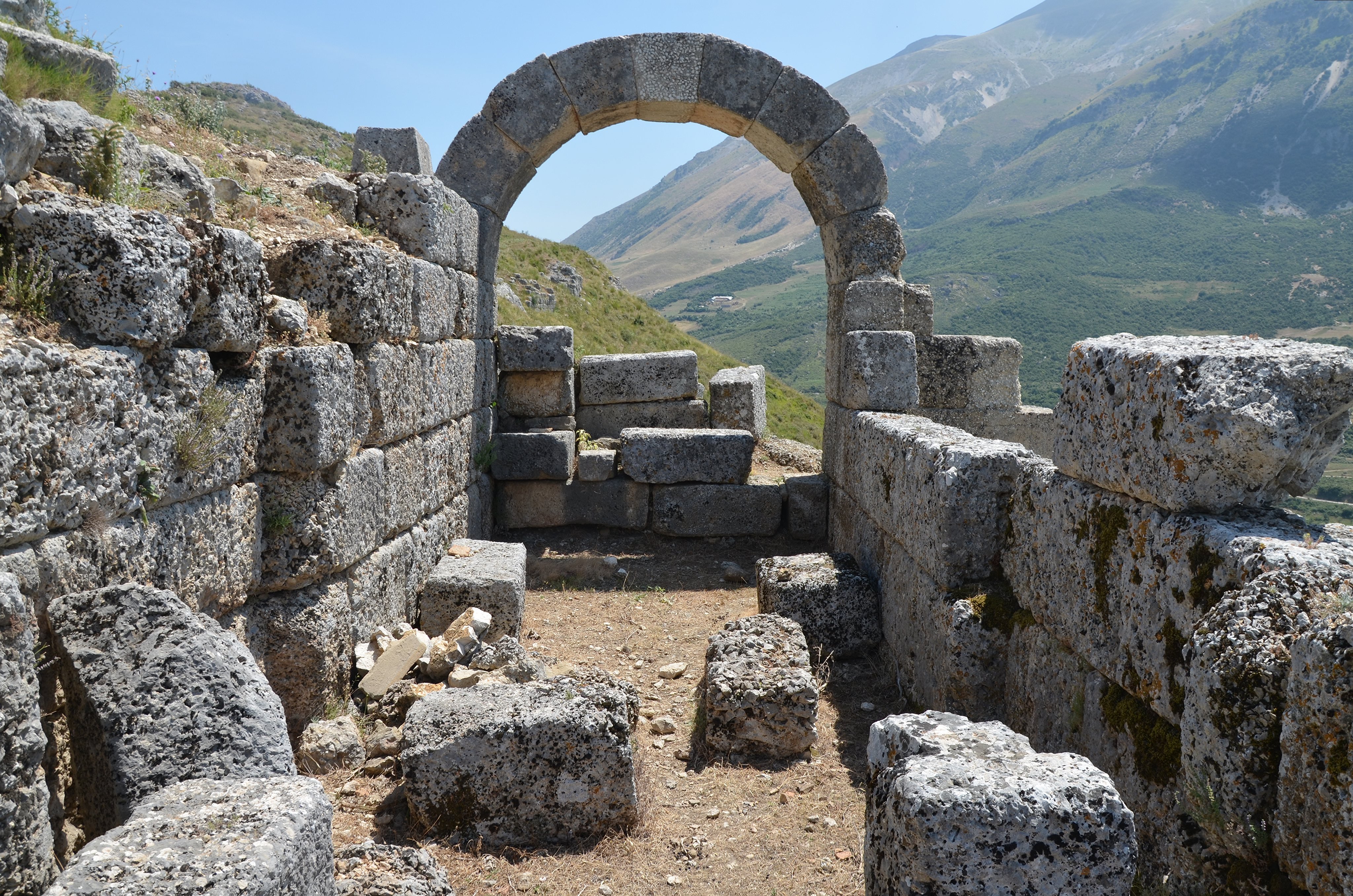
- Amantia Archaeological Park is located 34 km from the coastal city of Vlora. Itinerary: The road to the Amantia Archaeological Park, crosses the valley of the river Shushica and villages of this province: Vlora-Qishëbardhë-Drashovicë-Kotë-Vajzë-Ploçë. The connecting road penetrates to the villages of the Kudhës-Gërhot area. The ancient city of Amantia is located on the ridge of a hill between two peaks, at the foot of a range of hills. This early Illyrian center is today located in 15 ha of the Archaeological Park of Amantia. Born and flourishing in 10 centuries in constant change and enrichment, the epicenter of civilization is in a hilly area located at an altitude of 613 m above sea level. At this point is positioned the highest hill where the ruins of the ancient city begin, undergoing stretching in time through the squares and terraces. The hill where the Illyrian city of Amantia lived for 1 thousand years has a cone shape. It is separated from the range, and crossed by a stream. The ancient city of Amantia is located on a hill between the two rivers Vjosa and Shushica with an extension to the sea.
Orikum Archaeological Park
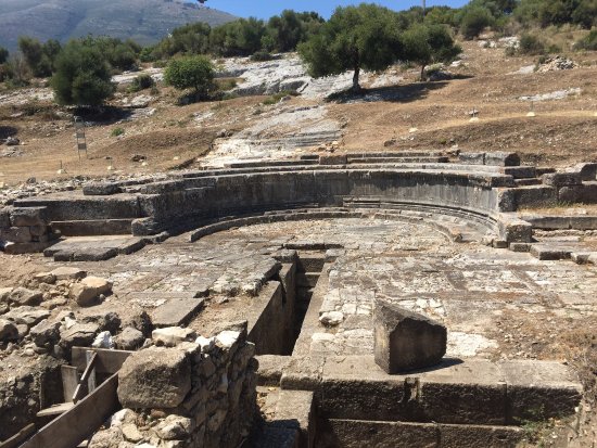
- The ancient city of Orik is located south of the bay of Vlora, on a low limestone hill called Paleokastra. The opinion of Albanian scholars is that Orik appears to have been founded by the Corinthians in 558 BC, almost at the same time as Apollonia. Starting from the century. II p.e.s. Orik is involved in all the conflicts between Macedonia and Rome and during the Ottoman period he was called Pasha Liman. Currently, only a small percentage of the ancient city has been discovered, archeological excavations continue and it is easily accessible via the Vlora-Orikum highway. Orikumi is one of the most important sites on the Adriatic coast, both historically, archaeologically and naturally. According to archeological data, the ancient city of Orik is founded in the middle of the century. VI p. Kr, while in historical sources it is mentioned that in the century. V B.C by Herodotus and Hecataeus of Miletus, as one of the most protected and important harbors of Epirus. In the century. III B.C, Oriku gets the full physiognomy of an urban center. Most of the internal infrastructure, including stairs, foundations of buildings, canals and cisterns for water storage is built on the natural rock of the hill. Public monuments are also built in this period. In historical sources it is a city mentioned for its importance in the battles between Macedonia and Rome at the end of the century. III p. Kr, as well as in the civil war between Caesar and Pompey in 48 p. Kr. Caesar in his memoirs of the Civil War describes Orik, as a well fortified city, with strong walls and several entrances equipped with towers. In the Ottoman period it served as a base for the navy, while after the Second World War the territory where the ancient city is part was isolated, as it was part of the territory of the Pashaliman Naval Base. In 2005, due to its historical, archeological and environmental values, the ruins of the ancient city of Orik were declared a National Archaeological Park. Archaeological ruins in Orikum have attracted the attention of foreign travelers since the beginning of the twentieth century, but genuine archaeological excavations began in 1958 by an Albanian-Soviet expedition led by Dh. Budina and N. Kabilina. These excavations covered an area of 400 m2 and discovered a monument in the form of an ax which was interpreted as a theater and some stairs carved in the rock that constitute the main element to understand the urban organization. It is an atypical square-shaped monument that is a unique example for the whole ancient world, dating back to the century. III-II p.kr. All the historical, architectural elements and the unique landscape where the site is located, between the lagoon, the sea and the Karaburun peninsula, as well as the archeological elements that follow from the excavations make this archeological park one of the most interesting to visit. It was an ancient city, today it is a National Archaeological Park.
Finiq Archaeological Park
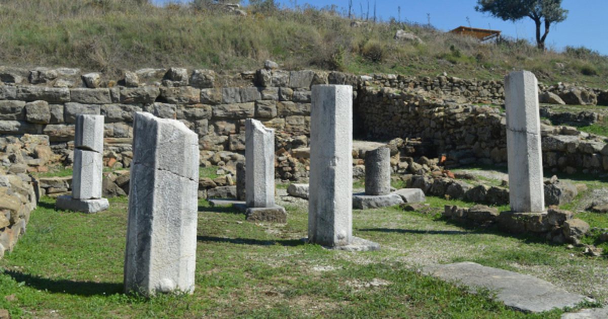
- The very large space of the theater, of about 17,000 seats located in the middle of the hill with the opening in the direction of the monastery of the Forty Saints served at that time as a meeting place of the “Epirote Public around Finiq”, in which decisions were made democratically for peace or war or consideration of matters. At that time power was exercised by three generals, one of whom was the representative of power, ipparxos, the second secretary of the Assembly and the third guarantor, coming from the three tribes: the Molossians, the Kaons and the Thesprotians. All of them were elected for a one-year term by the assembly. The place of worship of Finiq was Dodoni. The theater was rebuilt three times, after excavations revealed three different constructions. The first stage belongs to the beginning of the IV century BC. The building material is local especially the stage stone came from the same hill. The second phase of construction belongs to the 3rd century BC. The expansion of the scene was dictated at the moment when Finiqi became the center of Kaonia and the capital of Epirus. The walkways dividing the stairs are technically and carefully placed. The theater that was built at this stage exceeds the dimensions of the Dodon theater, where the diameter of the orchestra is 19.80 meters, while that of Dodon is 19.20 meters, the diameter of the cavity from the center to the top of the stairs is 129.5 meters while that of Dodon is 129 meters. On the stage of the theater were found very large pedestals with footprints on them which also held very large statues of ancient gods or emperors. The ancient city of Phenicia was rapidly fortified in three phases, a fact mentioned by the historian Polivios: the first began with the founding of the city around the 5th century BC and continued until the middle of the 4th century BC, and the second begins in the middle of the 4th century when the development of the whole city culminates and the third coincides with the rapid development of the city and the first minting of the local currency with the inscription “ΦΟΙΝΙΚΑΙΕΩΝ” around the 3rd century BC . The central structural complex of the city was the Acropolis or Agora which is located on the highest level of the hill. The Acropolis played a major social role and preserved it as the downfall of the city. In that place are the most valuable and well-maintained monuments such as the treasures and the basilica. The treasure that was first discovered by Ugolini (1926) served to house the treasure of the city as well as the “Epiriot Public”. Near the treasure that had the shape of the acropolis, the traces of a very large basilica can be clearly seen. History mentions Peregrini “Bishop of Phenicia who represented in 552 Epirus at the IV Ecumenical Conference Valeriano with Emperor Leontos”, Philip in 516 and Eustathion who in 568 transferred the chair to the monastery of Mesopotamia and later to Delvina and the Monastery of Kamena near Kakodhiq. A few meters away from the Basilica there are remains of Christian churches, while in the place called “Palea Avli” survive the ruins of early Christian temples with diverse mosaics. The episcopal temple of Finiq in honor of the name of the Virgin “Zoodochos Pigi” seems from the beginning to have been built on an older basilica and later rebuilt new with the same name in the center of the town located on the slopes of the mountain. Archaeological excavations in Finiq uncovered the characteristic two-peristyle dwelling of the 3rd century BC. The apartment had an almost quadrangular cross section and covers an area of 700 m2. It consists of a large quadrangular courtyard with peristyle, around which are lined several small rooms.
For more: http://bfiniq.gov.al/parku-arkeologjik-i-finiqit/
Antigone Archaeological Park
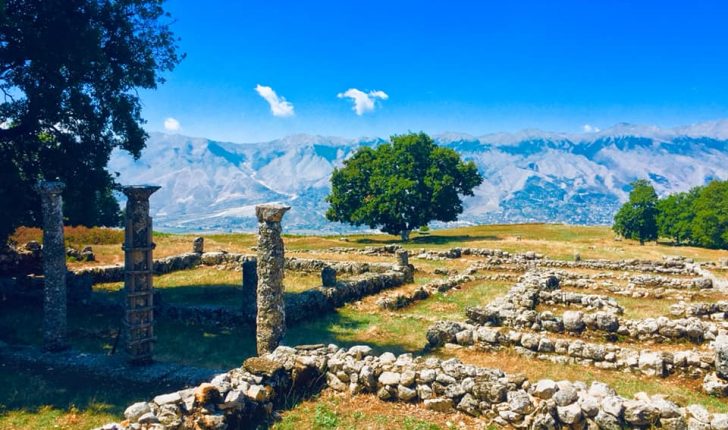
- Antigone Archaeological Park is located near the village of Saraqinishte in the Lunxhëria region, east of Gjirokastra. It is 14 km from Gjirokastra. The archeological park has an area of 92 hectares. Antigone was founded by King Pyrrhus of Epirus in 295 BC, who named the city after his first wife, Antigone. At the end of the 3rd century and the beginning of the 2nd century BC, it grew into an important economic, cultural and political center and took the form of a state (polis). It was walled, 4,000 feet long. There are many attractions to visit in Antigone Archaeological Park such as: mosaics, columns, promenade, antique stairs, surrounding walls, etc. In the village of Labova e Kryqit, located near the small town of Libohova, you can visit one of the oldest and most beautiful Byzantine churches in Albania, dedicated to St. Mary. It is built in a style similar to that of Hagia Sophia in Istanbul. It was thought the church had a relic, which is now missing. It was part of the cross where Christ was crucified.
For more: https://kultura.gov.al/wp-content/uploads/2017/12/Antigonea_mapguide_shqip.pdf

