CULTURAL MONUMENTS AND SITES ACCORDING TO DISTRICTS
1. District of Korça
Korça area
- Korça Old Baazar: The Old Bazaar is a site with early historical, cultural and artistic values. The bazaar features one and two-storey buildings, narrow alleys and a construction style that attracts the visitors’ attention. In past centuries, the bazaar functioned as a market for trade among merchants not only within Albania, but also from Turkey, Greece, Trieste and Venice. It has been noted for the row of inns, including the Old Elbasan and Old Monastery Inn, which served caravansary.
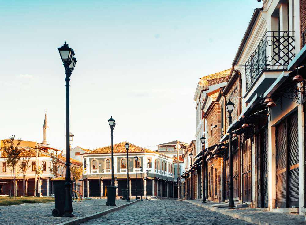
The Old Bazaar is home to an arcade of 33 shopping precincts with around 150 stores. Six of them are inns or guesthouses, namely:
1)Elbasan Inn,
2)Monastery Inn
3)Gjeli Inn,
4)Oparaks Inn,
5) Kico’s Inn
6)the Two-Gate Inn.
The buildings form an architectural ensemble, with coble streets between them.The bazaar buildings are structures with the stone ground floors and brick walls in the second floor. The roofs are covered with locally produced tiles.
- Korça Historic Centre: Korça’s old neighbourhoods are located in the city’s east. The old houses and the cobbled streets make these neighbourhoods an interesting area to visit.
- National Museum of Medieval Art: The National Museum of Medieval Art was opened in 1980. The Museum’s collection features medieval-era historical, cultural and artistic items, mainly related to the Byzantine and post-Byzantine Christian heritage. The museum showcases about 200 artefacts. It houses several examination and conservation laboratories, collection facilities, as well as a modest microclimatic infrastructure.

- National Education Museum: Situated in the city centre, the Museum once was the house of the patriot Diamant Terpo whom gifted it for the first Albanian school or “Mesonjtorja e pare shqipe” called by Albanians, which was opened in 7 march 1887. The museum, among others, holds the copy of the first reading and spelling book written by patriot Naum Veqilarxhi, as well as the second spelling book written by Kostandin Kristoforidhi.
- Archaeological Museum: The museum was established in 1985 and took on a wider and more complete shape after its reorganization in 1990. Housed in two Korça typical houses dating from early 19th century, which have been declared cultural monuments for their architectural values. The museum’s highlights include the prehistory of the south-eastern area, starting from the Neolithic period to the later phase of the Iron Age. Its collection holds around 1.200 artefacts found at prehistoric sites, mainly dating back from Neo-Neolithic, Bronze and Iron Ages.
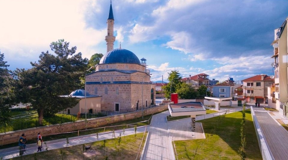
- Iljaz Bey Mirahor Mosque is located near the city’s bazaar in Korça and it is part of a social-cultural building complex.Its construction dates back to 1495 and it has been named after its builder Iljaz Bey Mihrahori. The mosque was originally part of a complex of socio-cultural buildings, that housed included the shrine, the tekke, the monumental tomb of the builder himself, the baths and the annexes of the temple (waqf). At the end of the 19th century and early 20th century, the clock tower was built at the entrance of the complex. The mosque is the first classical Ottoman monument in Albania and the oldest of the dome hall type in our country. The mosque has undergone restoration thrice after its construction, namely in the 16th and 19th centuries (1562, 1831, 1887). The mosque features and prayer hall and the vestibule, which is divided into three parts.The prayer hall has a square design and is covered with a hemispherical dome over trumpet archers in the corners, appearing in their full shape for the first time in our country. On the south wall is preserved the mihrab decorated like nike with stalactites and next to it the pulpit. On the north side there is a straight mafil, accessible through the minaret stairs. The hall has a unique interior space, which is illuminated by a large number of windows located on the side walls and the 8-sided trumpet arch. The mosque walls were built with the cloisonné technique with two rows of horizontal bricks and two vertical bricks, a technical used in the period before the Ottoman invasion. Between the bricks there are thinly plastered mortar stones to create a flat surface. Thus between the stones and bricks there are elaborate joints which testifies not only to high demands from the customer but also to good construction skills of local craftsmen.
- The House Museum of painter Vangjush Mio: The house museum of the Korca impressionist painter Vangjush Mio was declared a cultural monument and it holds 40 oil paintings, landscapes and many nature morte paintings. Vangjush Mio was known as a painter of landscapes, and is the first Albanian painter who opened the first exhibition in Tirana in 1920, and he opened a personal exhibition in Bari in 1942.
- Kamenica Tumulus: The Kamenica Tumulus is one of the largest known to date. It contains 400 graves and more than 3500 artefacts have been unearthed in this archaeological site. The Kamenica Tumulus is situated in south-easternmost tip of Korça. Like other ancient burial mounds in the region, the site is situated on the first strip of the terrace created between the plain and the hilly ring around it. The territory around the Kamenica Tumulus contains several other smaller mounds, already almost completely damaged. Despite the existing traces of settlements in various eras, a settlement comparable to the size of the social group represented in the Kamenica tumulus cemetery has not yet been identified. The nearest known settlement so far is that of “Belodova Castle”.As one of the most representative prehistoric monuments and the largest of its kind in the Albanian territory, the Kamenica Tumulus is the cemetery of a rural community that has served as such for more than seven centuries (from the Late Bronze Age, around the 20th century), 13th BC to the Iron Age around the middle of the 6th century BC). The site was unearthed in the early 2000s by the Archaeology Survival Group of the International Center for Albanian Archaeology in collaboration with the Archaeological Institute, Tirana.Ceramic wares are the most typical objects found in graves. The most represented forms are scales, amphorae, cups, etc. Other objects discovered during the excavations are represented by many categories of metal objects (bronze, iron, gold), bone, glass or stone. The highlights include a large number of types of long needles, semicircular and arched fibulae, pendants, tiaras, bracelets, beads, etc.
- Holy Resurrection Church belongs to cross-in-square architectural style. It features a square centre with an internal structure shaped like a cross, topped by a dome. The donor inscription dates its construction to the XIV century. The church’s interior is decorated with murals, which stand out for the perfect execution, harmonious composition and masterful use of colours and carries typical features of the late paleological period. The stylistic and historical analysis attributes the work to the same anonymous painters, who were engaged in the decoration of the church of St. Mary in Maligrad, St. Athanasius in Kostur, etc. Along with the paintings of the XIV century, paintings from a later period are preserved in the porch of the church, describing the scenes from the Apocalypse of John and are thought to have been painted by the Albanian painter known as Teacher Kostandin.
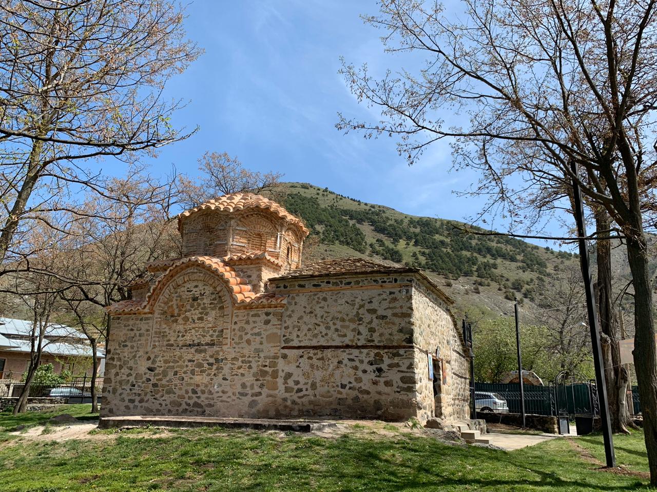
- Demetrius’ Church in Boboshticë is a one-nave church with an apse recently covered by a double roof. The church’s interior is decorated with mural dating back from two various eras. The first layer dates back to the last quarter of the XIV century, whilst the second between the XVII – XVIII centuries. The painting shows stylistic and iconographic parables with the church of Resurrection in Mborje, not only because it is the nearest church in geographical terms, but also because it is the foundation of the same group of donors and the work of the same studio of painters.
- John’s Church is a one-nave structure of medium size, consisting of a nave and a later enclosed porch on the west side. The nave has a rectangular plan and originally in was bounded by the altar area via a wooden iconostasis. The altar area consists of an apse, three-sided externally and rounded internally, and prosthetic and deacon niches.The floor of the church is paved with bricks, surrounded by pebble stone patterns. The church’s interior is decorated with murals of a high artistic quality, which represent the most complete cycle of the life of St. John the Baptist, as well as other New Testament-inspired images. They are classified as post-Byzantine paintings.
- Village of Voskopojë (Historic Centre): This is little village was once a cosmopolitan cultural and developed center founded in 1330, home to an array of religious and cultural sites and scenery landscape suitable for development of mountainous tourism. A skiing slope is available during winter and it hosts a number of local and regional winter sports tournaments. It is one of the rarest winter sports destinations.
- John the Baptist’s Monastery in Voskopojë: The St. John the Baptist’s Church and Monastery is an important monument, not only for its historical values as a XVII century building and as a reflection of the cultural and economic prosperity of Voskopojë, but also for its architectural values. It is a three-aisled Byzantine style church and as such it holds a special place in the monuments of this category throughout the country. The church also stands out for its artistic values, manifested in various objects preserved inside it, and in particular for the mural paintings by the monk Andon of Shipcka.

- Nicholas Church in Voskopojë was built in XVIII century. The structure consists of a basilica-type construction Struktura with a naos covered with a cupola, a narthex and a cloister. The church’s interiors are decorated with mural paintings by David Selenica and his aides Kostandin and Kristo. David’s art is distinguished for its realistic nature, as shown by the donor’s portrait, as well as by a deep theological knowledge. According to the inscription, the painting was finished in 1726. Around 24 years later, the Zografi Brothers were called to paint the cloister.
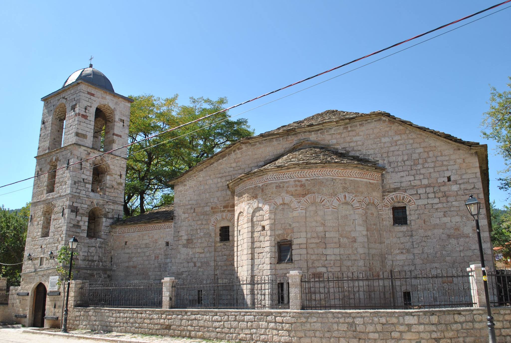
- Saint Athanasius Basilica, Voskopojë is a basilica type church building. The importance of the monument lies with the fact that it is one of the few examples, not only in Voskopojë but also other centers across the country, where builders and painters have left their identifiable traces and more valuable data through a series of inscriptions. The church’s mural painting finished in 1745 is authored by the then art personalities, namely Kostandin and Athanas Zografi, and is considered to represent one of the best moments of their artistic activity.
- Saint Michael Church, Voskopojë is a basilica type monument of relatively large dimensions, which stands out for its architectural formulation and rigorous execution. Also, numerous mural paintings, which manifest the adoption of the most qualitative features of the art of the XVIII century, are preserved inside this church.

- Saint Mary’s Church, Voskopojë is a basilica building standing out for its monumental values of the external architecture. The church was part of a complex of social buildings constructed in late 17th century and early 18th century, including the chapel of the saints Anargyroi – Cosmas and Damian. Inside the church are preserved mural paintings, icons, wooden carved iconostasis, which display great artistic values and have special historical significance. The church contains frescoes by Theodor Anagnost and Sterian from Agrapha, and the large icons in the iconostasis were painted 1703 by Constantine Jeromona. The church’s painting completed in 1712.
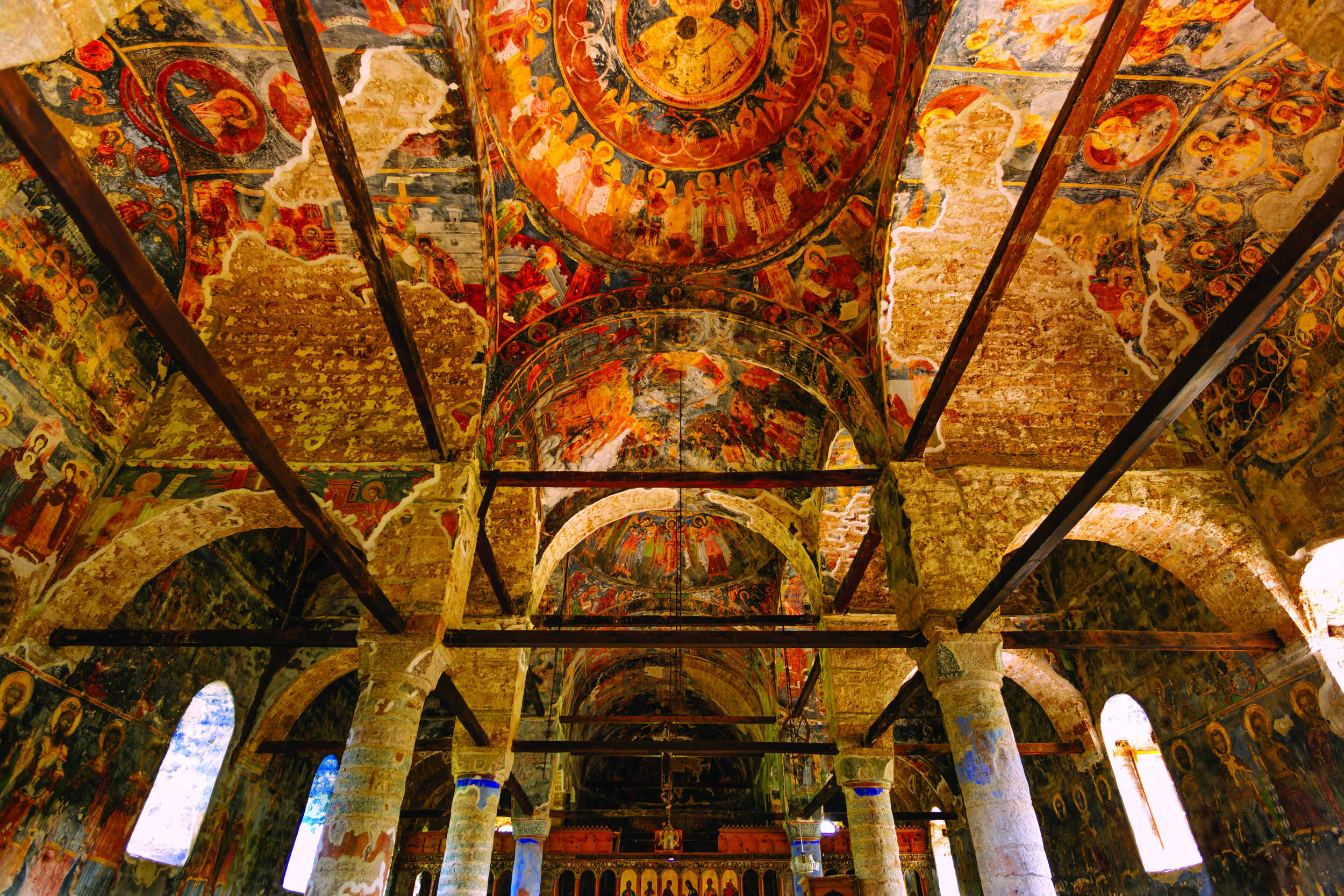
- Shipska was an important center that experienced high economic and cultural development during the 17th and 18th centuries. A small village, around three-hour drive north of Voskopoje, is now found on the site of the former town, the evidence of whose flourishing is only the Church of St. George. The monument is situated on a hill at the entrance of the village. It consists of the nave, the narthex, the cloister, the belfry and a later construction, which was attached to the original church construction on the southern side and it served as a shrine. The internal layout and spatial composition and structural construction are based on the same criteria as those of the basilicas in Voskopoje. The church’s interiors are decorated with murals which date back to the church’s construction period. The murals are based on an extended cycle inspired by the Old and New Testaments, and theological literature such as the Akathist Hymn, or The Lives of Various Saints. The construction of the church is related to the flourishing period of Shipska as a civic and trade center.
- Holy Monastery of the Apostles Peter and Paul represents one of the most important monuments of material culture in the 18th century Vithkuq, which in addition to the catholicon dedicated to the holy apostles Peter and Paul includes the cemetery of the saints Anargyroi – Cosmas and Damian. The monument is important evidence with outstanding architectural, historical and artistic values. The catholicon of domed basilica style was painted in 1763 by the brothers Konstandin and Athanas Zografi and Konstandin Shpataraku.
- Saint Mary’s Church is one of the best preserved monuments in the village of Vithkuq, a testimony to the city’s economic and cultural development in the 17th and 18th From an architectural point of view, it is a basilica-type building with a dome. The monument’s interiors are decorated with mural paintings. Construction features, similar to the church of St. Michael built in 1682, suggest that the church has been built in late 17th century and early 18th century.
- The Saint Michael’s Church is one of the oldest and most magnificent monuments in Vithkuq, built in 1682 and painted in 1728. From an architectural point of view, the church is a basilica-type building, with its interior featuring a complex system of arches and domes, which are hidden under the structure of the wide double roof.
- Saint Mary’s Church (island, Mali Grad) is the most representative monument in the Great Prespa Lake, standing out for its historical, architectural and artistic values. The church’s interior features the well-preserved murals created in three different phases and containing numerous inscriptions as well as the family portrait of Kesar Novak on the building’s west façade. All these data constitute an important historical source, showing us significant aspects of the foundations and artistic tastes of local nobles, as well as the organization of the iconographic program in the one-nave arched churches.
- Demetrius’ Church in Bezmisht is an important 14th century monument, which displays a harmonious blend between the architecture and painting. The preserved mural painting feature New Testament-inspired scenes and depictions of individual saints, including St. Demtrius, to whom the church is dedicated. The linear graphic treatment, the pale and raw colours set the dating of the painting in the 14th century.
- Saint Mary’s Hermit Cave Glluboko (Bezmisht) is located east of the village Bezmisht on the lake shore. It preserves the murals, which according to epigraphic data are thought to have been painted by the monk Partheni and the whole society of priests. The cave is an important expression of the birth and organization of monastic life on the shores of Greater Prespa Lake as its paintings constitute an important transitional stage towards the most advanced style of Byzantine visual art, which took place in early 14th
- Hermit Cave of Evangjelismos in the area known by the toponym Crnapesh or Gollomboç, near the village of Pustec on the west side of Greater Prespa Its chapel preserves mural paintings of good quality, which in terms of characteristics are typical of the Macedonian school and the studies so far have dated them to the second half of the 14th century.
- Saint Mary’s Church is a one-nave chapel at the centre of Gollomboç village, with an apse and covered with an arch. The church’s interiors preserve murals created in two various phases and which are an expression of the artistic activity in the Korça area during the late Byzantine era.
Devoll area
- Cave of Tren (Shpella e Trenit): The Cave of Tren the rock art in the Albanian territory and one of the elements home to a series of archaeological values. The cave is evidence to the indigenous population and it represents a tourist attraction for local and foreign tourists to visit. The cave is located on the western side of the Small Prespa Lake and it dates back to 6000 BC. A variety of items and artefacts, including paintings, ceramic wares have been found in the cave, an asset and real evidence of an early settlement. It dates back to year 6000 B.C. Its interior is prevailed by prehistoric wall paintings with hunting scenes. The Cave of Tren is s one of the first category monuments of culture, which proves the prehistory of the population in this area. The Cave holds a primary position among the overall archaeological monuments in the Devoll plain and Korça area. It became known as a prehistoric settlement for the first time in 1952 based on the observations conducted by H. Ceka and S. Anamali. The Tren Cave and the area around it have been subject to archaeological excavations and expeditions since 1966, discovering valuable objects in it.
Area of Kolonjë
- Saint Mary’s Church in Cerckë, Kolonjë, is on a rocky slope, part of which are enclosed within walls. The church consists of a narthex extending to the west and south, from the rectangular nave and the altar area. The church’s interior is decorated with frescoes of high artistic quality, the study of which has led to the conclusion that their prototypes are found in north-western Macedonia and the style, both of syntheses and those of individual paintings show close relation to the painting ensembles created in the third part of the 14th century in this area.
- Saint Mary’s Church in Barmash is located at the village’s entrance, outside residential neighbourhoods. The village cemetery is found in itscourtyard. According to the inscription, the church was painted in 1616. The church comprises the nave, the narthex and cloister.
Pogradec Area
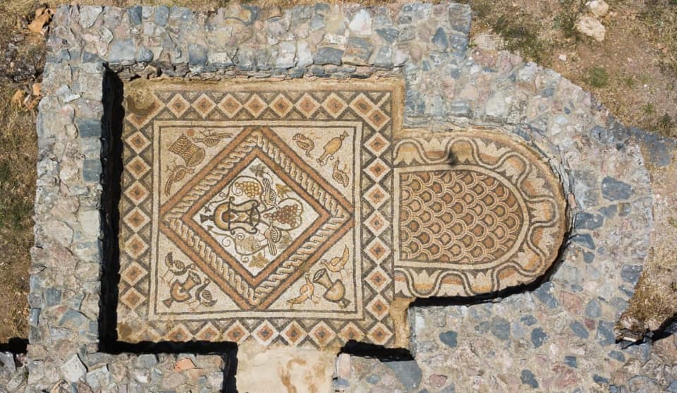
- Triconch Church in Lin is preserved in the form of ruins on the hilltop overlooking the present-day village of Lin, situated on a small peninsula on Lake Ohrid. It consists of a nave, two chapels with an apse to the south and north, a baptistery, an atrium and a quadrangular chapel on the north side, where you can descend through several steps. The church’s floor features colourful mosaics. The colourful mosaic is composed of ornaments with motifs from the flora and fauna, as well as with geometric shapes, with predominating cult symbols. Given the similarities with the churches located in the nearby areas, especially in Lyhnid (Ohrid), it is thought that the triconch church in Lin must have been built in the early sixth century.
- Saint Marena Monastery is built on a small plateau in the mountainous area of Mokra, in Pogradec, South-Eastern Albania. Llënga is situated down this hill, river Shkumbin valley and it was a developed thriving economic and cultural centre in the 18th The Church of Saint Marena represents a basilica, comprised of the nave, two-storey narthex and south open cloister with arcades and belfry. The church’s whole interior is covered with frescoes which, according to the inscription along with the construction of the church, are foundations built with the donations given away by the local residents in the city of Llënga on October 2nd, 1754. The painting’s theme is common to the post-Byzantine Orthodox Church: The Great Feasts from the Evangelization to the Feast of Christ, the Apocalypse theme, and depiction of individual saints. The painting of Saint Marena – Llëngë represents a work of the talented painter Kostandin Shpataraku, about 10 years after he had completed the icons of the Ardenica monastery in Lushnja. The painting is evidence to the painter’s artistic maturity; his work is human, the man who is the most important, differing for the prominent dimensions while the landscape loses its function by becoming a simple decorative element, which serves to highlight the figures in terms of color and composition.

- Lower Selca represents a significant archaeological site of the Illyrian period in the Dasareti province, which according to the written document, was known as the ancient city of Pelion, the site where the decisive battle between Alexander the Great and Illyrian leaders took place. The monumental cemetery is a clear expression of the indigenous inspiration of its builders, with carvings like Illyrian shield, helmet similar to the one discovered on the other coast of Ohrid bearing the inscription of Monun, the inscription of the Illyrian name Meko, the imitation of the Illyrian-Epirus theatre with right analems in the architecture of one of the tombs, constitute at the same time features of the identity of its users and their burial rituals.
- Golik Bridge has survived as a complete monument to this day. It was built in the 18th century and it was used during the Ottoman rule. It is a bridge with two semicircular vaults with a discharge window between them. The bridge was built with carved stones to make its structure stronger.
2. Shkoder District
- Castle of Shkodër is a typical medieval fortress. It retains traces of fortification walls from the antiquity. The castle is divided into 3 yards. Inside it, the castle features social and religious buildings, as well as a prison and military installations, like defence and watchtowers, gallery, or and Captaincy. The basic form of the castle is typical of the second half of 14th century and it has taken its present form following a series of continuous additions. . Inside of this system, we can clearly distinguish a number of Illyrian-era constructions in fourth century BC; mainly medieval constructions dating back to the Balshaj Dynasty in 14th century; Venetian period, 15th century; Ottoman rule era between 16th and 17th centuries; and finally those of Bushatlli Patriarchy period in the 17th The castle stands out for its well-built orderly walls, covered, worked and with many architectural fragments such as cannons or gun turrets, counter forts, gates, steps and vault. Large size stones have been used to build the ancient constructions, compacted stones without mortar but hewn to airtight fit with each other. The medieval constructions are built with small-sized but carefully placed stones. The Ottoman era has many reuses from previous periods and the constructions and walls lack the quality and order of the earlier structures. The Ottoman-era constructions feature randomly placed stones, with gaps among stones filled with pieces of bricks or tiles.

- Drishti Castle is s located northeast of Shkodër, on a rocky hill with a powerful natural protection that, besides the large sloping sites, it is also protected from Kiri River surrounding it in the north and west, in the south, while at the foot of the hill flows into Kiri a mountain stream. Perched on a high rocky hill, surrounded by such a river bend, Drishti castle meets one of the main requirements of a medieval fortification. The retaining wall of the city of Drisht occupies a much larger area than that of Shurdhah, while on the contrary, the upper enclosure is much smaller and does not create an upper division of the city, but only a castle as in the castle of Danja. The surrounding cavity wall of Drishti features two entrances, one from the east and the other from the west, while the castle from a single entrance that crosses the side of a rectangular tower. The castle has small, half circular towers made by a building technique with thin walls without girdles. After the invasion of Drishti by the Turks in 1478, its importance as a city and as a fortress was weakened and there was a massive fleeing of the population.
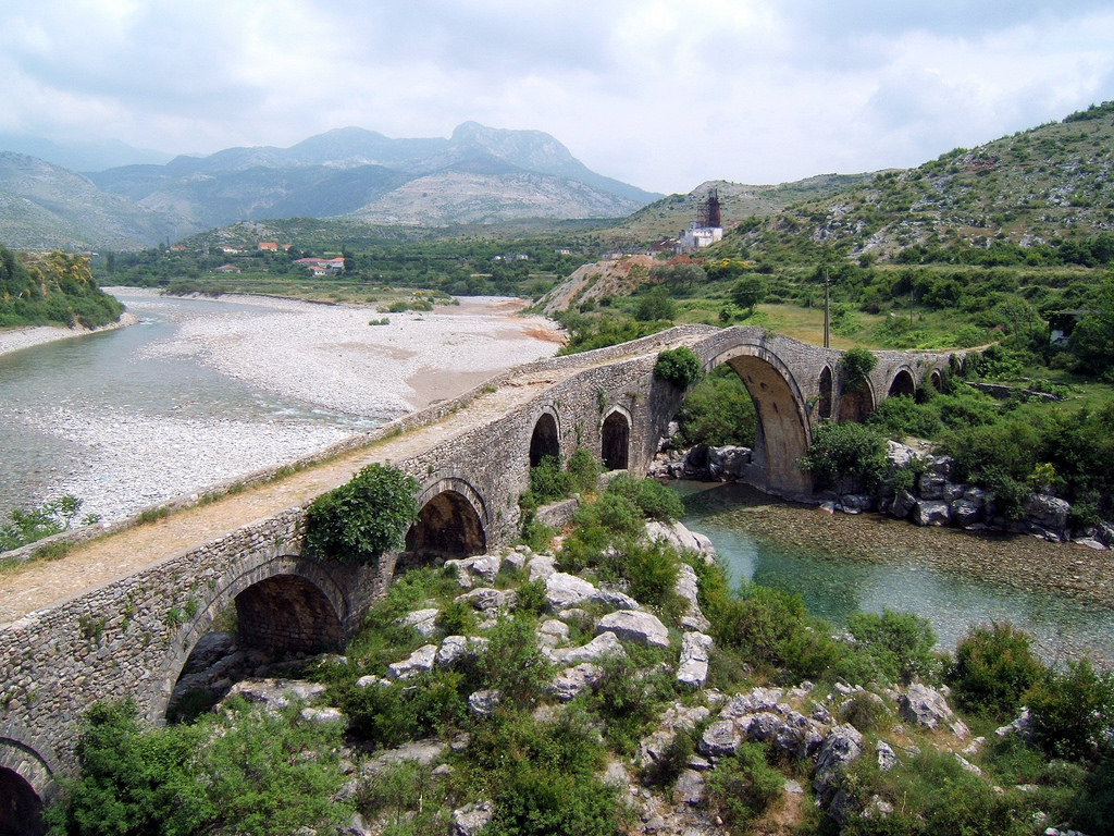
- Mesi Bridge is a first-category monument of culture. It lies on Kiri River. The whole area is built with stones and paved with cobblestones. It was declared a cultural monument of first category in 1948. The Mesi Bridge, built by Mehmet Pasha Bushati by the end of 18th century is one of the largest and best preserved stone bridges in our country. It is an arched bridge, built with over 13 arches of different dimensions, with a length of 108m. This bridge is located 8 km from the city of Shkodër, in Mesi village. Later, when apparently large water inflows flooded the bridge’s graded sides, there was a need to heighten and further extend it by adding 4 arches on the left and 5 arches on the right. The Mesi Bridge has been built of stone and its entire surface paved with cobblestones.
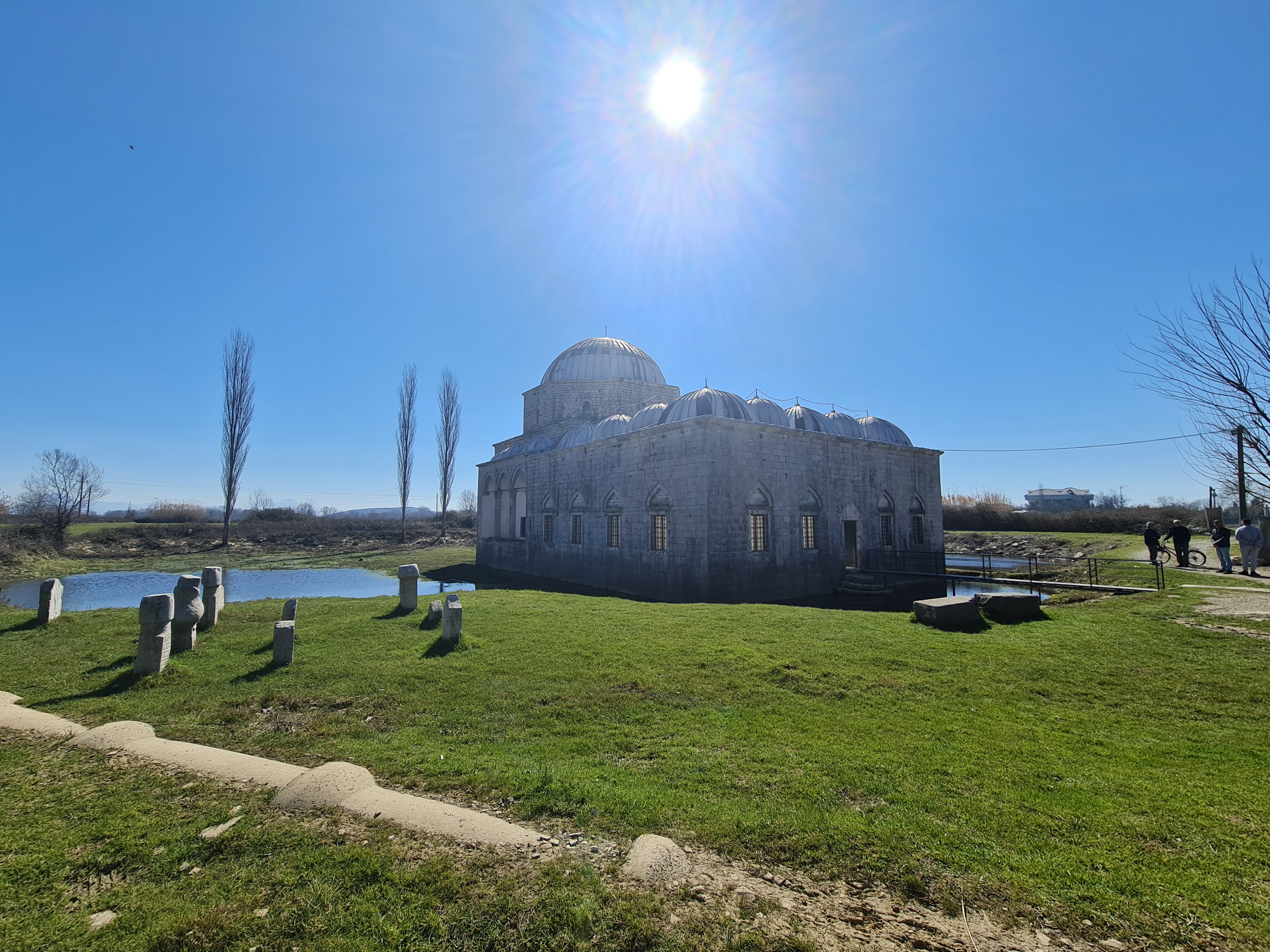
- Lead Mosque is a first category monument, built in 1773 by Mehmet Bushati an Albanian coming from Bushatllinj tribal family and vizier of Patriarchy of Shkodra at that time. e. The mosque is located inside the city of Shkodra. Mehmed Bushati was personally involved and supervised aspects of its construction, stones were chiselled under his patronage. The mosque represents a unique example of classical architecture monuments of the city and an enclosed courtyard, covered by a dome with fine arcades and decorated columns. The first Imam of the mosque was Haxhi Ahmet Misria, who was of Egyptian origin. He came to Albania after the contacts he had with Mehmed Bushati. After him, other Imams served and also took care of the mosque.
- The Bahçallek Bridge is built over the river at the city’s entrance. The bridge became fully operational in early February 1914 thanks to an investment supported Austrian authorities and local aristocrats. Currently the bridge’s plinths have sustained damages to due to large water inflows. Its metallic structure only remains intact. The bridge’s plinths are made of stone connected with iron beams.
- Shurdhahu Castle is situated on top of a 130-meter high rocky hill on the right side of Drin River, around 8 km south of the city of Shkoder. The hill was connected with a series of lower hills on the southern side of the river, but it was transformed into a man-made island following construction of the Vau i Dejes hydroelectric dam. The Shurdhahu Castle dates back to end of 12th century or early 13th century, but once the castle city thrived in 11th The castle was invaded by Serbs in 1184 and it was later transferred under the authority of the Albanian feudal family of Dukagjins and it was conquered by Ottomans in 1491. During this period, the city continuously declined and it ceased existing and was no longer mentioned after the 17th century. The defensive walls divide the city into two parts: the upper part located on top of the hill, and the lower situated on its slope to the north, east, and south. Castle U-shaped, triangular and quadrangular towers were built on all corners of the surrounding wall. The castle encompasses an area of 4. 7 ha.
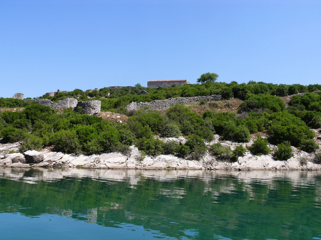
- Dalmaca Casle is situated on the top of a rocky peak, southeast of the village of Koman. According to the explanation given by F. Nopça, the castle of Dalmaca means “the castle of the Dalmatians” and the word Dalmaca, according to him, is simply the added genitive of the word Dalmatian (definite form = Dalmatia). The Dalmaca Castle is renowned for its cemetery. It was first discovered by A. Degrand, the French Council in Shkodra, in 1898. All it remains from the castle is just some wall ruins built with small and medium-sized stones and lightly chiselled on the exterior facade. In terms of the construction material and technique, the walls resemble to the Shurdhahu Castle walls. This technique is typical of the early medieval era. Church ruins have been found within the castle’s territory.
3. Gjirokaster District
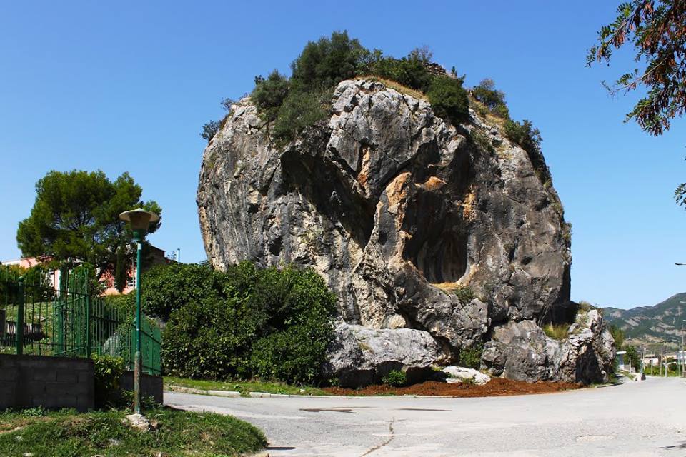
- -Stone of Përmet town is a massive 12-meter high rock with steep sides. The rock’s upper side is flattened in a surface of 15mx15m, which preserves the ruins of a fortification that date back to the fourth and sixth centuries. At the foot of the cliff, there is a tract of ancient period, similar to the fortifications of third century B.C. in the valley of Drino. On the surface of the stone there are two dilapidated premises; one used as a catchment with an area of 14m2 and the other with an area of 5m2.
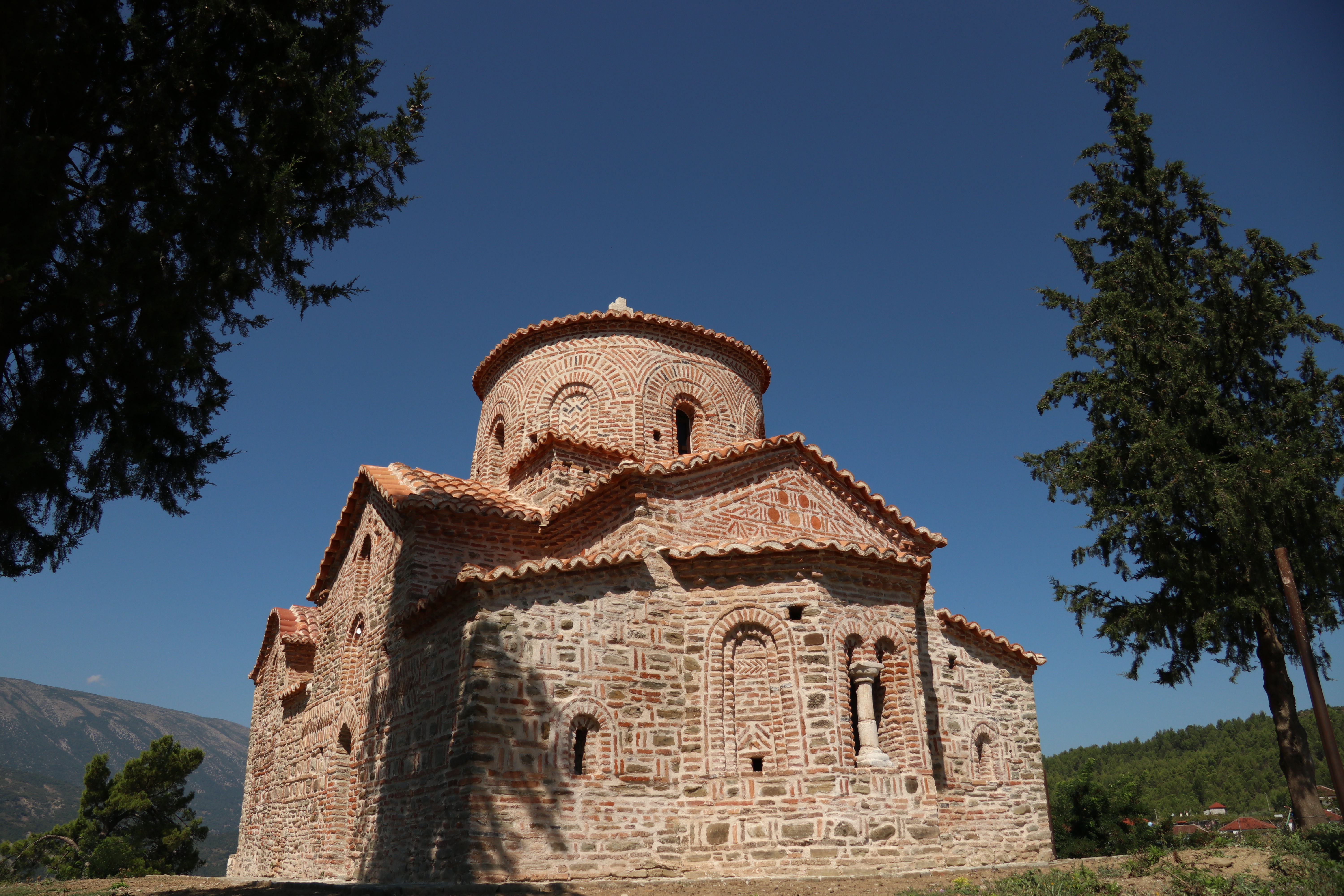
- Saint Premte Church is one of the oldest religious monuments in the area of Përmet and it is one of the best preserved examples of post Byzantine architecture and painting in the south of Albania. Built in the second half of 18th century, the church is located on the southern part of the town of Permet. y. It is a basilica construction, consisting of the nave, the narthex and the cloister. The church’s interior is decorated with murals, which represent an interesting ensemble of post Byzantine painting, completed in September 1808. Scenes depicting Virgin Mary Platytera and the Communion of the Apostles at the altar, portraits of saints and the depictions of scenes of Genesis from the moment of Creation and original Sin, etc., and of the New Testament followed by the chronological course of events. Also impressive is the painting of the zodiac signs and the inspiration of the painter from the Painting Manual and the art of David Selenica, he seems to be very familiar with. The inscription shows that the author of the paintings is Terpo Zografi and he completed them in September 1808.
- Leusë Church is dedicated to St. Mary and it is located in the village with the same name, which lies south of town of Përmet. The Church’is quite well known for its wooden iconostasis, carved with artistic craftsmanship. It consists of the central nave, built in 1812, the narthex and the cloister. The Church’s interior is decorated with murals of high artistic quality, painted by Fjonjati, Mihali and Gjergji, in 1812.

- Saint Elijah’s Church is located on a hillside in the village of Buhal, near the Vjosa River. It consists of rectangular nave, square narthex and open cloister on the south side. The church was originally a single-nave Byzantine chapel. Traces of this initial stage are still evident on the church wall. The church’s interior features frescoes of a high artistic quality, which preserve two phases of their painting. The first phase dates back to the time of church construction, whereas the second phase has to do with its reconstruction. Based on the stylistic features of the painting, it is thought to have been painted in the 19th
- Saint Mary Church in Kosinë is an early monument of the type cross in square with a cupola, whose basic features are not clearly formed, especially in the lower building. The internal part of the church contains murals from two different phases. The first phase goes back to the construction of the church, while the second one dates back to post- Byzantine period.
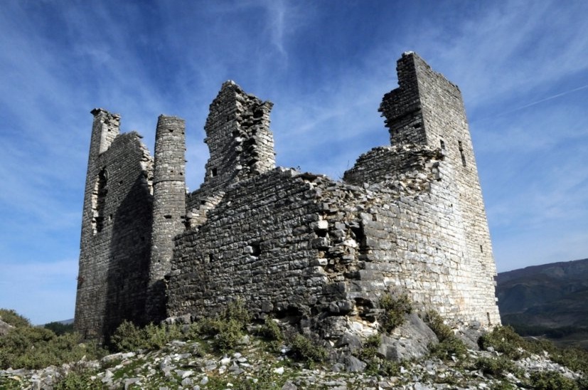
- Lefter Cullufe’s house museum is a first-category monument in the village of Buhal, Përmet municipality. It is a three-storey stone building with obvious urban property features. An arched-shape protruding corner, supported by two stone columns, is notable in the middle. The first floor consists of two rooms for storing cereals. There is winter room with chimney. To the right is the bedroom rich in wooden sideboards mounted on the wall. The porch stands out on the third floor and it is located in the corner consisting of 7 windows overlooking the valley.
- Illyrian Castle of Këlcyre built third century B.C., but it was reused during the medieval period.
- Cave of Bënjë (Bënjë village, Përmet) is located at the Langarica Canyon entrance at a height of eight meters above the river level. It houses an Neolithic-era cave settlement. The cave consists of limestone rocks. The inner length of the cave is 16m with a width of 3m and a height of 3m. Another 9-meter deep space and 3 meters wide and 3 meters high is found in the cave’s centre. The cave entrance consists of 4 spaces.
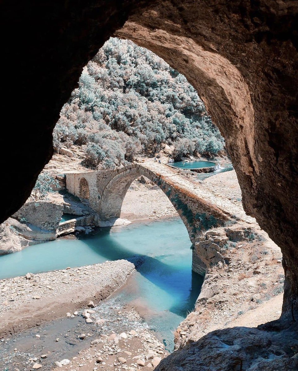
- Frashëri Tekke consists of two separate buildings, which are connected with a wall and a vault gateway at its centre. The building that is located on the right side is in shape of letter L, with an area of 325m2, which expands in three rooms, coffee chimney, cellar and bakery. The building on the left side is partly two-storey with an area of 218 m2. At the distance of 20 meters are two shrines, with domes, and separate entrances with an area of 102 m2. The building consists of black pumice stone bonded with lime mortar with chiselled straight corners and the roofs are covered with black stone slabs.
- House Museum of Frashëri Brothers is a first-category monument of culture and is located in the village of Frashër, Përmet. The house was destroyed in 1892 and it was reconstructed in 1974. The house is a two-storey building with an arched gate. On the right side is found the cooking room while on the left there are three rooms. To ascent to the second floor, where there are five rooms and a chimney room, one has to climb wooden stairs.
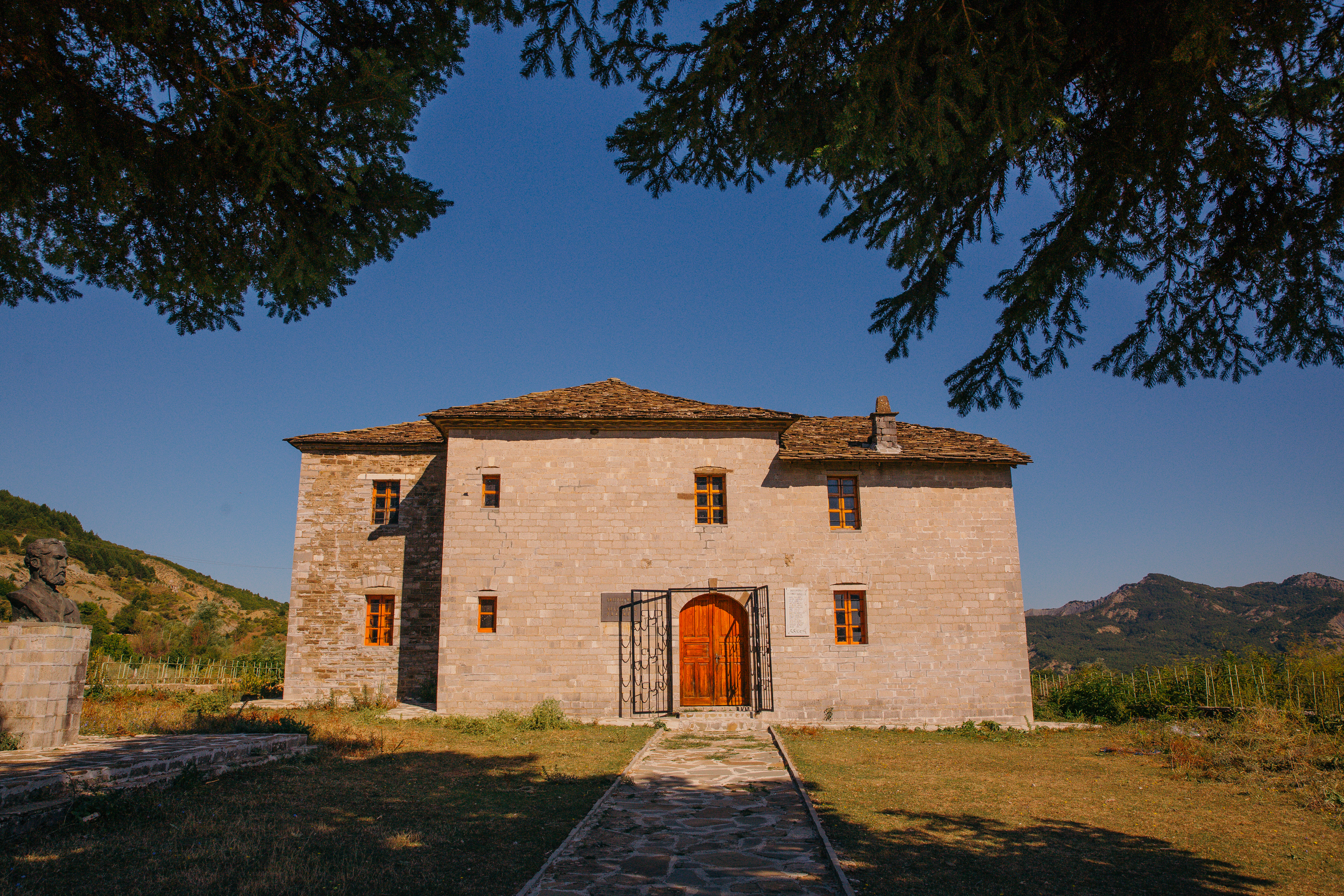
- Përmet Congress House is situated within the town of Përmet and it was built between 1938 and 1940 by the Italian army and it served as army barrack until 1944. The house has a rectangular shape and measures 29.3 m x 8.9 m, consisting of two rooms one of which served as a museum room. The roof has been covered with asbestos boards and with tiles nowadays.
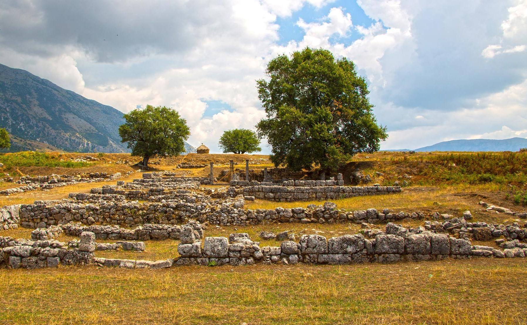
- Antigonea Archaeological Park in Gjirokastër; According to the ancient historian Plutarch, Antigonea was born out of love and was destroyed out of revenge and as sign of hatred. When Pyrrhus was 17 years old an uprising overthrew him as king. After that he was placed under the custody of King Demeter of Macedonia and later was sent to the court of Egypt’s king Ptolemy. He drew attention of the queen of ancient Egypt, Berenice, who selected him among other young princes to marry Antigone, one of the daughters of the royal Egyptian couple. Due also to the aid of his prudent wife, Pyrrhus managed to collect money and an army, and start off towards Epirus to reclaim the throne. In a sign of recognition, Pyrrhus founded and named two cities after them, namely Berenika and Antigonea. The first was situated in Thesproti, whereas Antigonea was found in Antitani. Antigonea was founded in the year 295 B.C. and it became an important economic, social, cultural and political centre also due to the control over the Drino River valley, which was used to be called the Straits of Antigonea in the Antiquity. The ancient city of Antigonea has the appearance of a dolphin, as it lies between two ridges, interconnected by a narrow neck, and is formed by a number of terraces folding together. The victory of the Roman Republic against the Macedonian armies of King Philip V had fatal consequences for Antigonea. After its ultimate victory in 167 B.C., Rome severely punished the Epirotes for allying with Macedonia and fighting against the empire. The Roman consul, acting on the Senate orders, plundered and destroyed 70 cities of Epirus and Illyria, including Antigonea, in 168 B.C. The city was totally destroyed by the Roman army and was never rebuilt. After that, the city was abandoned for several centuries and it was only in the sixth century AD when a Paleo-Christian church was built inside it.
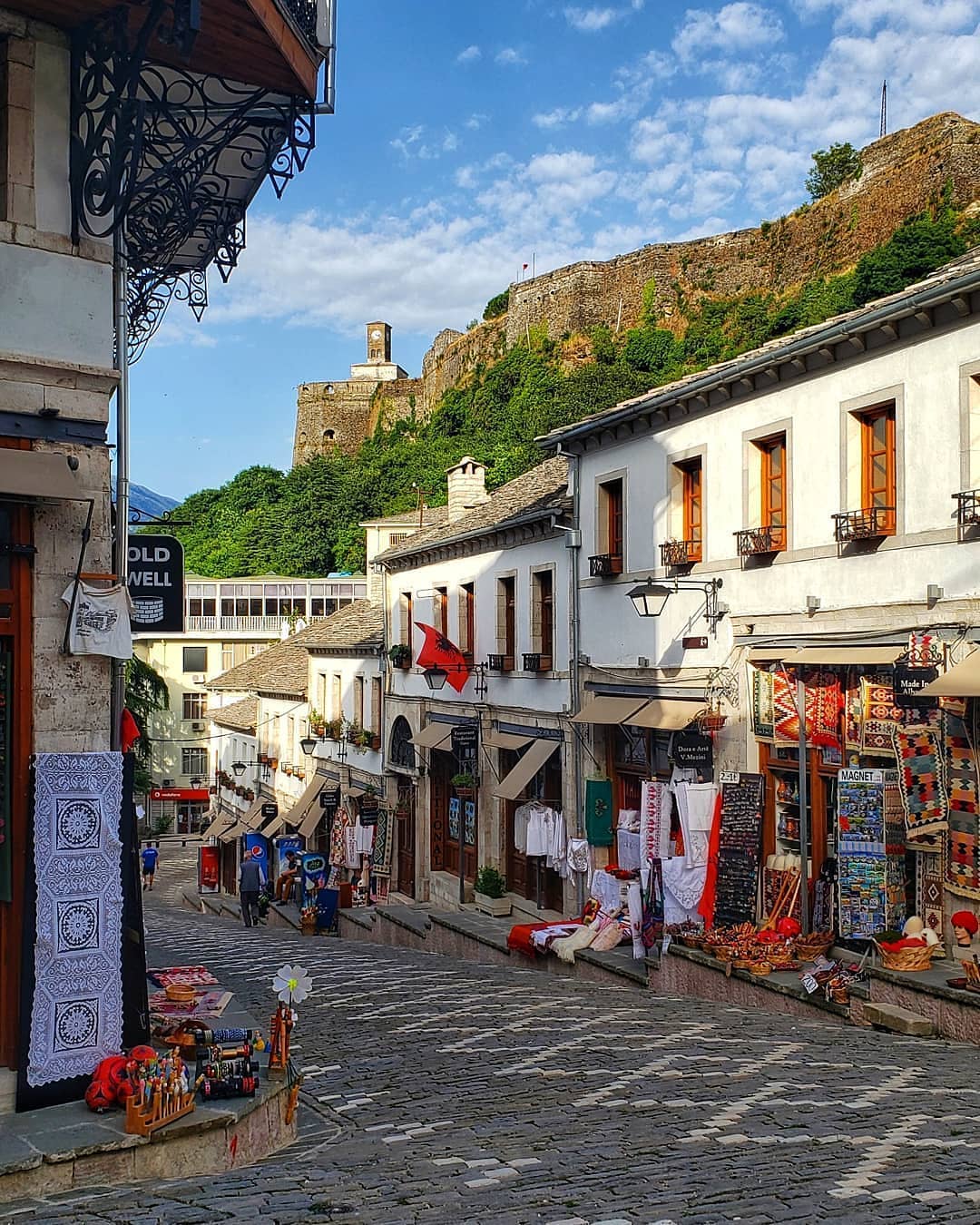
- Gjirokastra Bazaar is a trade-craft complex built (reconstructed) in centuries XVIII – XIX with unique historical, architectural and urban values for our country and a wider region. It played and still plays an important socio-economic role for the historical centre of the city of Gjirokastra. Its location at the city centre, compositional extension and architectonic – decorative aspect, give the complex a special significance regarding the types of Bazaars in our country. This is a first category monument and it is located in the southern Albanian city of Gjirokastra, which was inscribed on the UNESCO’s World Heritage List in July 2005. The city’s handicraft and market centre, the bazaar, as it came to be known in early 17th century, was transferred to the city center where it exists to this day. Bazaar was built there to be easily accessible by the residents of all neighbourhoods. Its design is radial, where from the Bazaar Pass, four main roads open, which serve as a connection with the residential areas. Located as a distinct urban center, it has an organic connection with the inhabited areas. Its urban scheme of significant radial trend for a better interconnection dates back to century XVII. On the contrary, the Bazaar constructions belong to a later time, centuries XIX and XX.
- Bazaar Mosque in the city of Bazaar Mosque or Memi Bey Mosque, an octagonal-shaped building, was constructed on the Bazaar’s western side. With its size and architectonic features, the building plays an important role in the centre’s urban layout. The mosque has been built on sloping terrain, which has limited the building’s composition to a half floor structure. At the bottom allows the construction of an arched underpass, on both sides of which are lined shops. According to the surviving inscription, the mosque was built in 1821. On its lower part an arched covered underpass has been built and it is lined with shops on both sides. According to the surviving inscription, the mosque was built in 1821.

- Ancient City of Antigonea is situated on the hill of Jerma, southwest of the village Saraqinishtë, 15 km from the city of Gjirokastra. Antigonea was built in the year 295 BC by order of Pyrrhus, King of Molloses, in honor of his spouse Antigonea and it is thought to have been burned down by the Roman general Emilio Paolo in the year 168 B.C. The 400-meter long fortifying wall encircles an area of around 45 ha. The wall is around 3.5 meter thick and three meters high. One of the distinguishing features of Antigonea is its very regular urban system with orthogonal roads and regular insulas (residences blocks). The most important and largest public structure within the city walls is the 60-meter long stoa (promenade) along the agora. After the city was burned down (signs of carbon evident in all the excavations conducted by Dh. Budina) the city went through a cease phase until fourth and fifth centuries AD. The ruins of a medieval church (IX-X century) have been discovered at the main crossroad. It is a small church which was built after the ancient city and the old urban system were destroyed.
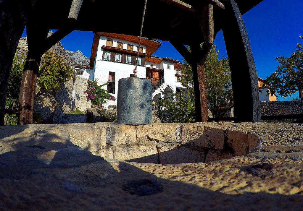
- Sofratika Well, although not in working conditions, is preserved almost complete and shows clearly its function. Entirely built with limestone-tiles, this hydraulic building is in the form of a cylinder with a diameter of 5 meters, raised 1m from the ground, in center of which rises the mouth of the Well for receiving water. The area around the mouth of the stone cylinder is paved with cobbles, with cross fall at the sides. You can reach the square around the mouth of the pit, by climbing three steps. They lead to a narrow and short cobbled street. Outside the large rigid cylinder inside the diameter four monolithic stone baths of different sizes have been placed to allow animals to quench their thirst. The water was pulled up after an empty bucket was lowered into the well. The limestone tile-cladded well has cylindrical shape with a five-meter diameter, one meter high above the ground and with its casing around. The narrow surface around the casing of the well’s stone cylinder is paved with cobblestone.
- Libohova Castle is built on a rocky platform in the eastern town of Libohova, Gjirokastra. The hill rising on the eastern side has a favourable position and dominates the castle. It is thought to have functioned as a fortifying building. However, the castle retains all the typical building characteristics of Ali Pasha. This castle, together with its surrounding Saraj, was built by Ali Pasha for his sister Shaninshanë.
- Saint Mary Monastery is located above the village of Goranxi in Dropulli region (Gjirokastra) and presents specific features regarding external decorative architectonic formulation. The nave is of the cross-shaped dome type, tri-apsidal, with internal dimensions 6,80×5,60m. Four columns, with capitals carved with plant motifs, have created a square central core, covered with a dome on a high drum. The altar environment is highly developed. The altar contains the apse of the bema, highly protruding out and on its side, two small apses of the prosthesis and the diaconicon, also protruding out. The church’s interior is lightened by small windows, open in the drum, in the apses and in the pediments of the wings of the cross, characterized by the striking proportion of the constituent parts. The nave is connected to the narthex on the west side with three arched spaces, it is covered in the central part with a spherical cap which rises above two arches on its side. The exo-narthex is covered with a cylindrical arch parallel to the longitudinal axis in the central part, standing above two transverse cylindrical vaults. The church was painted in 1600 and it consists of the central nave, narthex and exo-narthex.
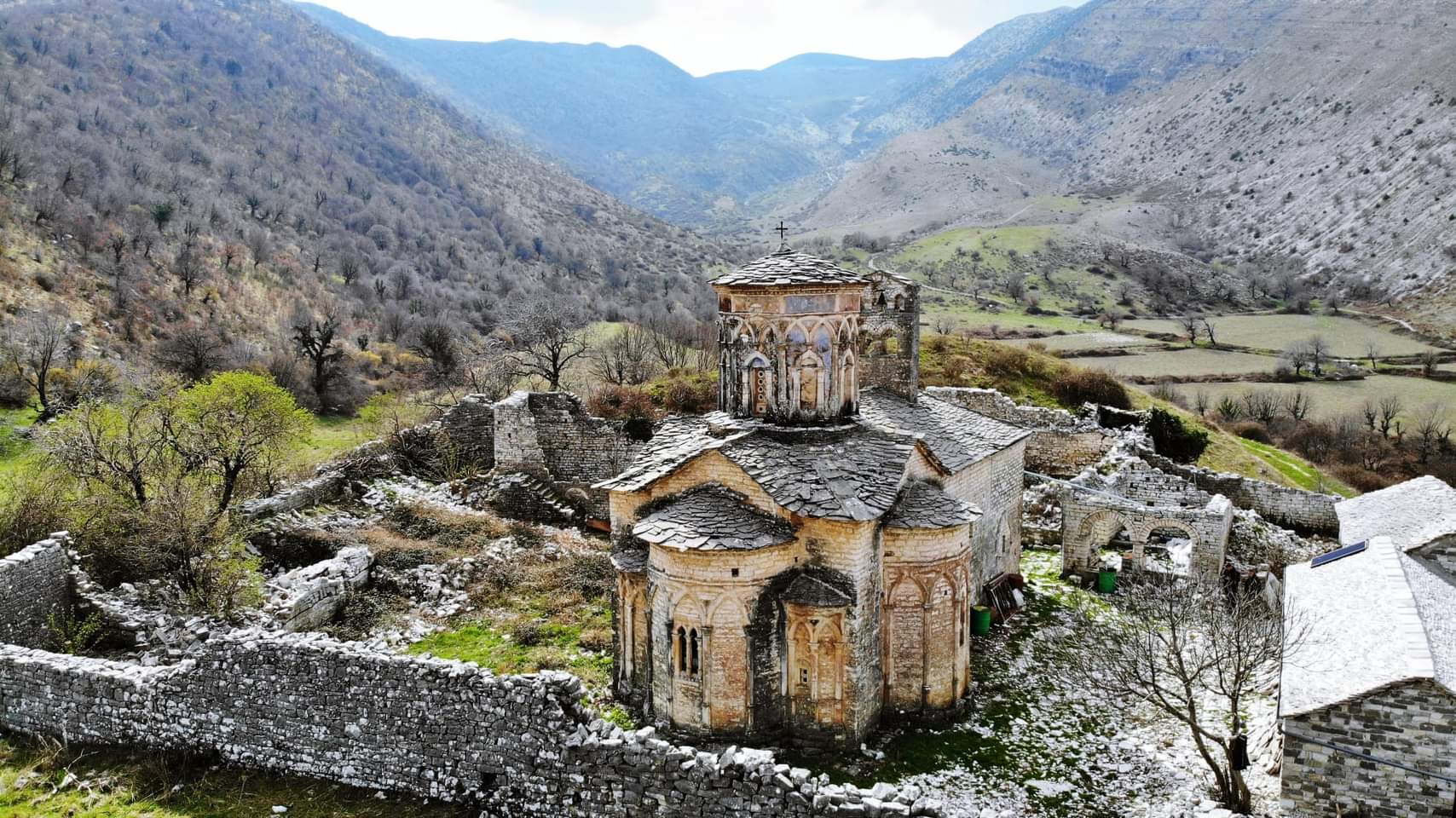
- Saint Mary Church is located in the village of Labovë e Kryqit. The Church of Labovë e Kryqit is one of the oldest in Albania and once contained a holy relic believed to be part of the true cross of Christ. The building is typical Byzantine with a high central dome, the Naos and naves built in order to create the image of the cross. The main entrance to the church is through a subsequent narthex. The Church, as seen today, is mainly a 13th century construction and of the Epirus Despotism time. Although an initial foundation can go deep to the time of Emperor Justinian in 527-565 AD.
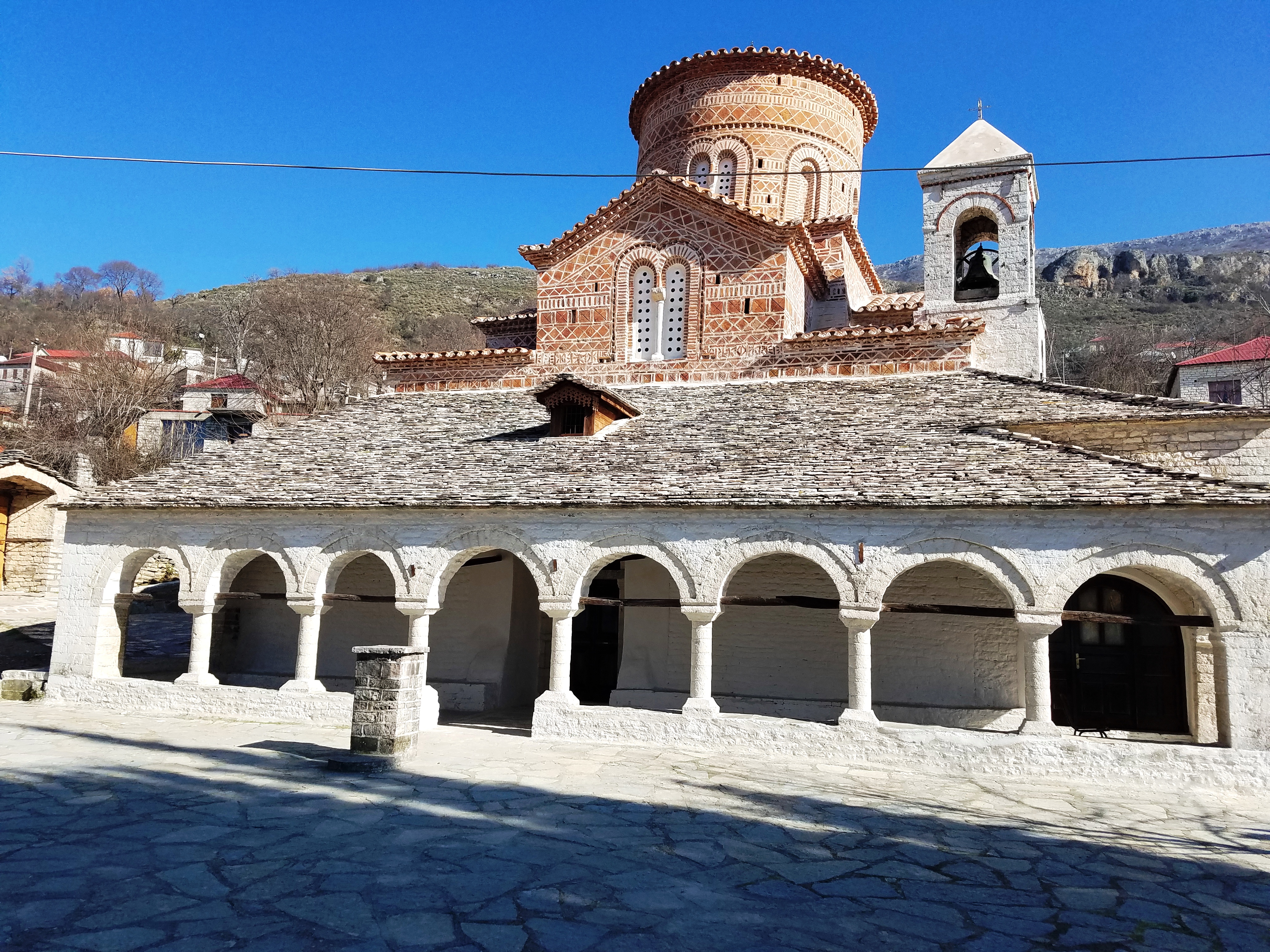
4. Elbasan District
- Archaeological sites in the city of Elbasan: The central city of Elbasan is identified as an area with rich archaeological and historical potential and the beginnings of the city can be found in the ruins of the second century BC. One of the most famous Roman-era routes, Via Egnatia, once traversed today’s Elbasan area, whose stations have been discovered around the city. During the Middle Ages Elbasan again played the role of a transit route, but home to a Christian population as shown by the finding of the Early Christian Basilica located in the city center. The Ottoman-era seems to have played an important role in city life as reflected both in customs and architecture. One of the most important monuments in the city of Elbasan is its castle together with its interior, where different-era monuments are identified and which is considered as an area with archaeological potential. Skampis Castle represents a Castrum Statum, or the fortress of a Roman legion. As every Roman military camp, this skampis too has been built according to an orthogonal plan, defined by the perpendicular intersection of two roads: decumanus was an east–west-oriented road in a military camp, and cardo, north–south road. This has also defined the castle’s layout. The castle has a regular quadrangle shape. The composition of the surrounding wall indicates three main construction periods, namely: Late Roman period; 2. Early Byzantine period; 3. And the Ottoman period. A special feature of the Albanian cities since the mid-14th century, as compared to other urban centers of the Ottoman Empire, was the presence of special towers and clocks in their urban premises. The tower clock in Elbasan is one of them.
- Church of Saint Premte, a first-category monument of culture, is located in the village of Valsh, Elbasan. The church’s interior features murals painted by the 16th century master, Onufri. The church is a single-nave chapel and it also includes a small cloister.
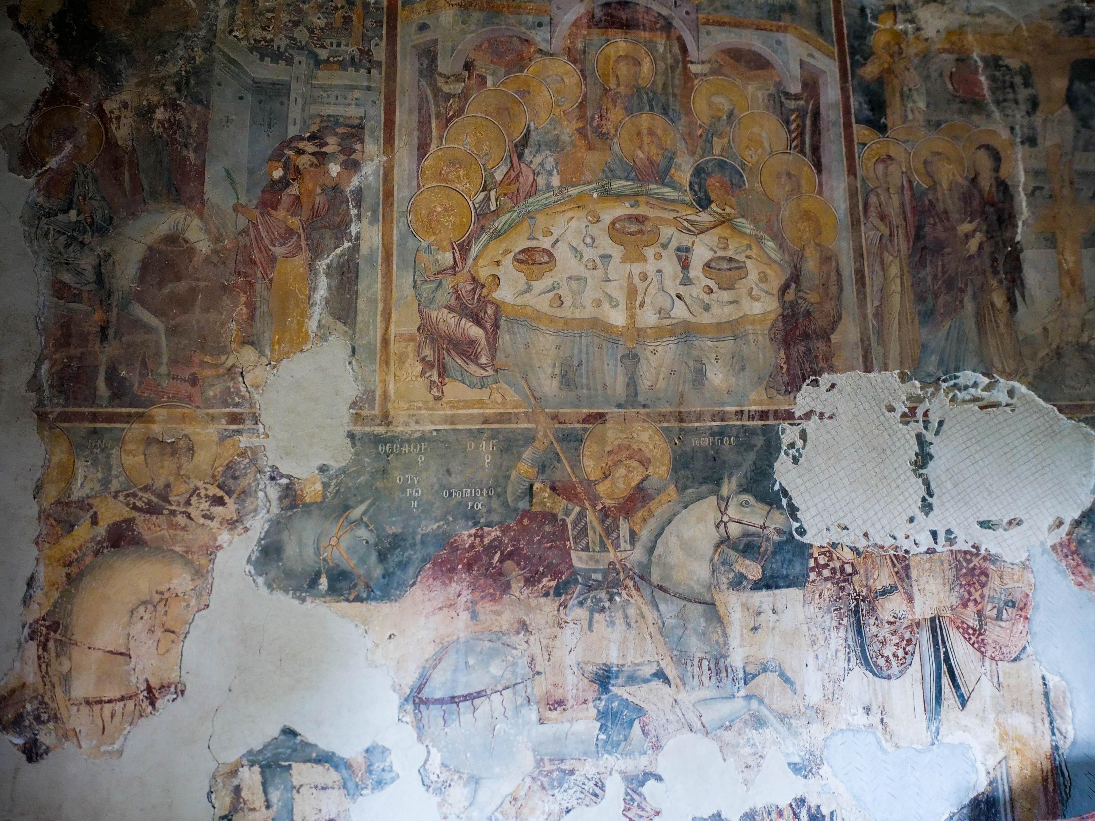
5. Diber District
- Castle of Grazhdan is located adjacent to the national road linking Bulqize and Peshkopi, around 11 km in southeast of the town of Peshkopi, between two streams, Grazhdani (north-west) and Maqellara (south – west), which flow into the Black Drin River. The castle is built on a hillyfield terrain at about 525-600 m above sea level. . It stands out for its very important geostrategic position in the Black Drin basin, especially for trading – military roads, Via Egnatia and Lissus-Naissus connecting the provinces of New Epirus, Dardania and Macedonia II. The area of about 34 hectares makes it the biggest city of the Late Antiquity period in our country, after Dyrrahu. The castle dates back to century IV B.C.
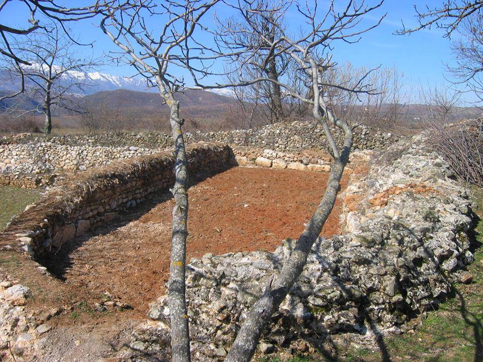
- Kastriot Museum, a second category museum, is located in the village of Sinë, Diber district. The Museum’s construction started in 1982 and it was open to the public for first time in 1985. The Kastriot Museum is a one-storey facility built of stone and lime mortar, with a somewhat simple plan with two rooms and the entrance hall between them. The museum was fully restored in the framework of the Nationwide Year of Skanderbeg 2018 and has now been transformed into a genuine tourist attraction.
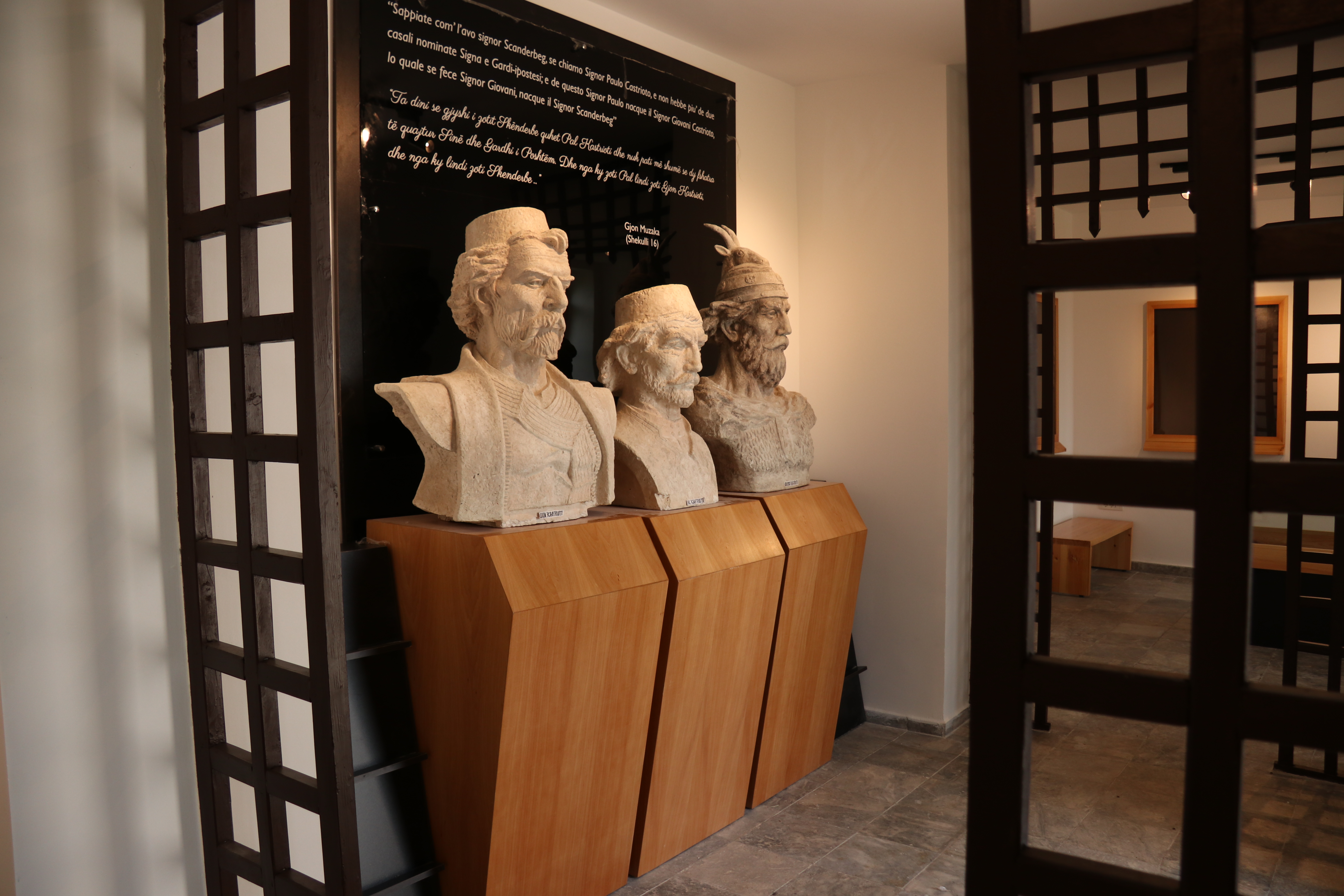
- Church of the Holy Transfiguration in the village of Herbel in Peshkopi region is located on south-western side of the village and it consists of two parts. The church’s eastern side, together with the three-sided apse date back to the pre-Ottoman invasion and today serves as altar for the rest on its western side. Both sides are covered with roof over a wooden structure, whereas the original church building was covered with a cylindrical vault. The eastern part of the church is built of limestone and lime mortar, while bricks seem to have been used to level the rows. Based on the construction technique the first phase of the church dates back to the 12th century.
6. Durres District
- Castle in city of Durres; Durres was the largest fortified city in the central coastal Albania. The city was founded by settlers coming from Corcyra and Corinth around 625 B.C, although archaeological findings in its territory witness the establishment of this settlement in an earlier period. In written texts the city appears with two names: Epidamn and Dyrrachium, but in the Roman period only the name Dyrrachium started to be used. No traces of these walls remain from this period; however, the importance of the city as a trading centre is observed in the numerous castles built to defend it and the main road artery connecting it with Macedonia and other local regions. During the Late Antiquity, the city was protected by strong walls and towers that made up the basis of fortifications during the Early and Middle Ages until the Ottoman invasion. The fortification of Durrës with triple walls was completed by Emperor Anastas. The first fortification formed the Acropolis, the second constituted the biggest quadrangle castle, while the third one, without towers, was in the north of the city.

- Rotonda: An ancient market square was discovered in the years 1987- 1990 and it was declared a cultural monument in 2003. It is believed that the monument was built from Century II B.C. up to century IV B.C. and it has been operational as such until century VII. It was discovered by the archaeologists as they unearthed the ruins and a square of a Byzantine-era market. Later, this Bazaar was turned into cemeteries. The monument is composed in the form of a circular portico, among which there is a podium. The monument has served as a public square where fairs were organized.
- Amphitheatre is one of the most important monuments of ancient Durrës. It is a construction of the Antonine century (century II A.D.), built during the reign of Trajan. . Today the amphitheatre is located within the city walls built by Anastasi in century VI. Studies suggest that the amphitheatre had a 15000 to 20000-seat capacity. Its major axis is 136 m and from the hill is stored up to 20-meter height. During the Middle Ages the site was used by local residents for protection. In its underground galleries was built a Paleo-Christian church, which is decorated with mosaics showing St. Mary with the imperial clothing between two angels. The composition is also accompanied by portraits of donors, such as Alexander with his wife. It constitutes one of the earliest evidences of early Christianity in the city.

- Orpheus Mosaic: The hidden ancient Orpheus Mosaic has only been partly discovered during archaeological excavations in 1988 in Durres and it represents one of the most beautiful masterpieces of Roman art in the city. The mosaic’s main scene depicts Orpheus sitting on a dessert rock and wild animals and creatures that have gathered around him amazed at the divine music of his lyre. Although partly discovered, the mosaic’s panel is designed to feature Orpheus at its highlight, but the right part of the mosaic showing the animals gathering around him is already lost. It is separated from the rest of the mosaic images in compartments by a complex frame, consisting of red, black and white borders and double strips. It is also separated by borders with a series of geometrical decorations and motifs, as a six-pointed star, squares, rhombuses, which have integrated floral motifs. They alternate with each other forming a whole harmonious image. The theme of Orpheus among animals has been quite popular between second and fourth centuries, and is the only one of several scenes based on the myth of Orpheus widely depicted in Roman art.
- Ishem Castle is situated on a hill east of the village of Ishem, built on a dominant position from where the Ishem plain and the Kruja-Dajt mountain range are observed from the east, the estuary of the river, and the Cape of Rodon, and a part of the Adriatic coast from the west. The castle was built between 1572 and 1574 by a local feudal named Mehmet on orders from the Ottoman Sublime Porte. Upon completion, the structure was fortified and armed with cannons and a garrison of soldiers was housed in it. The castle has a quadrangular layout (100×40 m), two gates, and 5 watchtowers. Purpose and time of its construction are precisely known thanks to the historical sources. In the 16th century, Ishem was part of the Sandzak of Ohrid, a province experiencing continued peasant revolts and riots against the Ottoman Empire. It was for this reason that the feudal lord Mehmet proposed to the Sublime Porte to construct a heavily fortified castle in Ishem, which would protect the vilayet from the insurgents.
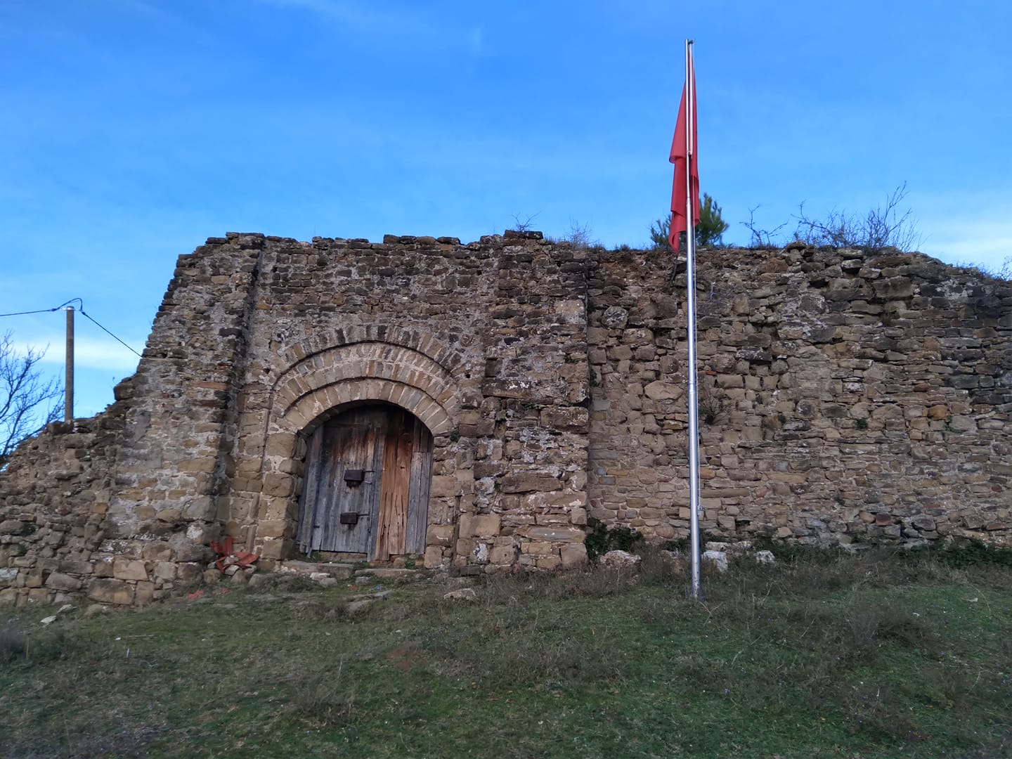
- Cape of Rodon is a rocky cape very close to Tirana, the place that offers a mixture of history, untouched nature and the sea. The Cape’s north-eastern part is home to one of the most important objects of cultural heritage, Skanderbeg Castle, whose construction began after Kruja’s first siege in 1451 and it is thought to have completed around 1452. What has been left from this first category cultural monument is the main tower and some fortified defensive walls. Unlike other forts in Albania, Skanderbeg Castle is not protected by high walls on all sides.

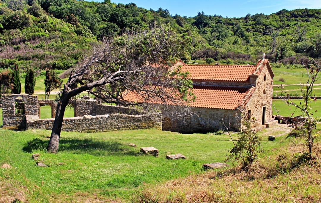
- Saint Anthony (St. Ndoi) Church is located on Adriatic coast, northern part of the Cape of Rodon. The site is referred as St. Anastas’ Church in historical documents in the 14th In 15th century, the church was taken over by the Franciscan missionaries who restored it and since then it has come to be known as the St. Anthony Church. The church originally had one-nave and a narthex at its entrance. The construction technique is simple, with the side bearing arches being not round-shaped but pointed ones. It is not known when the side naves were added to the church, but some of the frescoes left in the northern nave date back to the period when the monastery was built.
- Roman Gate Wall or Porto Romano is located around 7 km north of the city of Durres in the area called Porto Romano. It once served to close a narrow strip of land, between the sea and the swamp. The wall of the gate was built to protect the city of Durrës from a possible attack from the North, making the best of the terrain, the proximity to the sea and the marsh of Durrës. This is also confirmed by the Caesar’s armies’ attacks against Durres several years earlier. Ten centuries later, when the gate wall was no longer working, the Normans set up their camp in one of the hills north of Durrës, and occupied the city. The Roman Gate Wall was built by Justinian I, who according to the Prophecy of Caesarea, built a new fortress in Durrës.
- Basilica of St. Mehill is located on the west side of the hill with the same name, in Arapaj area, about 6 km from the city of Durrës. It was discovered by the archaeological campaigns conducted in the ‘80s. The floor of the basilica is paved with polychrome mosaics, with anthropomorphic, zoomorphic figures and geometric herbal decor. It is one of the most beautiful Paleo-Christian mosaics in our country, dating back to century V – VI A.D.
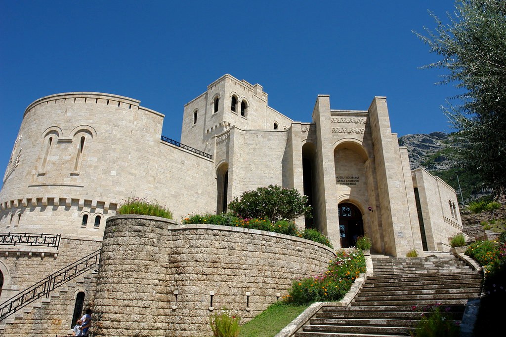
- National Museum “Skanderbeg” Kruje is one of the most visited museums and cultural tourism attractions in Albania. Housed inside the ruins of the centuries-old castle of Kruja, the museum opened in 1982. The museum was constructed as tower type dwelling, mostly built in the north of Albania, as an Albanian medieval castle and a memorial for the most important and popular figure in Albanian history, Gjergj Kastrioti Skanderbeg, Albania’s national hero.
- Ethnographic Museum, Kruje was opened on November 20, 1989. Located on the grounds of Krujë Castle, this original house was constructed in 1764 by Ismail Pashë Toptani as his family home that blends local elements with the architectural style of the Ottoman Empire making the museum unique. The Museum house plays host to 15 rooms, all of which highlight life in the town of Kruja and its history.
7. Tirana District
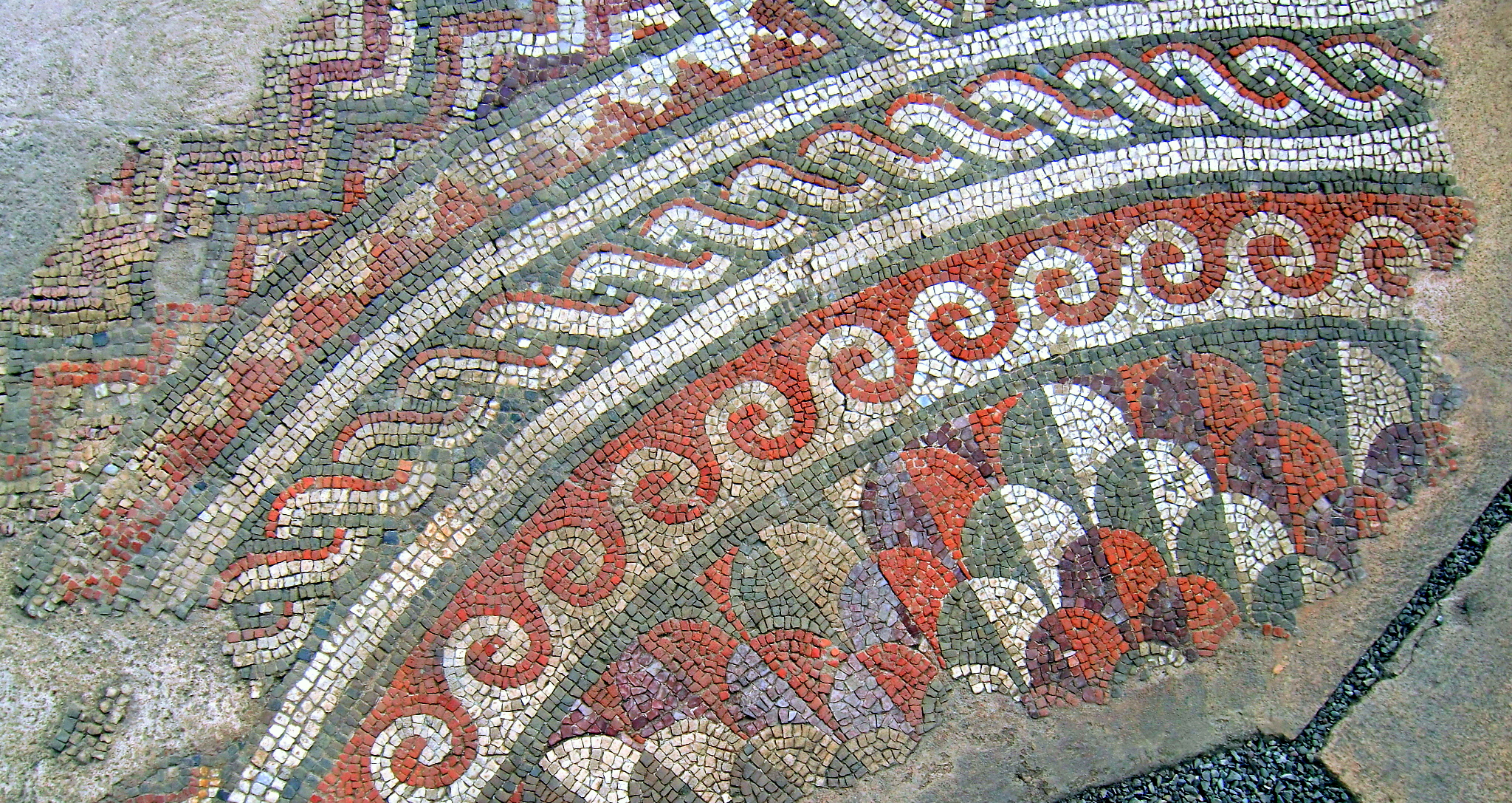
- Tirana Mosaic is a first-category culture monument since 1973. The monument consists of the ruins of an ancient building which were accidentally discovered in 1972 during the construction of an apartment building in the “Partizani” residential complex, Tirana. The ruins of the ancient building consist of three rooms decorated with polychrome mosaics, mainly with geometric motifs, built with opus tessellatum technique. The Institute of Cultural Monuments and the Institute of History launched the excavations immediately in the ‘70s. In addition to the mosaic floors, fragments of walls and ceramic wares, tiles and bricksm dating back to the beginning of the settlement in the first century AD, were discovered during the first phase of the excavations. The complex is thought to have been a rural dwelling (villa rustica). In the third century AD the settlement is thought to have been replaced by a condominium complex, divided into two parts in the pars urban (residential part of the villa) and pars rustica (manufacturing part of the villa) which had also agricultural function. Later in the fourth and fifth centuries, a Paleo-Christian Basilica was built on this site. The Paleo-Christian Basilica was built in the central hall of the rural house. Like in all churches of this period (second half of IV century AD), there were major renovations and reorganization of the building. The church’s architecture is simple, but with signs of geometry and design used to enhance the entrance leading to the altar on a long, straight axis. Based on the archival records (ICTK Technical Archive), the mosaics of the three premises have undergone massive restoration and conservation efforts since their discovery in 1972.
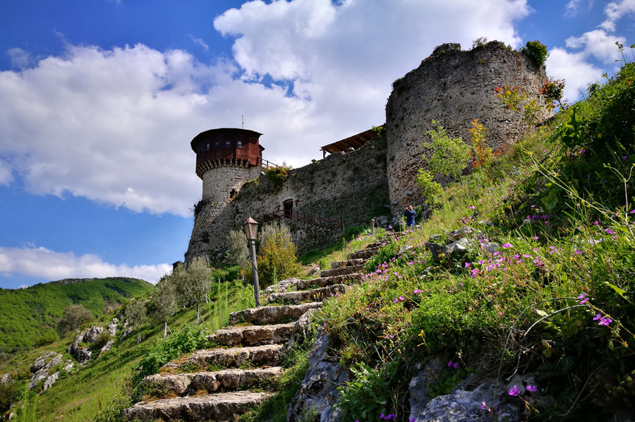
- Petrele Castle is located on a rocky hill at the height of 400 m above sea level, around 17 km from Tirana and is built on a very protective position. Since antiquity, this fortress controlled the crossroads with economic and military importance, as Via Egnatia (Durrës-Tiranë-Elbasan route). It is thought that was built during various periods starting with the late antique period (III-IV century AD) and was rebuilt during the reign of the Byzantine Emperor Justinian I. This castle has a triangular shape and its perimeter not larger than 100 meters.
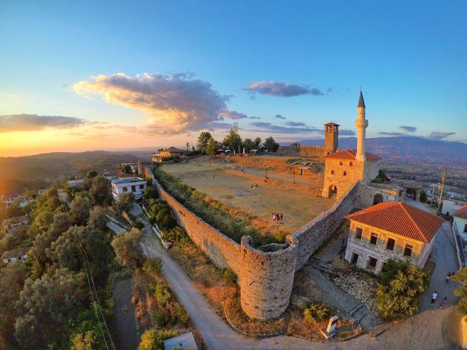
- Monumental Tomb in Persqop is located in the eastern part of the Mountain of the Villa, on the slope of the hill. It is part of the settlement known as the “Ancient Walls and the Perscopian Tomb” on Mount Petrela. Persqop was one of the ancient cities that were not reused for a long time. The monumental tomb is 3.3 km from centre of the village of Petrele. Monumental tomb, according to Albanian scholars, is classified as tomb with two chambers. Due to the lack of complete finds during the archeological excavations, its period is not accurately dated, but it is related to the rest of the fortified settlement which dates back to the V – II century BC, which coincides with the period known as the “Illyrian civic period” and where traces of the influences of Hellenistic culture are found.

- Preze Castle is a medieval castle built on a rock that extends down to the north-south direction and has the shape of an irregular pentagon. Its small size and the unstable surrounding walls, classify this castle as a facility that has served to observe important economic and military routes traversing the plain of Tirana. The castle’s eastern side is protected by the terrain itself, while the western side is a flat territory; therefore the fortification is concentrated in this part.
- National history Museum is Albania’s largest and most important museum institution. It was inaugurated on November 28, 1981. A collection of 6200 archaeological treasures, artefacts and museum objects are showcased in its pavilions, with most of them dating back to the IV millennium BC, up to the second half of the 20th The museum building stands out for a compact volume on a centrally composed square plan symmetrically in front of an atrium courtyard. The National History Museum is also a scientific research institution. In addition to the pavilions, the museum also houses archive and laboratory facilities, temporary exhibition venues and conference halls.

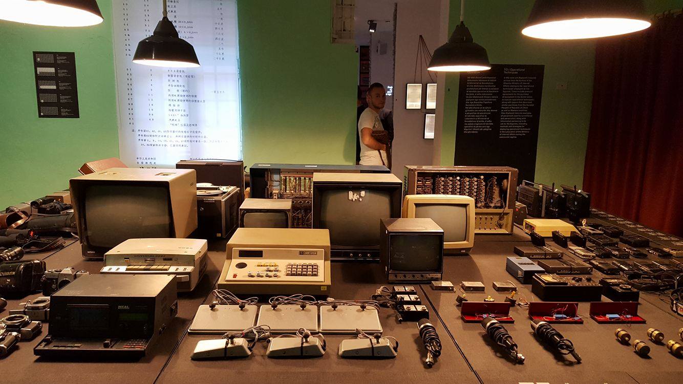
- National Museum of Secret Surveillance “House of Leaves”, opened on May 23, 2017, it is the newest museum in Albania and certainly the most intriguing one, an attempt to narrate one of the darkest periods of the country’s history to young people and to foreign visitors. Located in Tirana downtown, right in front of Orthodox Church: “The Resurrection of Christ” and near the Bank of Albania building, the site that once temporarily housed Gestapo during the occupation of Albania in WWII was turned into the Central Directorate of the Secret Service from 1944 to 1991. Designed to feature 9 sections, the “House of Leaves” consists of 31 rooms which are connected in coherence with each other and each of them have a special function.
➢ Kavaje Sub-prefecture
- Bashtova Castle has been built on a field aound 400 meters north of Shkumbin River and 4 kilometres from the Adriatic coast in the so-called the Villa Bashtove area in Kavaje. Bashtova castle is mentioned in early 16th century on a map drawn by Piri Reiz in 1521as integral part of a manual, which served sailors for practical needs. According to the Turkish traveller Evliya Çelebi, the castle was founded by the Venetians and it was later conquered by the Turks, when Sultan Mehmet departed for the conquest of Shkodra in 1478. The most probable construction time of the castle is the last decade of the 15th century, especially after the reconstruction the Elbasan castle by the Ottomans in 1466 to replace the strategic value of other coastal castles that were far away for the defense of Durres. What worried Venetians at that time was the possibility that Ottomans could exploit the area’s rich timber and forest resources to build ships and venture out to the sea. Bashtova castle held a garrison until 17th After this period, the western wall was rebuilt after having collapsed due to the flooding from the river. Austrian archaeologists Prashniker and Schober consider it a late antique-era structure. According to Gjerak Karaiskaj, based on historical sources and construction technique, the date of construction of the castle should be between the years 1467-1478 and it has been built by the Venetians.. The fortress is a rectangular structure oriented to the north-south direction and it comprises a roughly 60 by 90-metre area. A tower is built in all four corners and in the middle of each wall, with the exception of the western wall which belongs to a second phase of construction (rebuilt in the 18th century).
- Church of Saint Premte is located in the hilltop of Çetë village, about 2 km east of the town of Kavaja. The church’s interior is decorated with frescoes, painted by Joan Çetiri (Katro) from Grabova, whose activity spans from 1792 to 1813. The church of Çeta constitutes the northernmost monument where Joan Çetiri or other painters of Çetiri family worked.
8. Fier District
- Saint Mary’S Monastery Church in Ardenicë represents one of the largest religious buildings in the area of Myzeqe. The church is built in a dominant position on a high hill, on one side of which lies the wide area of Myzeqe field, while on the other side you can see the Adriatic Sea. Located between the villages of Kolonjë and Libofshë, it was a culminating station, in constant contact with the economic and social aspect of these two areas. Southern branch of Via Egnatia traverses the western side of the hill, where the monastery is built. The route continued to be used also during the medieval period. The religious site is interesting not only for its monumental values, but also for its rich history. According to historical sources, the monastery was founded during the Despotate of Epirus era. The legends have it that it was the place where the marriage ceremony of Gjergj Kastriot Skanderbeg took place in 1451, while the inscription dated May 1st, 1477 shows the existence of the monastery in that period. Ardenice Monastery represents an architectural ensemble with a triangular layout, with the church at its centre. The complex consists of the Chapel of the Holy Trinity in the northeast, the Assumption of the Blessed Virgin Mary Church in its southwest and hospices around them, which planning is conditioned by the terrain.
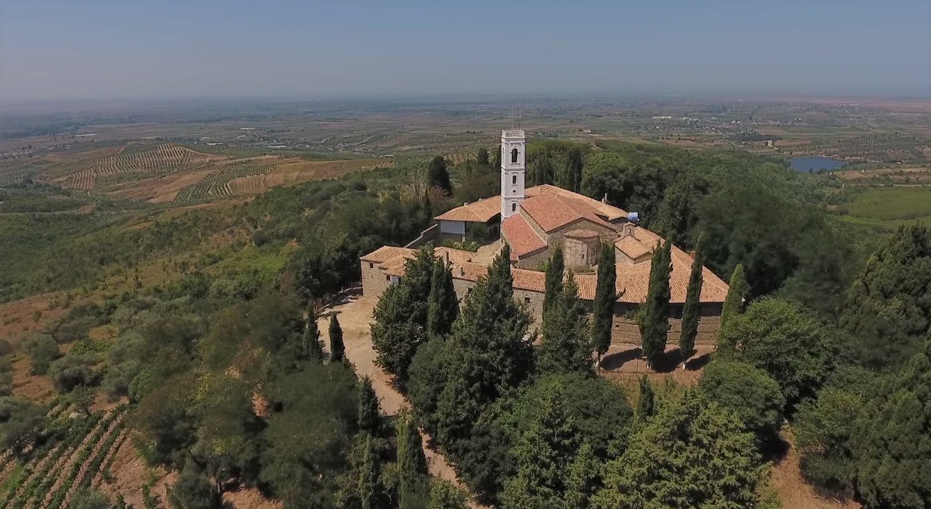
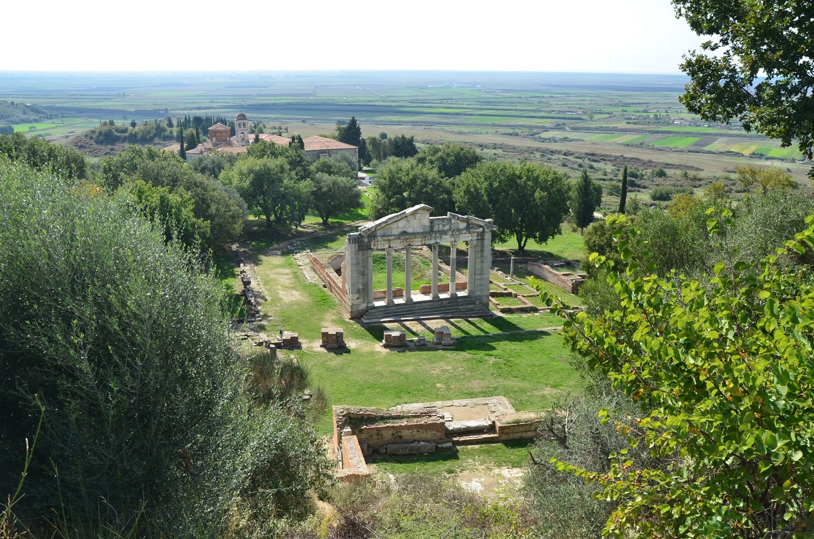
- Archaeological Park of Apollonia represents one of the largest centers of the Mediterranean world and the Adriatic basin, which was founded around 600 BC by a group of Greek settlers coming from Corinth and Corfu. After its establishment, the city was named in honour of the God of Apollo. Its strategic position near the river Aoos (Vjosa) ensured it the status of an important port city, which together with Epidamnos – Dyrrah, were two of the most important Mediterranean cities during in the Hellenistic period. Throughout its existence, the city went through a history of both development and wars. The city, together with Dyrrah, fell under the rule of Illyrian King Glaucias in the fourth century BC (around year 312), and in third century it was autonomously ruled by King Monun, whose capital was Cakran (Hill of Gurëzeza). The city reached the peak of its economic prosperity in third century BC, hence the city’s most important works discovered to date were built during this period. In the year 229 BC, Apollonia fell under Roman rule and, being an important city, Apollonia was visited by a number of leaders of the greatest empire of all times. During this period it turns into one of the most important gates of the famous trans-Balkan route Via Egnatia, while Octavian Augustus was studying oratory in Apollonia. After about eight centuries of prosperity and continued economic growth, the city began to go through tough times as a result of natural, political and military hardship. The Aoos riverbed was deviated following an earthquake around 3rd century AD, separating the city from the sea. The tremor proved fatal in an era where all commercial activity took place via the sea. The city gradually lost its economic importance by turning into a simple religious site. The disintegration of the slave-owning system and the attacks from the Goths caused the area’s shrink and demographic depression. Despite efforts to rebuild the city’s defensive walls, nothing remained from the former splendour, and the fourth century documents refer to the city as an important Episcopal and religious site. In the fifth century AD, this centre was transferred to Bylis, which became one of the most famous Christian centers in the Mediterranean, as evidenced by the numerous religious and cult sites decorated with multicoloured Paleo-Christian mosaics. The only monument testifying to Apollonia’s later medieval history is the Monastery of St. Mary, originally built in the 13th century on the ruins of the Paleo-Christian Episcopal residence, using materials from the ancient monuments of the city, mainly the theatre. The monastery stands out for its architectural values. The monastery continued to be used by a small community of monks until the 19th After this period, the city was abandoned and drew the attention of mankind through archaeological discoveries, which continue systematically to this day.
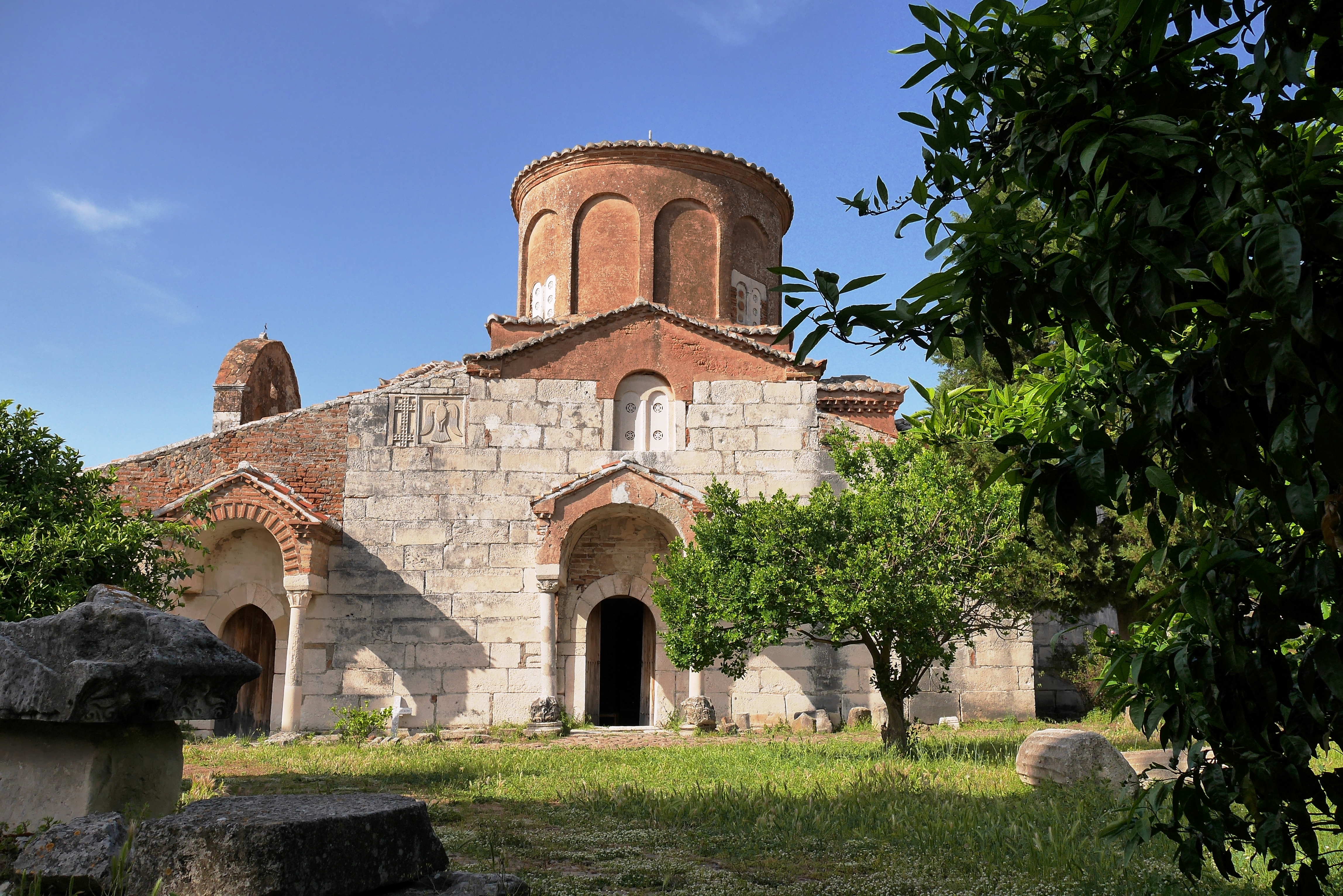
- Mary Church and Monastery in Apollonia is a byzantine Christian complex with architectural features that blend eastern and western construction traditions, rendering to the monument a special individuality. While its construction dates back to the 13th century, this effectual merging of ancient and byzantine architecture renders the monastic complex a timeless source of rich historical, architectural and cultural value. Some of the most visually striking parts of the monastic complex are several icons and murals located within it, along with the mosaics inside the refectory (or monk’s dining hall). The interaction and rivalry between these two spheres of influence is reflected in the architectural formulation, the decorative sculpture and the pictorial and technical execution of the frescoes. Despite the fact that the building’s architecture is Byzantine in design, some elements of the exonarthex, sculpture and features of the painting display the work of masters practicing Romanesque construction and painting techniques. A few scattered cypresses serve as the perfect background to the spiritual atmosphere found here.
- Saint Kolli (Nicholas) Church, first-category culture site, is located in southeast of Ardenica Monastery. The church is a valuable asset for the area of Libofsha and entire Myzeqe, for the history and the frescoes inside it.
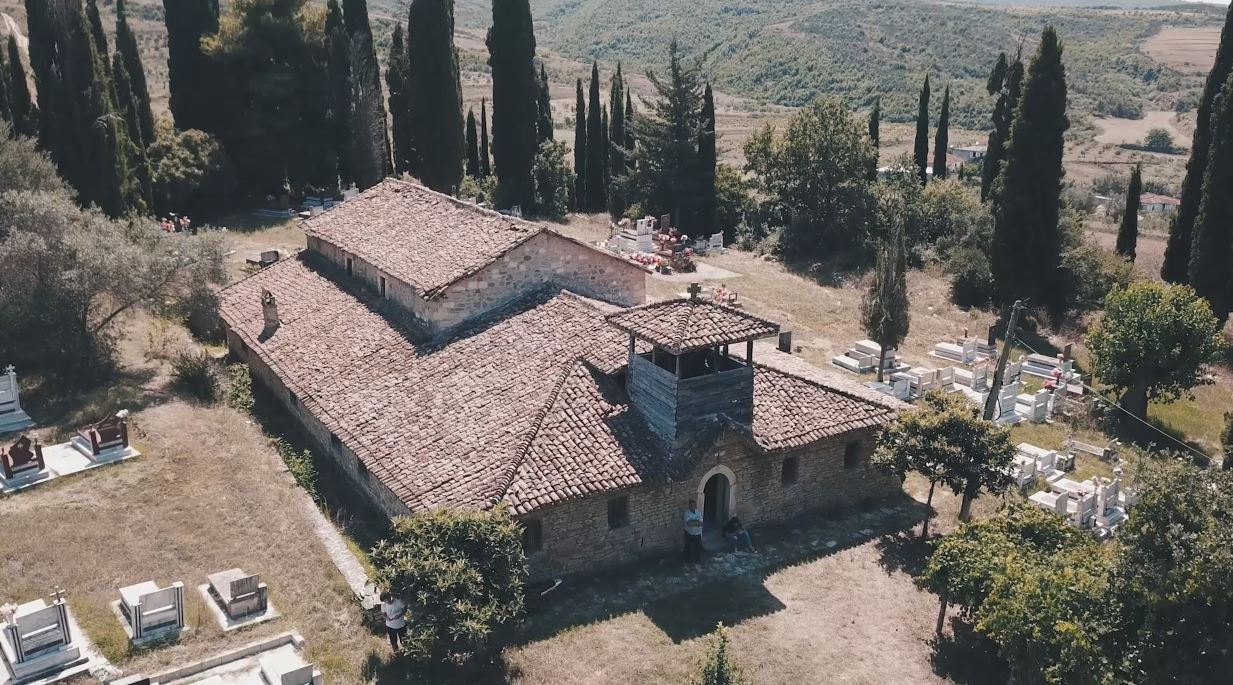
- Church of Saint Todri in Kadipashaj is a basilica construction and consists of the nave, narthex and the cloister. The interior of the church is illuminated by numerous open windows in the upper parts of the north and south side walls. The entrance is from the west side through the narthex, which is attached to the nave on this side. The latter is two-storey structure. The church’s interior was decorated by Joan Cetiri and his nephew Nikolla, two famous icon- and fresco-painters from Grabova, in 1801.
- Saint Kolli (Nicholas) Church is located in the village of Upper Krutje, Lushnje. It was decorated by painter Nikolla Çetiri from Grabova in 1811. The church is a variant of the churches in the Myzeqe area, consisting of the nave and the cloisters around the three sides of the nave. The church has a continuous function and is largely frequented for the weekly mass, baptisms, weddings, funerals, memorials etc. The village cemetery lies around the church.
- Saint Mary’s Church in the village of Bishqethem in Lushnje. The church was built in 1798. It was painted by Johan Çetiri from Grabova. The church is a three-nave basilica with cloisters on three sides. It consists of the nave with the altar area, old building and cloisters to the north, south and west.
- Saint Kolli (Nicholas) Churh in Toshkëz consists of the nave and cloisters that surround it on three sides – north, south and west. It was built in 1811 and painted in 1813 by Joan and his son, Naumi, of the Çetiri family from Grabova.
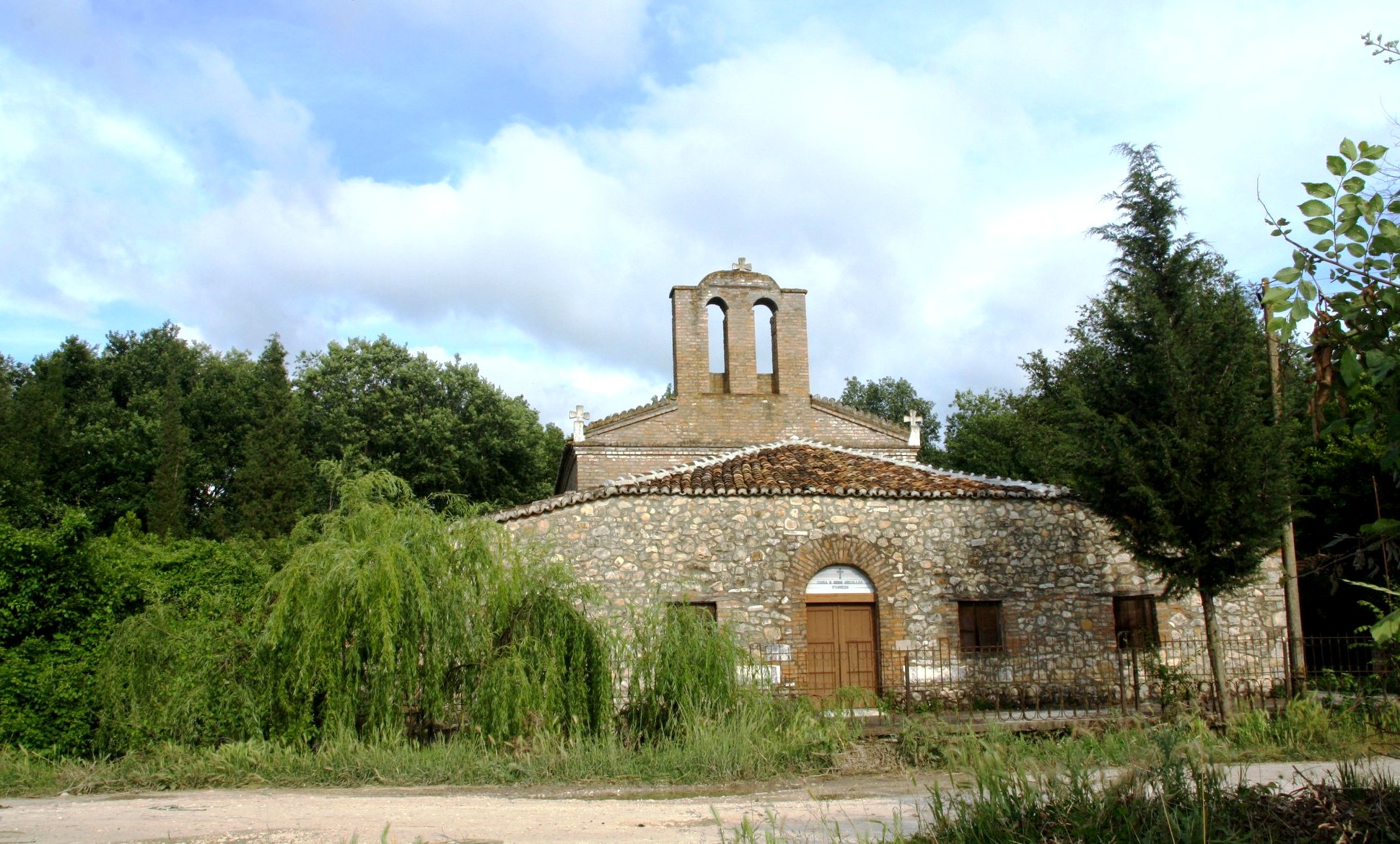
- Archaeological Park of Bylis (Ancient city of Bylis). The city’s origin dates back to the middle of the fourth century BC and to the end of the sixth century AD. But, after the sixth century, it was no longer inhabited and the city was spared of the damage. Thanks to this, Bylis is an important center even in the sixth century when it was abandoned, which is evidenced by the five basilicas discovered inside the surrounding walls. The city is believed to have ceased existing between 587 and 588 with the Slavic conquests, when the city was totally destroyed and the population fled. However, there are opinions that the end of the city should not be this date, but a period several centuries later.
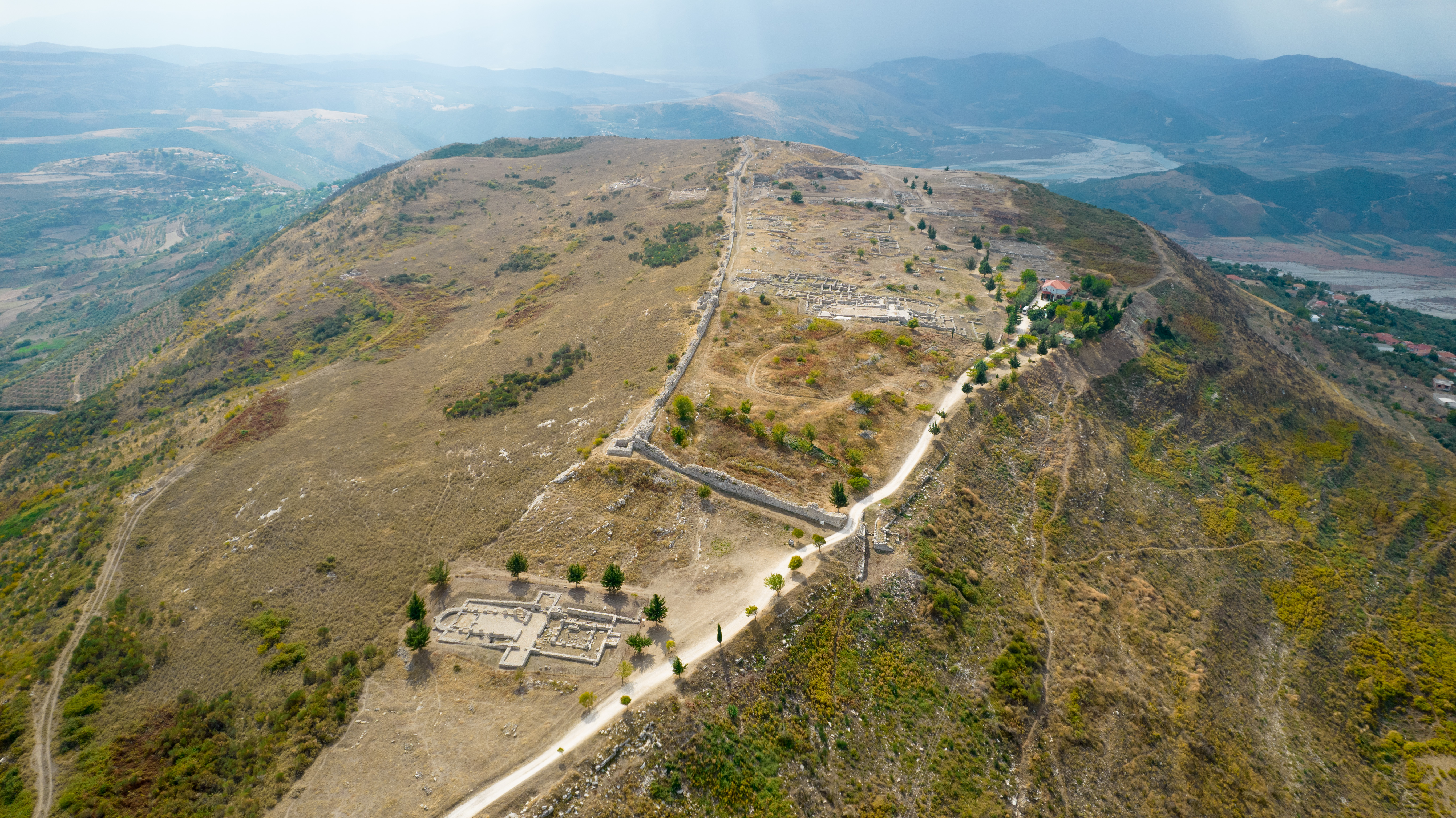
- Ruins of Paleo-Christian Church of St. Mary (basilica), Ballsh are located at the entrance to the town of Ballsh, about 6 km north of the ancient city of Bylis. The church was built during the Middle Ages after the city of Bylis was abandoned and it was constructed with materials taken from local churches as this Episcopal center was destroyed. Ballsh Church is well known because the Bulgarian tsar Boris and his people were baptized in 866.
9. Vlora District
- Kanina Castle represents a civic center of the Hellenistic period (century III- II B.C), which flourished as a medieval city up to century XVIII, without changing its fortification system. The castle is surrounded by a 986-meter long wall and it encompasses an area of 3.6 hectares. It is located in Kanina village, near the tourist coastal city of Vlora. Kanina is the balcony of the coastal area of Vlora bay, protected naturally from Shushica valley. This urban antic-medieval centre is of importance for researchers, for the interpretation of Illyrian-Arbër continuity, serving both tourism and the cultural tourism.
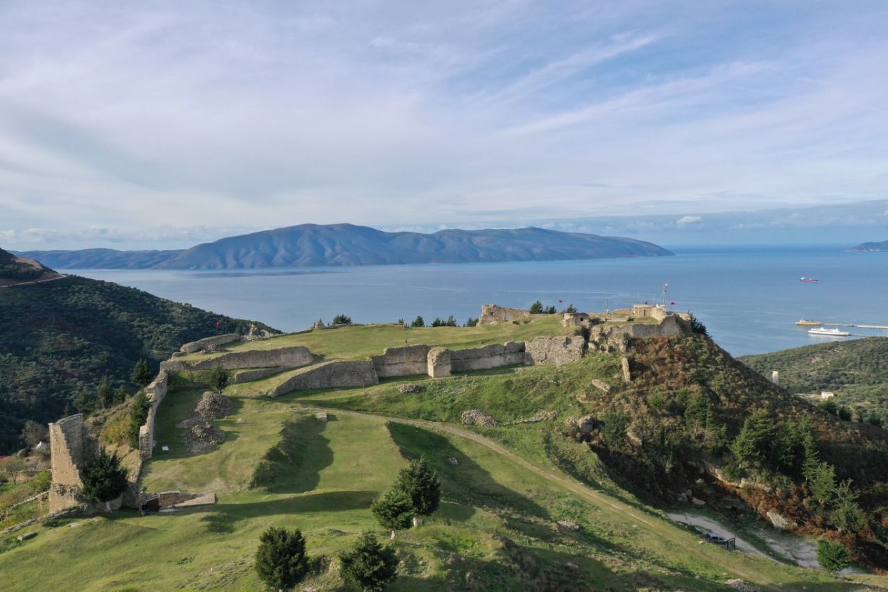
- Himara Castle; Himara is a city with a long history that goes back to the ancient times, 13th century BC. In antiquity, the city was known by the name of Chimera. The very first mention of Himara goes as far back as the 1st century from Roman author Pliny. The site is located on a hilltop where the castle neighbourhood is found nowadays. Surrounded by giant walls and built on stone blocks, Himara’s fortification began in the 13th century B.C. Another fortification was built in the fifth century B.C. with walls built with polygonal stone blocks while in the fourth century B.C. was fortified with trapezoidal type walls. Between fourth and third century B.C., Himara was one of the thriving cities on the Akroceraunian coast, along with Meandria (Borsh). Dwellings are built of stone and partly on the rock on the west side of the rocky cliff. The importance of this center in the ancient period is appreciated through numerous archaeological finds, such as ceramic objects, spearheads, iron swords, etc. and a inscription dating back to the year 169 B.C. that has been found in Delphi, according to which the city of Chimera (Himara), sends to the oracle of Delphi theorodoks (priests), along with other cities of Phoenicia and Abantia. Among the ruins of the castle are also some interesting and beautiful churches, including the Church of St. Sergius and Bacchus and the Church of St. Mary Kasopitra. From the ninth century, Himara was continuously invaded by the Byzantines, Slavic, Bulgarians, Normans, Despotate of Epirus, and Anjou. At the end of the 13the century it was taken over by the Venetians, who rebuilt the castle and fortified its harbor with stacks. The city continues to be highlighted during the Ottoman rule and on the documents in later centuries, while it is known for supporting important national figures such as Gjergj Araniti and Skanderbeg.
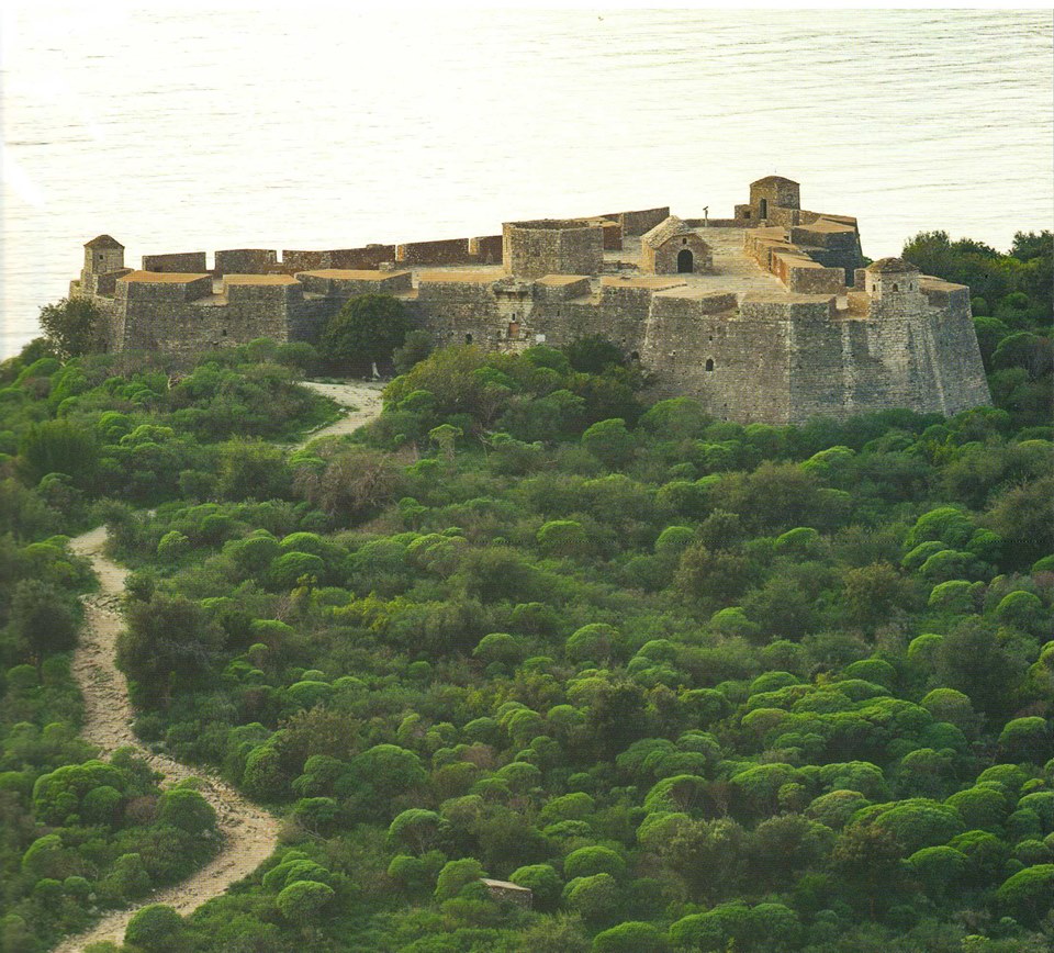
- Porto Palermo Castle was built by Ali Pasha in 1804. At that time, the ruler was distinguished for reconstruction and construction of a series of fortifications. He created a whole system of separate castles and towers, as he predicted a potential conflict with Turkey. Castles were built in strategic key points, near the country’s main roads and ports. The Porto Palermo Caste’s position speaks for itself. To build his military fortifications, Ali Pasha hired a large number of Italian and French architects and engineers, but the construction work was done and supervised by Petro Korçari, a Korca master, between 1800 and 1812.
- The fortress is a historic monument in the city of Vlora. Ruins of Vlora Castle are found in the city centre, right behind the Independence Monument. The excavations carried out in spring 1985 unearthed the ruins of a wall. It marked the launch of archaeological excavations in 1986. The cultural layer is represented by two periods, late antiquity and the middle ages, which also coincides with the construction phases of the surrounding wall. The fortification system was built in 5th century A.D. and later reinforced (sixth century, and early seventh century). The fortification system included quadrangular reinforcing towers.
- Orik Archaeological Park is first mentioned by Herodotus and Hecataeus in the fifth and fourth centuries B.C. and called it the harbour of Epirus. By the mid-fifth century B.C, according to the historian Pseudo-Skylaksi and later by Kalimahu, Orik was populated by Amants. While Apollodorus, quoted by Stephan of Byzantium, describes Orik as a polis. According to archaeological data, life in this city begins around the fourth century and recognizes an important development during the Hellenistic period, when the urbanization of the city began. Being a port and coastal city near the most important trade routes in the Adriatic, the basis of its economy was the sale of raw materials, provided by the quarries in Karaburun and the rich forests of the Akroceraunian mountains. In the middle of the fourth century, Orik is shown in the oracular tablets of Dodona as an ally of Korkyra. Like many cities in southern Illyria, Orik must have been under the rule of the King Pyrrhus of Epirus. Once the Epirus rile ended, Orik issued its own coins, borrowing Apollonian models with the facet of Apollo Agyieus – Obelisk. According to Pseudo-Scymnus, an anonymous Greek author and geographer, the city of Orikum was settled by the lost Euboeans, who were blown off course by strong winds on their return voyage from the battle of Troy in the 12th -14th centuries B.C., whereas according to Pliny colonists from Colchis established the city of Orikum. Being the nearest harbor and a trading center on the Adriatic coast, Orikum was important to military as well and played an important role in the war between the Romans and Macedonia of Philip V. Julius Caesar used the area as a troop encampment for several months until Pompeius Magnus took them in the mid-first century B.C. In the second century A.D., Philostratus highlights the last efforts of Herodes Atticus to rebuild the city. In the late antiquity and in the early Middle Ages, the importance of Orikum in the Vlora bay diminishes as Aulona thrives and its name is no longer mentioned in historical sources.
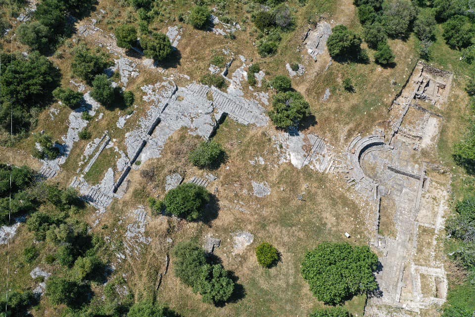
- The Archaeological Park of Amantia is located in the village of Plocë, 34 km east of the city of Vlora. The park features an acropolis, necropolis, and a stadium. Acropolis, the highest peak of the city, is surrounded by a square and polygonal stone wall. Some squares have been opened at the rocky side of the acropolis where the ancient dwellings were built. The upper rocky plateau, sloping different in its sides, forced the builders to adapt the walls, the construction technique and their direction to this site. The castle’s main entrance is found on the northern side, where a fragment of its arch is still preserved. The foundations of the temple and the Paleo-Christian basilica have been unearthed at the Acropolis. The church’s nave and alter have been divided by cylindrical column. The city’s walls were built with large square stones and slabs (5th century BC). The temple had a square shape and with a roof supported by cylindrical columns. Next to it lie the foundations of the three-nave Paleo-Christian basilica.

- Monumental tomb of Ismail Qemali; Ismail Qemal Bej Vlora (1844 – 1919) was an Ottoman Empire civil servant, activist of the national cause, member of the Ottoman Majlis (Council) and founder of the Albanian state. Ismail Qemali was the first signatory of Albania’s Declaration of Independence and the chairman of the council of ministers of the Provisional Government of Albania. On November 28, 1932, on the 20th anniversary of the independence, upon a request from Vlora residents and by a Royal government decision, a memorial tomb created by sculptor Odhise Paskali was built in the city garden, right where the house where he was born and where he proclaimed Albania’s independence. A magnificent monument stands next to the memorial tomb today, symbolizing this historical event on November 28, which would give the beautiful name to that large square: “Flag Square”.
- Saint Mary’s Church is located on the island of Zvernec, opposite the village with the same name. Its style is of free cross with a dome and narthex, while the exonarthex and the open cloister were added later. The architecture of the church, with cast and ornate mouldings, the treatment of facades with arcades, are elements that date back to the second half of 14th Romanesque architecture impact is obvious in its external part, which relates to the power and the domination of the noble family of Balshaj over these territories.
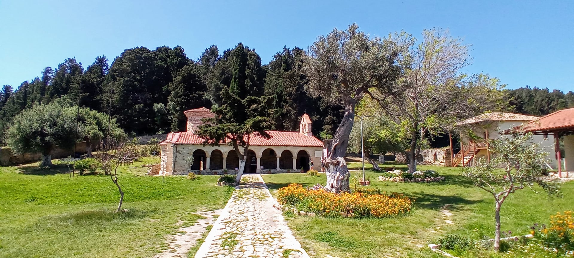
- Demetrius’ Monastery Church is located in the village of Qeparo, where it forms an architectural ensemble together with other social facilities, church administration building, school building, etc. The year 1760 carved on a stone, on the right side of the west gate, is thought to indicate the year when the church was built.
- Church of Source of Life (Marmiroi) in Orikum is located behind Pashaliman, in a secluded place on the crest of a low hill in the western part of Vlora bay. It has been dedicated to the image of Saint Mary, as the Source of Life, but, in people’s memories it exists as “Marmiroi”, a name that appears in historical sources in 1307 and relates to the marble quarry nearby. Marmiroi Church dates back to the early stage of middle Byzantine period, the first half of 10th

- Saints Sergius and Bacchus Church represents the former seat of the Himara archdiocese and around the year 1019 it was annexed to the Head Diocese of Ohrid as the 10th century historic documents. The church was built on the highest point in the north of the castle of Himara. The church comprises the narthex, naos and the place of the altar separated from them by a stone iconostas and the narthex on the western side. The church bears traces of two construction phases. The original construction included the naos and the lower wall parts, since the higher parts have been built and rebuilt several times, whereas the narthex has been constructed during a later stage. The old walls were built of medium and small size limestone. The walls have been repaired several times at different periods. Based on these data, construction of the church has started around the end of 10th century or beginning of 11th
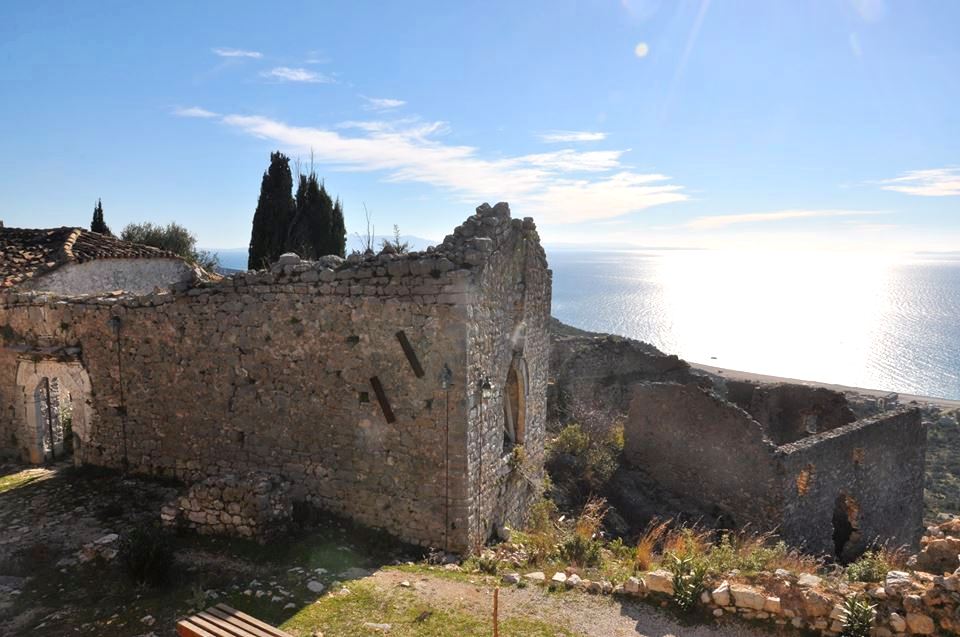
- Saint Spiridhon Church was built in the lower neighbourhood of Vuno village, where it forms a building ensemble along with the other social buildings, including schools and church. The Church’s interior is decorated with murals which, according to the inscription on the southern gate, were painted in 1784 by Jani from the Eparchy of Drinopolje and Gjirokastra, with the contribution of the local village residents at the time of Bishop Joaniq. The very same master is believed to have also painted the icon of Christ and the Archangel Michael in the iconostasis.
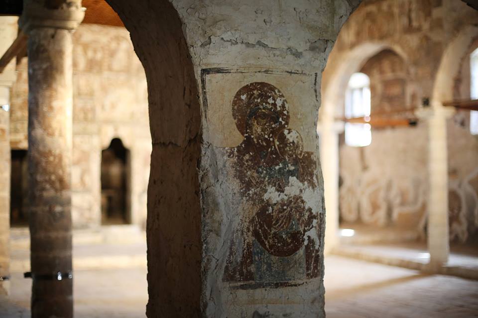
- Ipapandia Church is located at the lower part of Dhërmi village, close to the sea. It preserves the typological features of the coastal single-nave churches. The church’s interior is decorated with wall paintings, which reflect two different construction stages. The paintings of the first phase are related to the Ionian School of painting and according to the inscription, they were completed in 1751, while the paintings of the second phase are completed in a Fjonjat studio in Kostur area, and date back to the second half of 19th

- Saint Stefan Church is located at the lower part of Dhërmi village, close to the sea. In its current state, it represents a small post-Byzantine chapel, the walls of which are integrated parts of an earlier basilica, consisting of the central nave divided into three naves, the altar and narthex on the west side. The interior of the church preserves traces of mural paintings of two different stages of implementation. The first stage belongs to 16th century, while the second one was completed in the second half of 19th century, by the Fionjat studio.
- Saint Premte Church is a 17th century building in the village of Lukove. It is a basilica-type three-nave church with a dome, with interior dimensions 8.90 x 4.40 m. The church is built with 70 cm-wide stone walls and a double roof covered with stone slabs, which is interrupted by an octagonal drum on which the church’s dome stands.
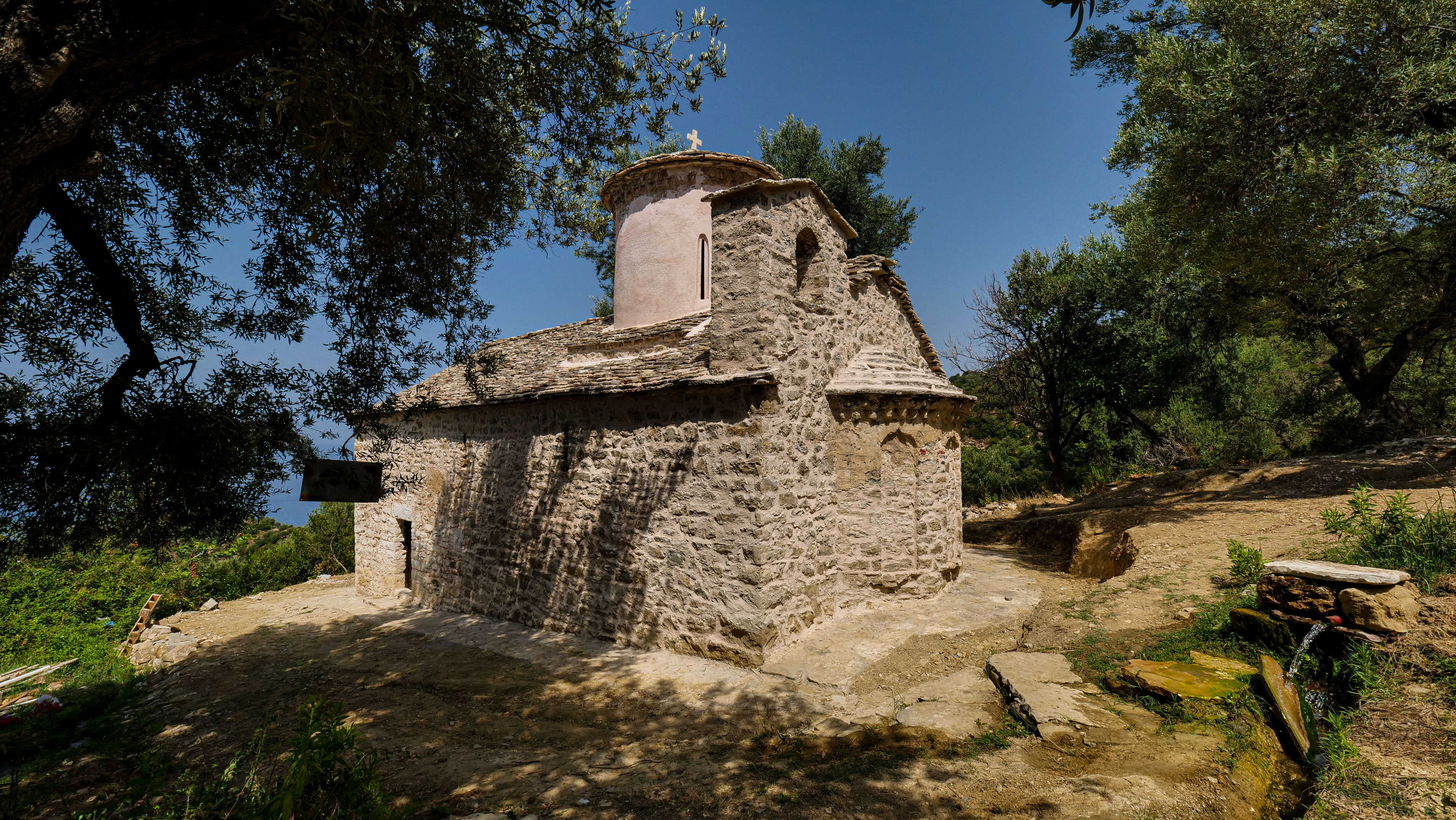
- Muradije Mosque features cubic halls and the minaret, while traces of the former porch are preserved on the north wall and its foundations. The walls are built with regularly placed stones and bricks, two rows of carved stones, alternated by two rows of bricks. The building is covered with a dome. The entry to the mosque is on the north side. The mosque has been built in second half of the 16th The mosque is designed and built by the Albanian architect Sinan, who was one of the most important builders of mosques in the early Ottoman era. The Mosque of Muradije is built with supporting walls. The walls are made of stone and bricks. The building is covered with a spherical dome made of stone.
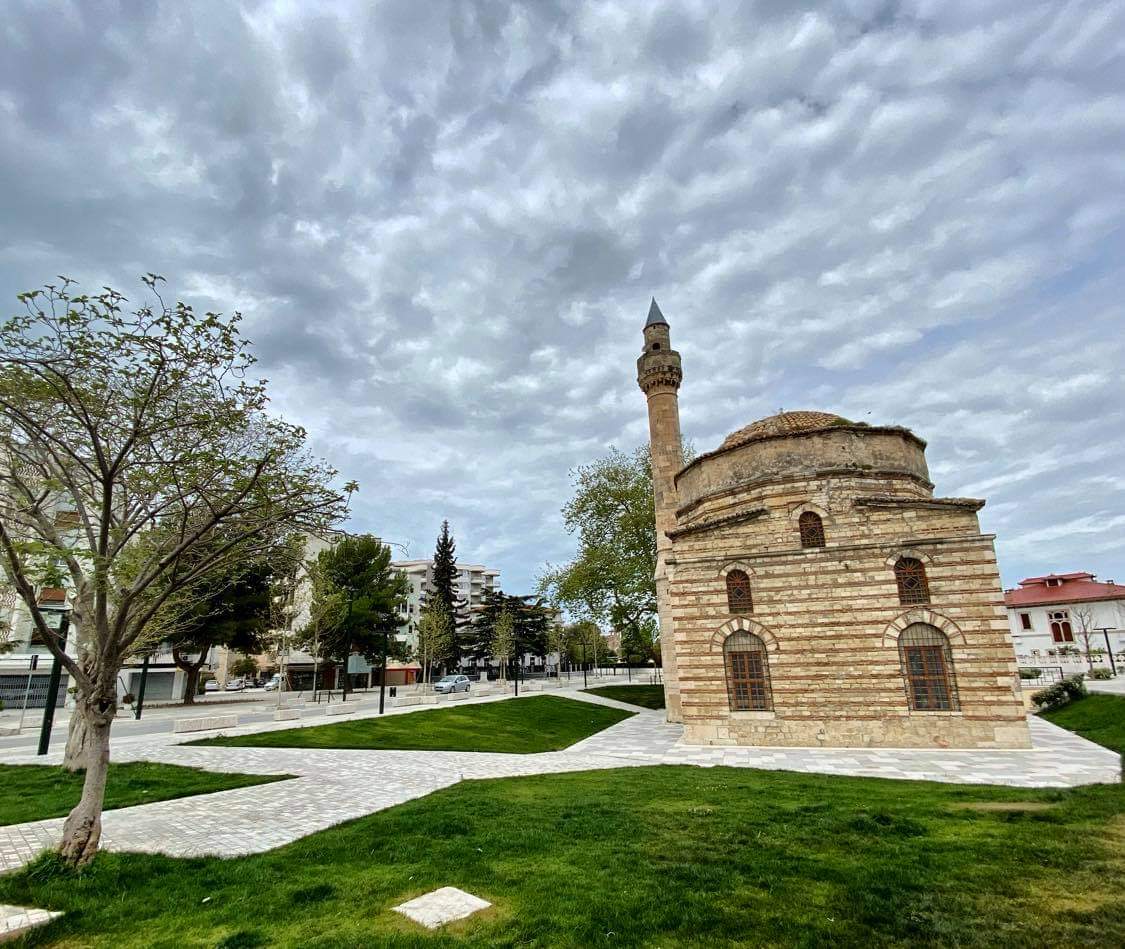
- Justin Godard Street Ensemble, a pleasant cobbled alley separating two sides lined up with buildings with sweet bright colours that represent typical Vlora houses in a straight line. Many of these houses have been declared first category monuments of culture. The two-storey house of Marigo Posio is one of the historic buildings. Marigo Posio is known as the girl who embroidered the Albanian national flag. Before the 90’s this street hosted various state commercial activities and was inhabited by old local families. After the 90’s, newcomers settled in. Local autochthonous families have looked after and have frequently maintained the old buildings along the alley. The buildings’ facades, balconies, doors, windows, railings, and roofs have sustained damages and need repair.
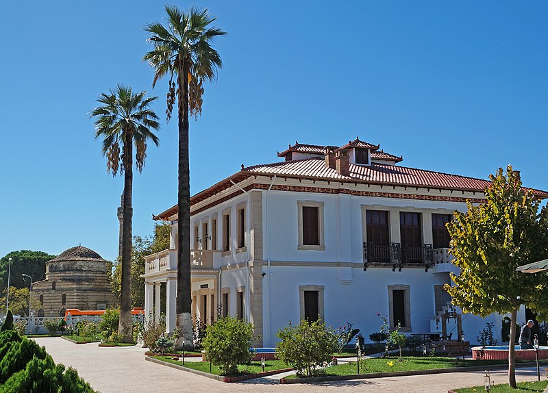
- The Clock Complex in Vlora was built in 1918 under the auspices of the then Mayor Ali Asllani and funded by local merchants. In addition to its practical functioning aspect, the Clock Complex also boasts aesthetic values. The market and the clock are designed by Italian specialists. The clock has served as a landmark for the city and the market area. The structure saw introduction of new construction technologies and materials, including reinforced concrete and binders with portland cement. The building underwent a restoration project in 1996, when its interior and exterior facades were renovated. Interesting about this monument is the presence ornaments in frames and rosettes with patriotic motifs, including Skanderbeg’s portrait overlooking the front of the building, the double-headed eagle overlooking the east.
- Eqrem Bej Vlora Museum House was built in early 19th It is the house of the famous Vlora family. It is a two-storey building with the roof covered with Marseille tiles. It is used for the exhibition of historical and ethnographic artefacts. In addition, it is worth mentioning that it also houses very rich library.

Delvine District
- Delvina Castle, a ruined castle rises on a rocky ridge in the fertile plain of Vurg. The structure overlooks road leading from Gjirokastra to Delvine, traversing the Muzine Pass. The city of Delvine is built around the castle. According to the Ottoman explorer and traveller Evliya Çelebi the castle was built prior to the Ottoman invasion. This fortification is related to the strengthening of the Arbëresh principalities. The similarity of the third phase with Kardhiq castle, which dates back to the second half of the 12th shows that the first stages date back to an earlier era, but the pottery found deep in the castle’s foundations belong to the Middle Ages. The building technique with reinforcing layers rules out the possibility of construction in late antiquity. Based on historical data and the technique of its original construction, the castle dates back to the 11th and 12th centuries, while the structure took its final shape in the 13th and 14th
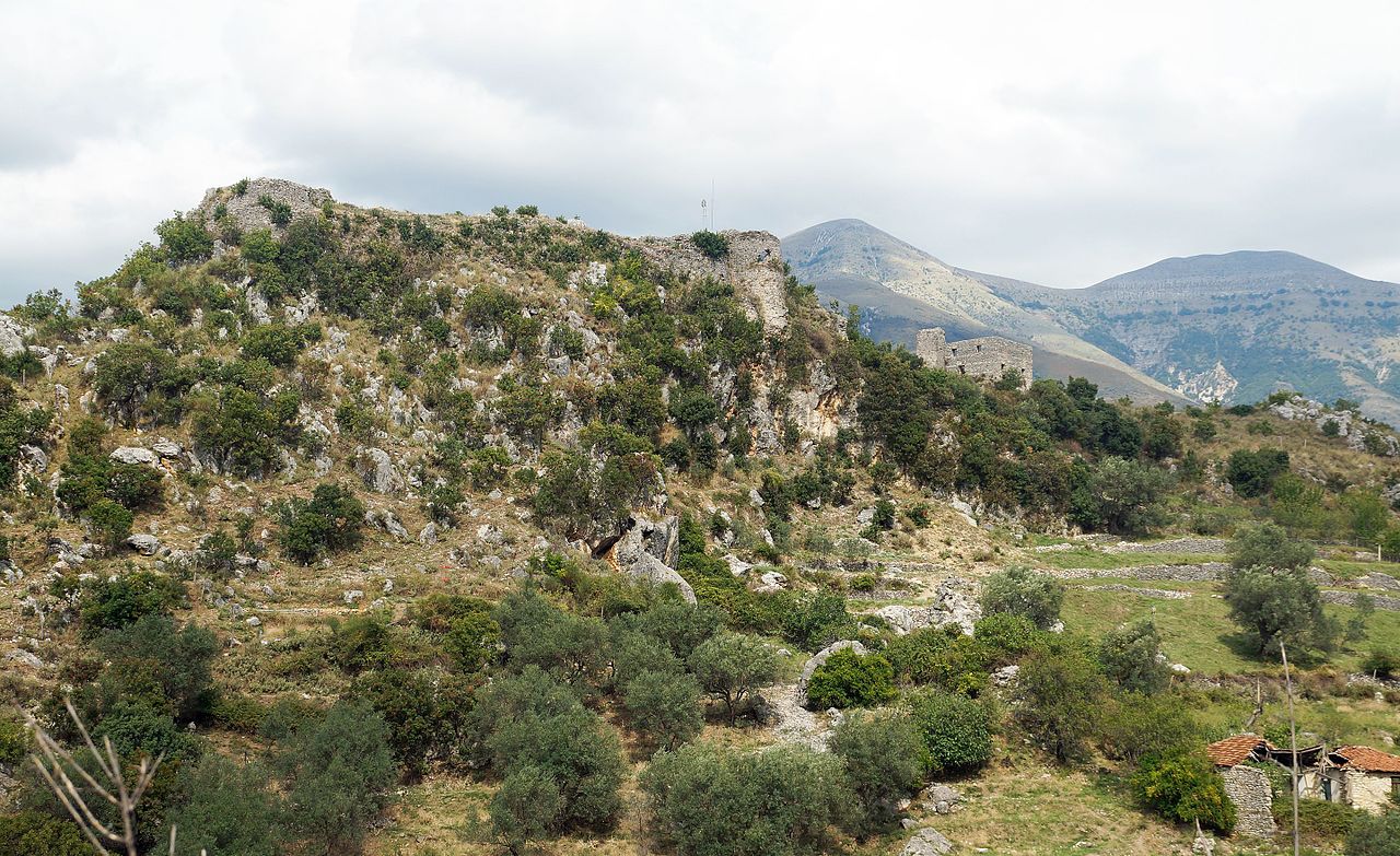
- Ancient city of Phoinike: The first settlements here date back to the Bronze Age, yet Phoinike took the shape of a genuine city in the fifth century BC and became the most fortified center of the Illyrian tribe of the Kaons. The city’s fortification was carried out in three stages, in three different time periods. Right at centre of Phoinike hill stands the acropolis, the heart of the city. It seems that the city thrived in the 2nd century BC. The main findings in the ancient city date back to this period. The acropolis in the field on the west of the ancient city is quite interesting. In 233 BC, Phoinike became the center of the Epirus League. In 230 BC, the Ardians, another Illyrian tribe from the North, briefly occupied the city. The ancient city of Phoinike is also famousas the place where peace treaty between the Romans and Philip of Macedonia was signed.
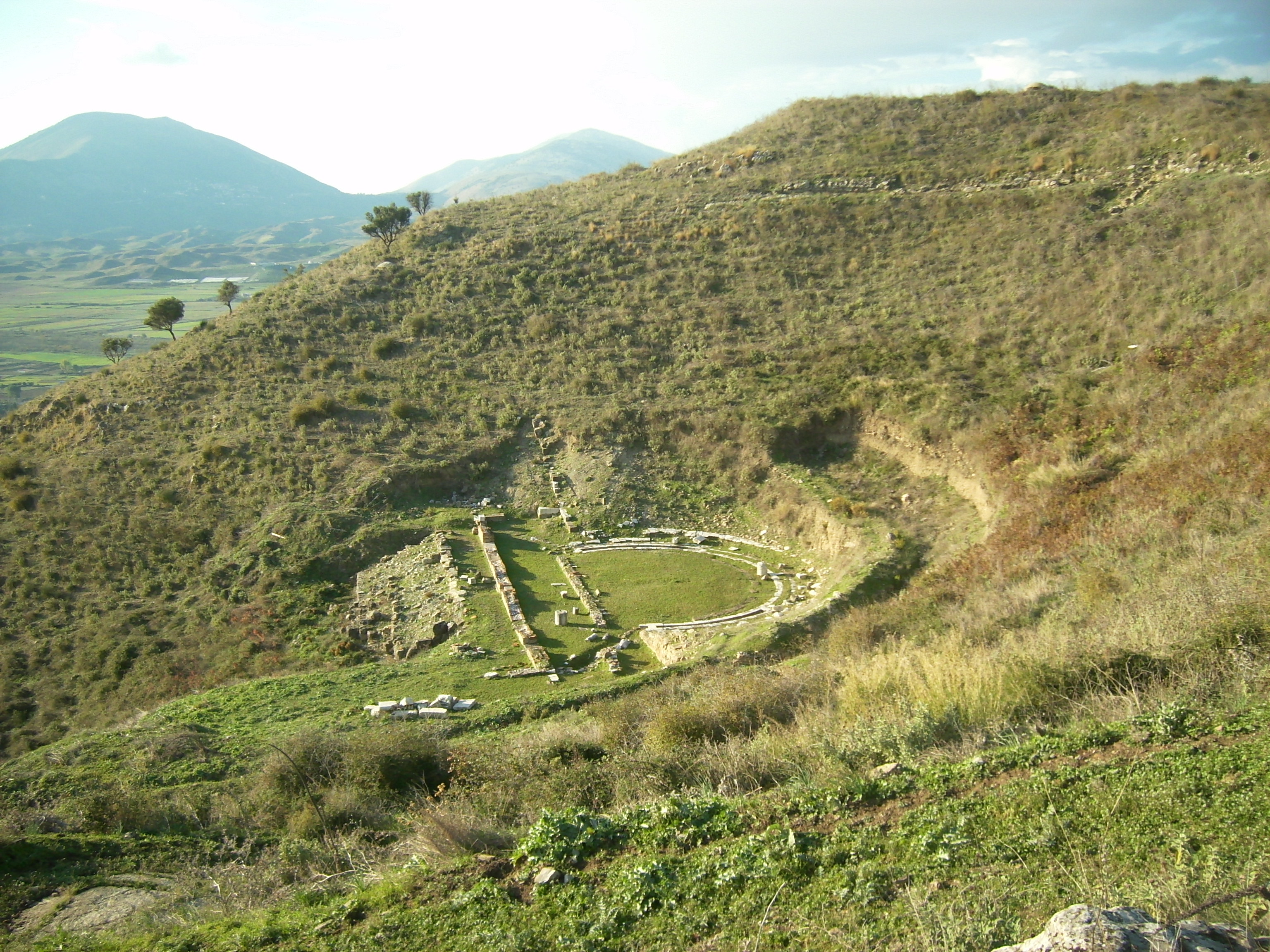
- Cave with Paintings in Kostar village is dedicated to Saint Mary and it is located between the villages of Kostar and Brailat, Delvine district, on the road linking the two villages. The cave was dug and opened at the foot of Lihogja Mountain, on its north-western side, with a wide view towards the village of Kostar. The cave has been an important pilgrimage site since earlier periods as clearly evidenced by the existence of two different layers of paintings. The first stage is thought to date back to the middle or late Byzantine era. The Saint Mehill church is the closest monument, a religious site thought to date back to the 12th and 13 century based on its architectural features, construction technique and archaeological material. It is thought that the church and the cave, which today serves as a monastery and is integrated within a later structure, have been historically related to each other. The murals are of a high artistic and technical quality. They are made with the recording technique, as is most evident in the inscription on the west gate. The compositions are inspired by gospel texts and contain an extended iconographic cycle, with scenes depicting the life of Christ and the Virgin Mary. The paintings also feature individual portraits of saints (folk saints, military and royal saints). The second phase carry features of post-Byzantine painting, a combination of Byzantine and local painting traditions. Taking notice of its characteristics, but also on the inscription engraved on the stone of the entrance gate, it is most likely that this phase dates back to the second half of the 18th
- Saint Jani Basilica is located around 1 km west of the village of Blerimas (Shijan) on the left side of the Kalase River, on top of a low hill with sandy geological composition. It is right here where the ruins of a late antiquity church are found and local residents call it by name Saint Jani basilica. The basilica has gone through four construction stages: first phase dates back to the 10th century, when the structure was a small, single-nave and an apse, with a semicircular layout, five entrances, with the one in the western part featuring granite columns. The second phase dates back to the end of the 10th century and first half of 11th century, when the church was transformed into a three-nave and three-apse Basilica, with a semicircular layout in the eastern part, a narthex and a new entrance in the southern part. An outer narthex was added during the third construction phase, when the central venue was divided into three parts. Finally, in the fourth phase, after the Basilica was destroyed, a small chapel was built in the northern part of the narthex. At this stage the walls are decorated with frescoes. Various tombs are found inside church area and outside it on the east side.
- Church of Saint Koll Monastery in Mesopotam is located on the southern part the monastery. This church is unique of its kind s the largest among preserved Byzantine churches in Albania in XI-XIV centuries. The church has a cubic shape with the central part rising above and is crowned by four domes. It is thought that on its three sides, the church was surrounded by galleries or open porches with arcades that were torn down in 1793. According to researchers, in 1510 the church was hit by an earthquake and it sustained significant damages. The church is known for its unique architecture, its brick decoration, sculptural relieves on the exterior walls of the facades, the artistic values, the high level of Byzantine-style building, including the Roman influence. It dates back to the XIII century as shown by the emblem of D’Anjou.
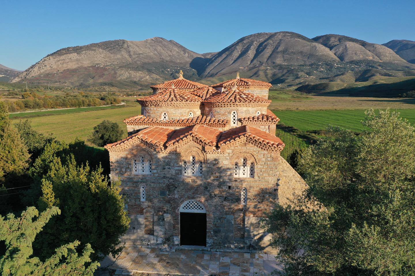
- Saint Thanas Church in Pecë is located north of the access road to the village, about 500 m down the national road. The site is a small chapel. The church’s interior is decorated with mural paintings that constitute important evidence in the study of artistic activity and the country’s historical context, but also for the activity of a prominent artist back then. Based on the inscription on the nave’s west gate, the paintings are the work of the talented artist Ilia Llongovit and were created in 1525. The complex is characterized by simplicity, freed of details, strong colour contrasts and their careful processing, the trend to render the saints a noble / military appearance, features that refer to the tradition of the late Palaeolithic period, especially that of north-western Macedonia. The limited focus of the iconographic cycle on a few main scenes only, the large size sections of top level representations, as well as the same date of painting with that the church of St. George in Upper Leshnica, also created in 1525, suggest limited material means and financial of painting donors, as well as the need for its speedy completion, even by making use of the templates of a larger church. Llongovit’s painting reflects the features of religious art, shortly after the fall of Constantinople (1453) and the conquest of the most important Albanian cities. The activity of this painter, identified only through the two churches today, shows not only the continuation of the Byzantine tradition but also the new reality the monumental painting in the provinces was going through.
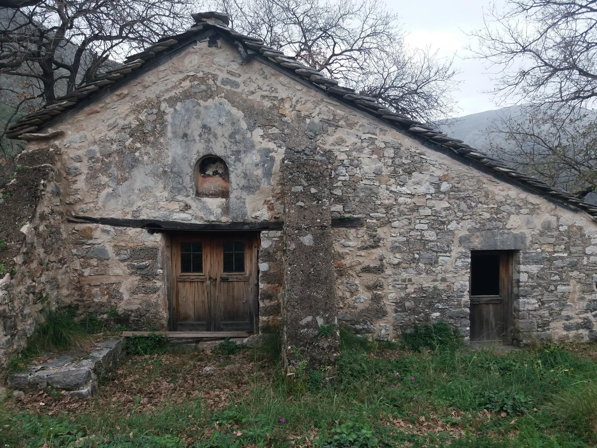
- Gjin Aleksi Mosque is a 15th century mosque in the village of Rusan near Delvine. The religious complex consists of the Gjin Aleksi Mosque building, surrounded by 4 polygonal tombs and the fountain. The mosque is a very precious monument of its kind. Two polygonal tombs or Teke are placed in front of the porch of the mosque, a third tomb is attached to the southern wall of the Mosque and the fourth tomb is located in the backyard. Part of this complex on the east side is an early fountain. The Mosque’s main structure consists of the porch, the prayer hall and the minaret.
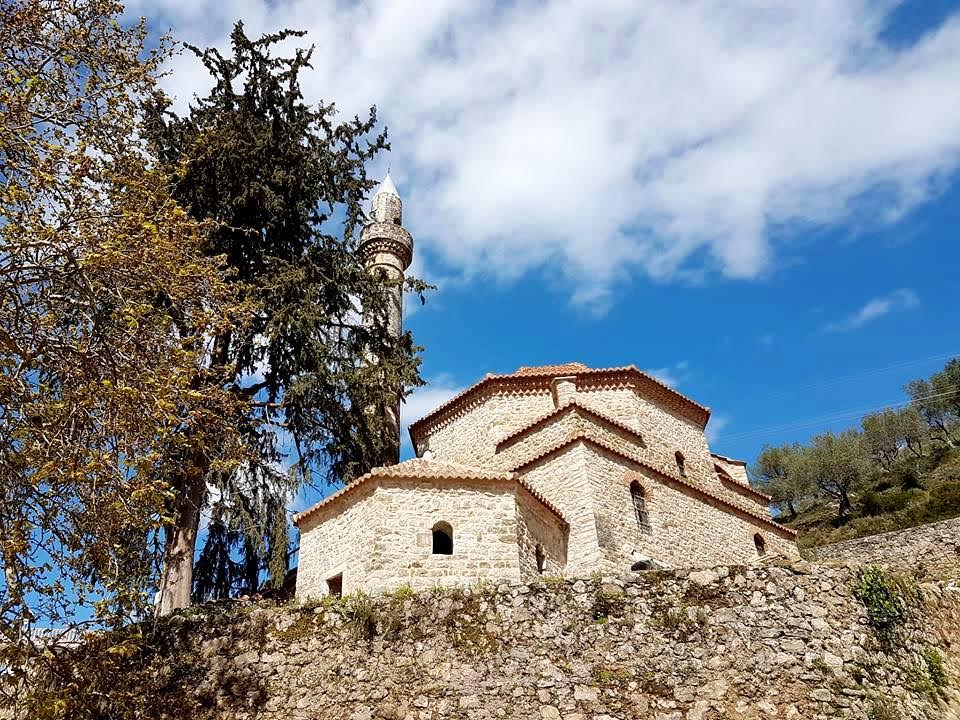
- Islamic Complex of Xhermehalla, Delvine; The site is a noted Cultural Monument of Albania, located in Delvinë, which was built in 1682. The site rests under the view of the Delvinë Castle. The Islamic complex’s most important object is a mosque built 16th century, with old relics and two caskets inside, a Hammam, built at the beginning of the 16th century, and the mezzanine of this complex, built in the 17th The two tombs are thought to have been built between 18th and 19th centuries. The mosque typologically represents the mosque with a square layout and it is built with stone walls and lime mortar.
Saranda District
- Qyteti antik i Butrintit; Butrint is a magical place. The unique combination of archaeology and nature creates a special atmosphere found nowhere else in the Mediterranean. Prehistoric sites have been identified within the nucleus of Butrint, the small hill surrounded by the waters of Lake Butrint and Vivari Canal, as well as in its wider territory. With its hinterland it constitutes an exceptional cultural landscape, which has developed organically over many centuries. The island of Corfu closes the view to the west. Butrint has been described as a microcosm of Mediterranean history, with occupation dating from eighth century BC. Given its strategic location, Butrint has come to existence of the Mediterranean history since the First Peloponnesian War in fifth century BC at its earliest evidence, up to the Napoleonic Wars in 19th century AD. Its Greek, Roman, Byzantine, Angevine, Venetian, Ottoman monuments reflect this long and complex history. Butrint’s perimeter wall encompasses an area of 16 ha, further extending along an area of 24 ha in the ancient surroundings of the Butrint plain behind the Vivari canal. The site’s central part is completed by a good defence system connecting.
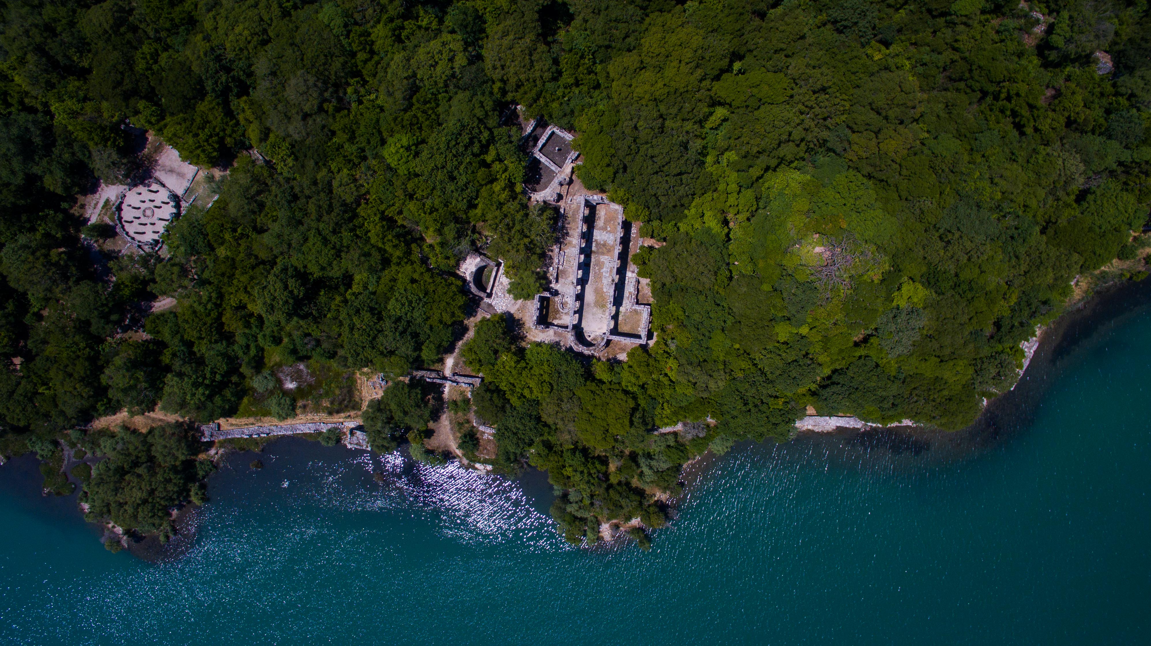
- The Borsh Castle is located three kilometres northwest of the village of Borsh, Saranda. The castle is built on top of a rocky hill overlooking the ancient city of Borsh, which once was built on the slopes of this hill. The castle dates way back to the 3rd – 4th centuries, BC. The castle holds an important strategic position, not only because it is located adjacent to the sea, but also close to one of the two gorges that crossed Ceraunian Mountains, in the Middle Ages known as the Himara Mountains, connecting the coast with the interior of the country.
- Castle of Lëkurës is another Ottoman-era fortification. The castle is located on a high hill southeast of Saranda, near the ruins of the Lëkurës village abandoned a century ago. The castle’s layout is almost square, measuring 42 x 44 m, with two round towers located in the northwest and southeast corner, and a rectangular tower on the western wall. In terms of layout solution, Lëkurës Castle is similar to the other Ottoman-era fortifications, such as Preza and Peqini castle. Each of them, besides round-cornered towers, also features a rectangular tower in one of the walls. Based on the available data, the most likely time of the castle’s construction is second half of 16h century until end of 17th
- Church of Saint Mary Monastery, Kakome; The Saint Mary Monastery rises on a hilly plateau inside the Gulf of Kakome, away from residential areas. The nearest village is Nivica- Bubari. The position of the monastery and the architectural – constructive level of the remaining constructions testify its Importance and values. The monastic complex is composed of churches, towers and a two-storey building, which was used for service premises. The entire monastic complex is surrounded by high stone walls, where can be found also the well protected entrance gate.
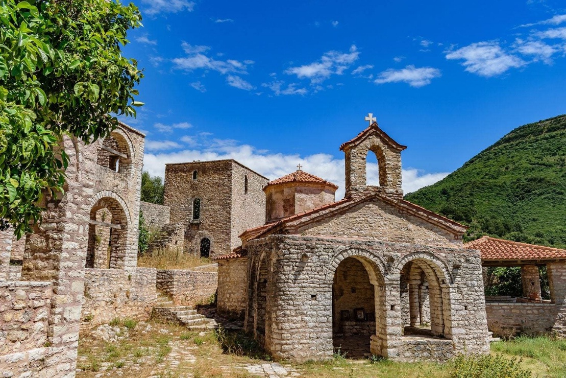
- Church of Saint Mary Monastery in Mavrodhivër is located in the village of Dhivër. It was built in the late 16th century AD. The site consists of the nave, the narthex and the altar. The first is a 7.30 m x 4, 80 m nave and is divided into three naves, with the central one being higher than the two lateral ones. The nave is lighted by small windows and is connected to the narthex on the west side. The altar area contains the prosthesis niche and the apse. The church’s murals were painted in 1604 by Mihail and Kostandin from the village of Gramoz. The church was restored in 1998. The church frescoes are damaged at the bottom 1 m above the floor.The site is a basilica type church, covered with a system of arches. The wall is built with stones and lime mortar.
- The Saint Gjergj Church is located in the village of Upper Leshnicë. It is a simple single-nave church, built in 15th century on a steep terrain. It is one of the first post-Ottoman churches built in the country with its interior size 5,30 x 2,90 m. It consists of the nave and the altar area with a circular apse protruding from the nave and a simple wooden iconostasis. It is covered with a wooden roof, without a ceiling and windows, and a stone-paved floor. The church’s interiors were painted by Ilia Llongoviti (1525) from the village Llongo, Dropull, who has also painted the frescoes at the Saint Thanas Church in Pecë. The paintings in these churches are some of the oldest in Albania, after the Ottoman occupation.
- Church of Saint Mary Monastery in Krimarovë is built on the hilly area overlooking the village of Piqeras and the coastal landscape. The church represents the monastery’s compositional center, with all it remains being ruins of the dwellings on the northern and southern sides. It consists of the nave and narthex on the west side. The architecture is of the basilica type with dome, triabsidal, with internal dimensions 8.30×4.60 m. It is divided into three longitudinal naves through two rows of columns. The central nave is covered with a cylindrical vault and it is intersected in the central part by the dome. The year 1672, carved on a walled stone above the southern gate of the church of the monastery of St. Mary, indicates the time of its construction.
- Peshkëpi Church is located southeast of the village Nivicë – Bubar, in the place known by the locals with the micro-toponym Peshkëpi. It is a three-nave basilica with arcades on wall pillars, with three apses on the east side and a narthex on the west side. The central apse was three-sided on the outside and semicircular on the inside, while the prosthesis and diaconicon apses were semicircular. The maximum length of the basilica, together with the apses and entrances is 16×12.4 m. Its floors are paved with the opus sectile technique. These stages are also reflected in the mural painting, which decorated the church walls and arcades on the dividing pillars of the naves. The composition featuring the narthex was created during the first phase and it depicts group of people identified with the martyrdom of the 40 Saints of Sebaste that has to do with the symbolism of the Baptism of Christ. The time when the church was destroyed and consequently abandoned is related to the events in 1336 and the punitive campaigns launched by the Byzantine emperor Andronicus III Palaeologus.
- The Saint Mary Church in Malçan village, Dhivër is a pot-Byzantine church with a cross-shaped structure and with a dome, built in the late sixteenth – early seventeenth century. It consists of a nave and a narthex on its western side. The nave is of the cross-shaped dome with internal dimensions of 6.60 x 5.90 m, but the compositional features and structural construction are still incomplete. The altar area, which is divided by a wooden iconostasis supported on the eastern pair of columns, contains the bema with the protruded apse. Unlike the church’s bare walls, the drum is highly decorated. It contains 12 niches of stepped windows and covered with brick arches, on which a flat frieze decorated with pieces of tiles is sculpted. The narthex is simple, covered with wooden roof without ceiling.
- Saint Thanas Church in Sopik is built on the highest hill in the centre of the village of Sopik. It consists of narthex, central nave and apse. On the north side, the porch of the church is provided with one division roof. Nowadays, the church looks like a 17th century construction and it is thought to be raised on the foundations of an earlier building. The church’s interior does not feature any exposed frescoes, which have been covered with plaster during Albania’s dictatorial regime.

- The Saint George Monastery (Manastiri i Shën Gjergjit) in Demë is built on the hill of Dema and offers stunning views over the Ionian See on one side, and the Butrint Lake to the other, overlooking the strip of land dividing the Ionian Sea and Butrint Lake on the top of the Ksamil Peninsula. Although located far from residential centers, the site has been quite famous in ancient times because of the barrier wall in foothill, extending from the lake to sea to fortify the territory of the city of Butrint. Two chapels and two service buildings are all what it remains from the old monastery, while the rest are new constructions.
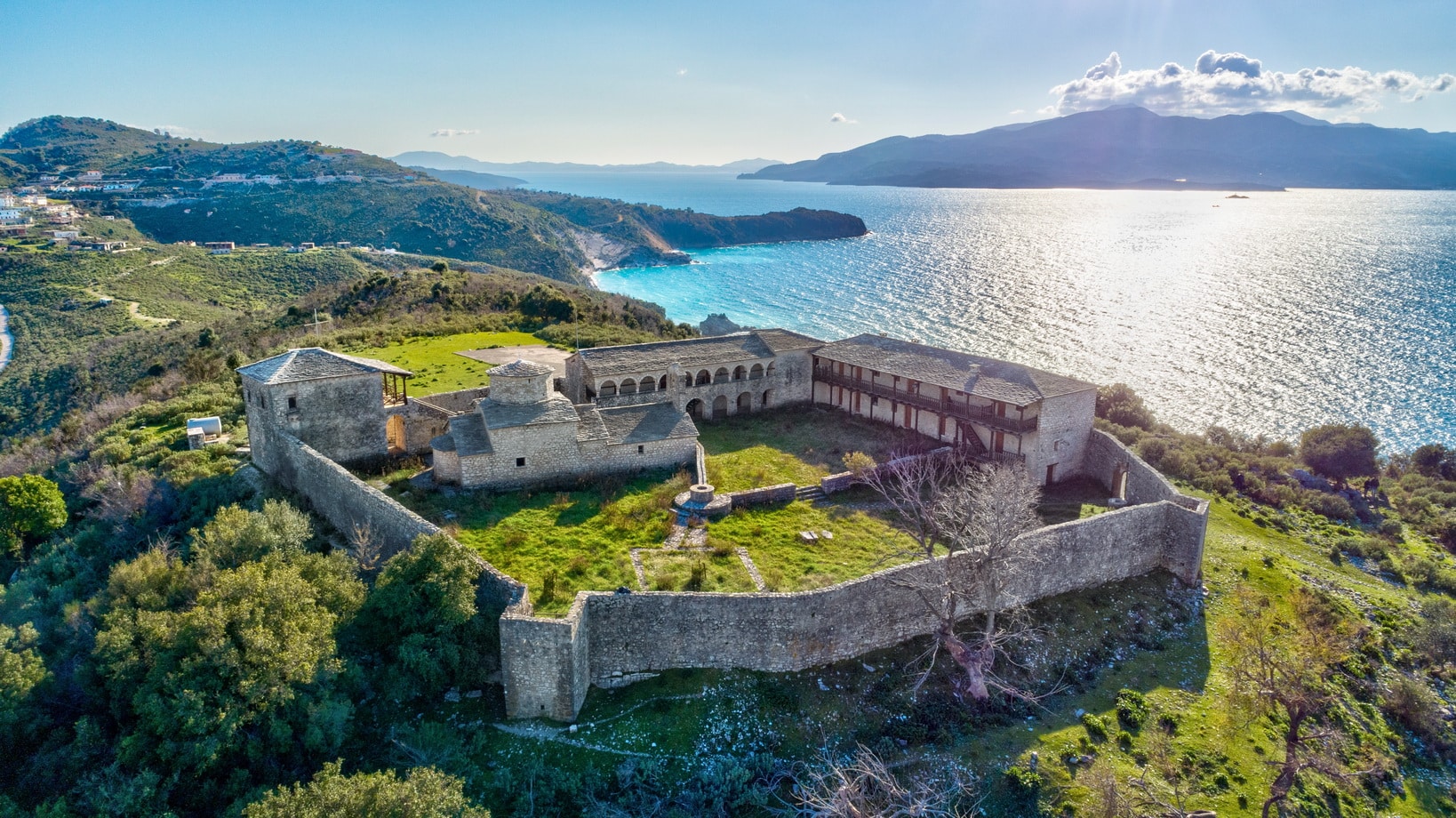
- Monastery of Shën Mëri in Krorëz rises on a rocky shore with natural protection and a broad view of the coastal landscape. Churches and towers remain from the monastic complex. The church is in a cross shape, with a dome with internal dimensions 7.90 x 4.40m. There is a two-storey bower in the church. The tower or the fortified building is three-storey, with closed style and few and small lighting spaces. Besides these buildings, there are ruins of other buildings around the church. The monastery courtyard is paved with stone slates.
- The mosaic is found on first floor of former Post Office building. The mosaic was discovered in 1968 by archaeologist Dhimosten Budina and it dates back to the Late Antiquity. The hall was discovered during the work on construction of the former Post Office building. Fragments of the mosaic were unearthed and it shows the premises of a third-century building. According to the archaeologists involved in the excavations, interventions were noticed to turn the building into a religious site (fourth-century basilica). The 12.8 m x 11 m mosaic consists of three parts: emblems, frames and side motifs. It is built of small stones and lime mortar. Certain parts of the mosaic are damaged and deformed; the eastern part differs from the western one, and the mosaic is mainly composed of geometric figures (arches, squares and spirals) and birds, the most beautiful of which is the Eucharistic scene. Apparently, one or two centuries after the initial stage of decoration, mosaic craftsmen have faced new demands as the building’s function was changed.
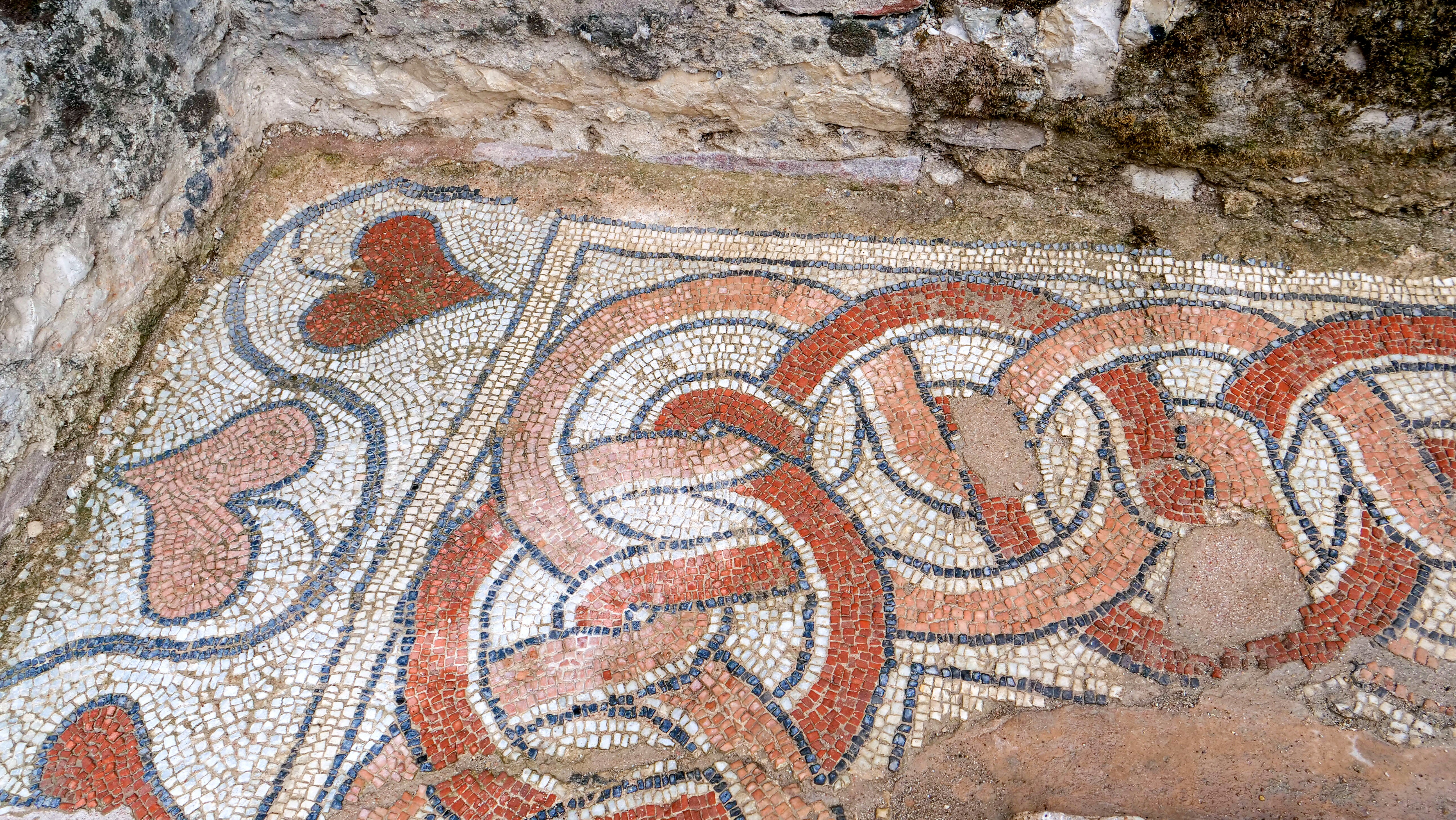
- Synagogue and Basilica in Saranda; Traces of a mosaic were unearthed at a depth of around one meter during the excavation works on construction of the Palace of Culture in the southern coastal town of Saranda. The ruins are the remains of the center of what was once a wealthy Jewish community that lived in the area. Regular archaeological excavations have taken place on the site discovering interesting building ruins dating back to the Early Medieval period. These ruins, if considering the traces of the medieval castle, are related to the constructions inside it. Recent excavations clearly show that a religious building with its floors covered with mosaics has most probably been part of the construction ensemble.

- The nearby basilica is located west of the village of Çiflik and Çuka e Ajtoit, on a low hill on the bank of the Pavël River. Other ruins that the locals call “monastery” are found on the hilly plateau. The church is a three-nave basilica and consists of the nave, the narthex and the altar. The three-layer construction technique, with the lower one being built with stones and pieces of bricks and tiles between them, the middle one shows the same technique with the east wall and the upper one with the clausonage technique, rank the church in close relations with the churches in Berat and in general with the churches of Arta in Epirus. The church is thought to date back to the 13th
10. Lezhe District
- Lisus Castle and Skanderbeg Memorial; the early stages of construction of the Castle of Lezha date back to third century BC. The walls’ maximum height is 8 m and width 2.5- 4 m. m. Later phases saw Roman, Byzantine, Venetian and Ottoman buildings on the Hellenistic buildings. The castle covers an area of 2 ha, and the perimeter of the surrounding city walls is up to 850 m. The castle’s lower part has defensive purposes and the upper part where we distinguish the constructions of social character such as: religious sites, water reservoirs, weapon storehouses and dwellings. The earliest construction phases have ancient typology, with large dry stone walls and placed in polygonal and trapezoidal.
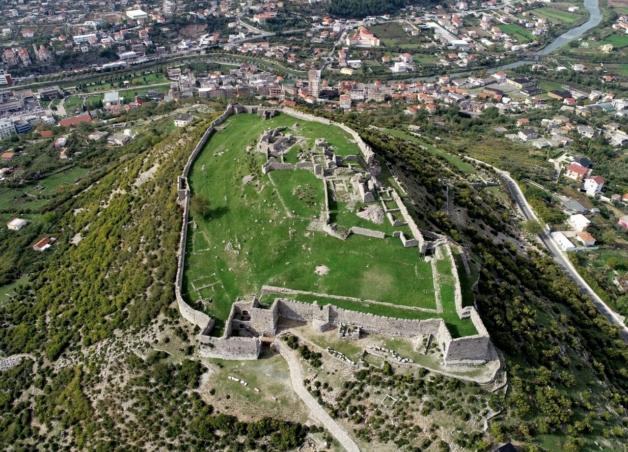
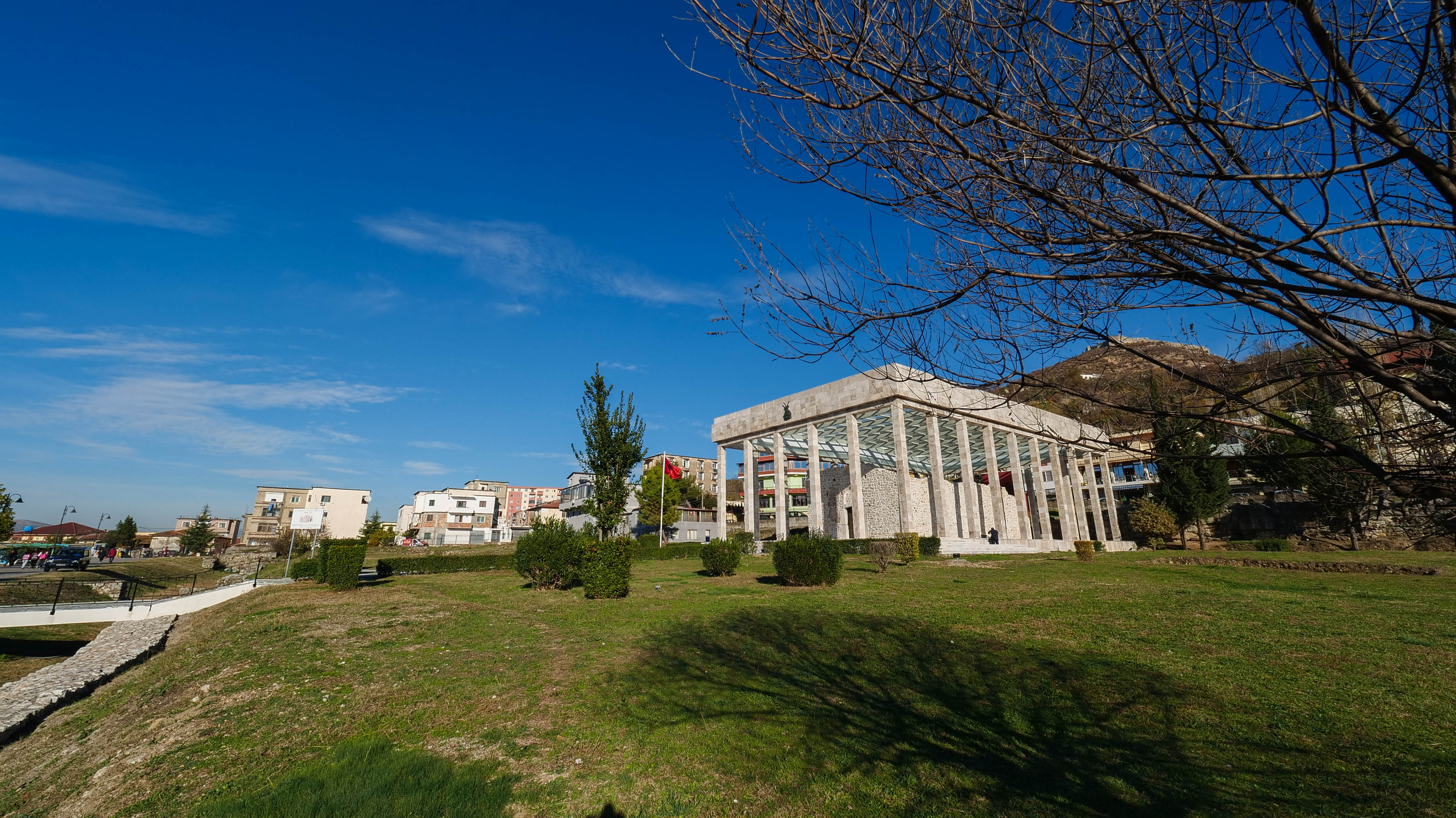
- Ruins in Shelbuem Mountain (Akrolis), Lezhe; Akrolis represents the earliest traces of civilization in the city and suburbs of Lezha as it coincides with the historical period of transition from the Bronze to the Iron Age. This archaeological site, in addition to several mural fragments both in north and southern side is somehow poor in terms of the archaeological material, as the latest archaeological expeditions in 2007 have shown. Some fragments of polygonal type walls are still to be found in the northern side that testify to the oldest traces of this ancient fortification, whereas the four trapezoidal rows of stones still preserve the remnants of the ancient Saint Shelbuem Church, which was turned into a mosque during the Ottoman invasion after 1478.
- Rubik Church (Rubik Municipality, Mirditë) or Shelbuemi Church, currently under the jurisdiction of the newly established diocese of Rrëshen, has historically been part of Lezha diocese. It was built in century XII as a Byzantine church and repainted in 1272. According to written texts, it is closely linked to a community of monks of the Benedict Order. This is also evident in the clothing of Abbot Innocent, presented in miniature in Deisis composition, which belong to the Latin rites.
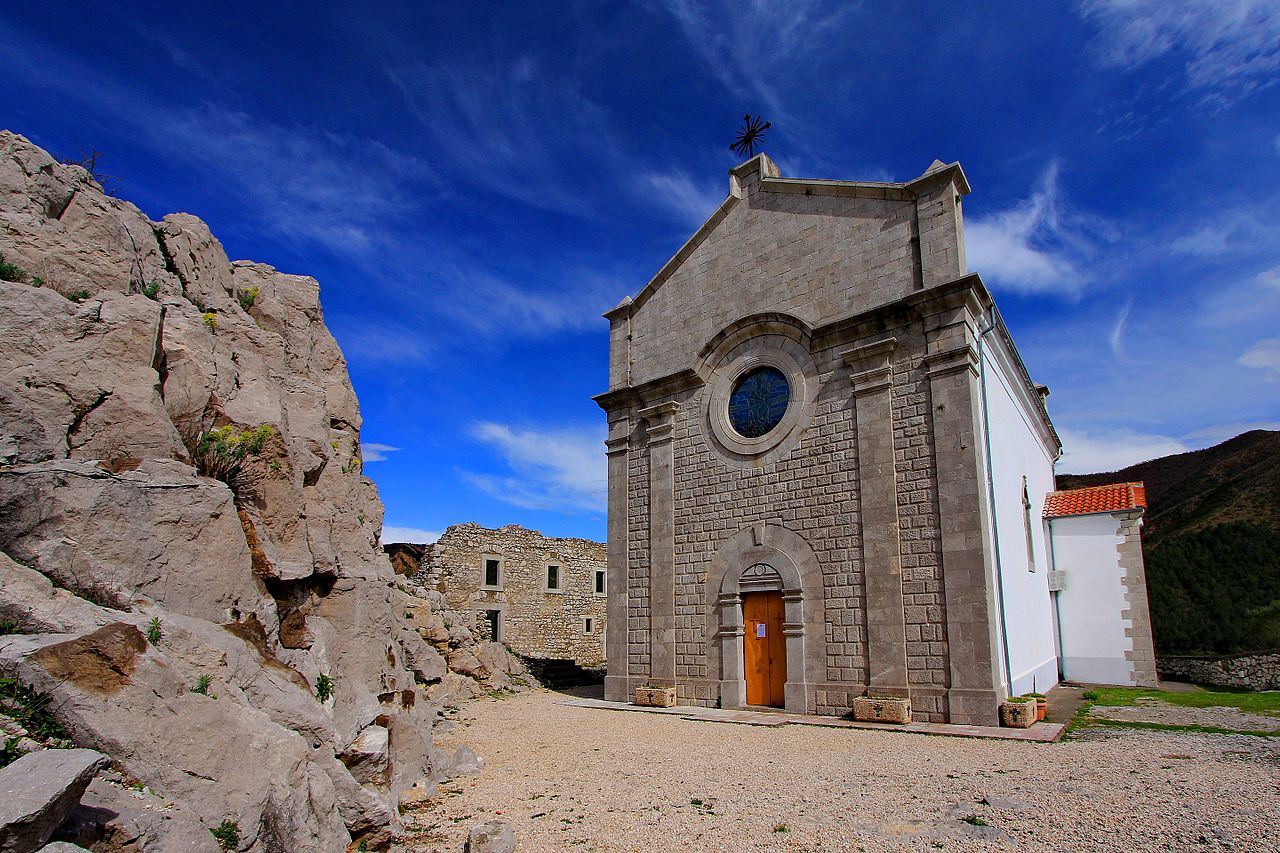
11. Berat District
- The museum city of Berat is a world cultural heritage site (traditional historic neighbourhoods like Mangalem, Gorice and Castle, the Onufri National Iconographic Museum and other galleries, museums, churches and mosques). Berat has been inscribed on the UNESCO’s World Heritage Site list since 2008. In 2010, the majority of international tourists to visit Berat came mainly from the Western Europe, namely from France, Great Britain, Italy and Germany (55%), and Albanian nationals living abroad (29%).

- The Lead Mosque, also known as the Izgurli Mosque, is a 16th-century historical mosque located in the centre of Berat. The site was built between 1553 and 1554 by the local feudal Ahmet Bej Izgurliu, at the time a vassal of the Skuraj family. The Lead Mosque was built on the site of an early monastery. It was the first small monumental type mosque, typical for the Balkan countries, with a spherical dome and a portico in front of the entrance, unlike other mosques built in Berat until then. The Lead Mosque in Berat is classified in the same typology like the Mirahori Mosque in Korça, Muradie Mosque in Vlora, Gjin Aleksi Mosque in Delvine and the Allajbegie Mosque in the town of Peshkopi that were all built during the period between 15th and 17th Actually is consists of the prayers hall that has an elegant decorated ceiling in wood and its entrance. The shrine is built with wide-stone walls. Five open windows are on the three sides. The walkway leads you inside the mosque and the minaret rises on the right site. The mosque’s exterior has a sensitive decorative aspect created by placement of red bricks in two horizontal rows and by white squares of stones separated from each other by two vertical bricks alternating from row to row.
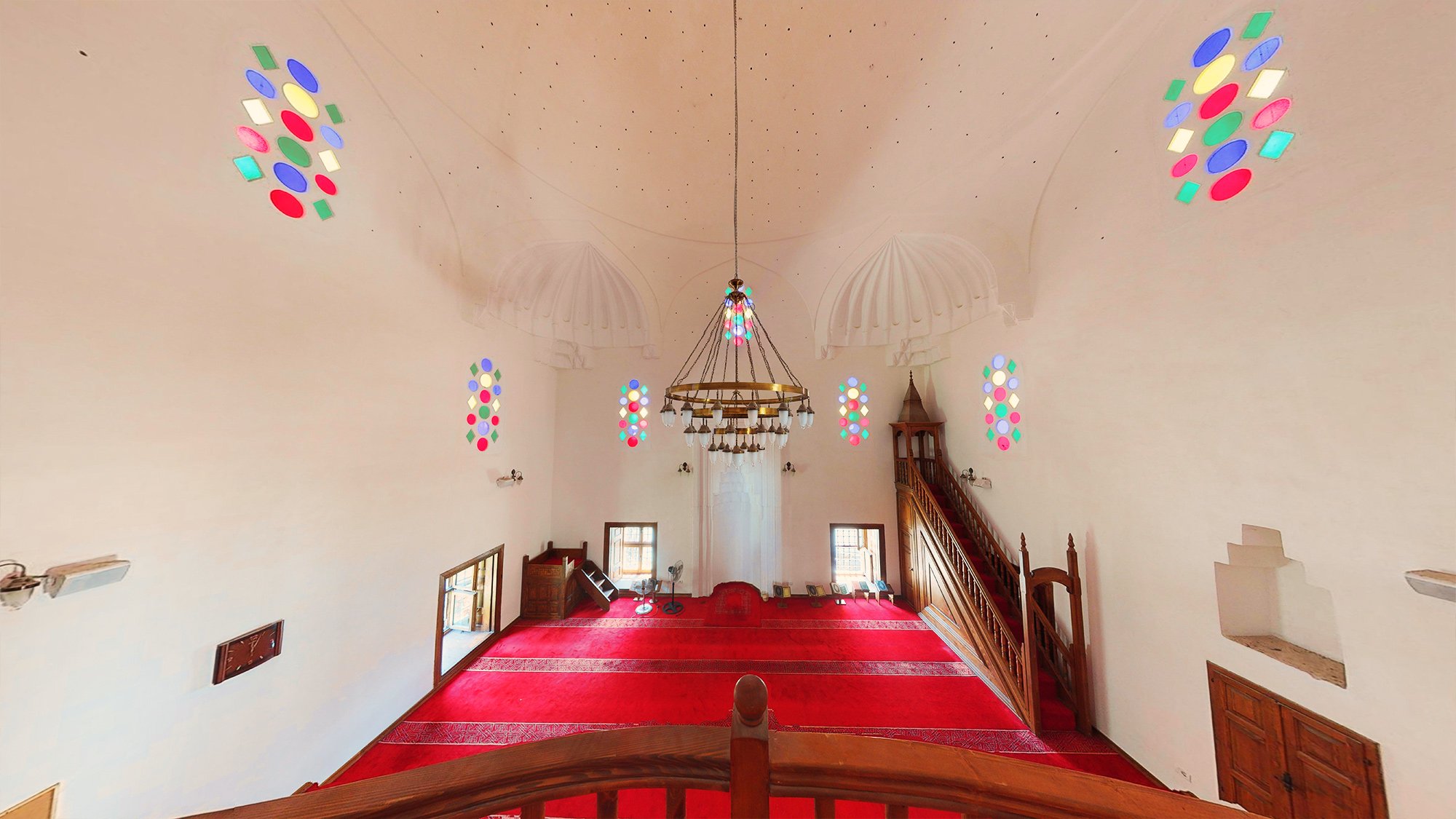
- Berat Castle is built on a hilltop 187 meters high, to the left of the mouth of the river Osum. Originally a proto-urban settlement, in the VII-V century BC, as a strategically important point, it was transformed into a castle town with walls reaching up to 1,400 meters in length and with an area before 10 ha. Historical sources prove that since this year the castle of Berat has been the object of various attacks. In the past the safety of this castle has been maximal, because its designers built it exactly on this hill where the south side falls sharply on Osum, the east and west sides have a steep slope while on the north side the hill sits towards the neck of Bifta, providing communication. Unlike other fortifications, Berat Castle boasts 24 towers with squared shape stones and built at different periods starting in the fourth century BC and their construction completed under Ali Pasha’s reign (1813-1821). The 9.6-ha area of the castle houses a number of churches, most of them now turned into ruins, Turkish sarays (palaces), the ruins of two mosques, water wells called Saranxha, Sallabanda square, the square called the big field etc.

- Gorica Bridge, built in the centre of Berat city, the magnificent Bridge of Gorica over Osum River is one of the most beautiful Ottoman bridges in the Balkan region, and connects the city with the neighborhood of the same name. Originally built in wood in 18th century, it was later built with a double vaulted stone structure in 1777, under the rule of Ahmet Kurt Pasha and rebuilt in 1920, 1930, when it was adapted to serve both as a bridge for pedestrians and for vehicles. The 129-metre long and 5.3-metre wide bridge is built about 10 metres above the riverbed. It is a seven-arch elegant bridge along its whole length. The Bridge remains intact following a series of repair and reconstruction works in the end of 19th century and early 20 century. It is a 127-meter long stone bridge built during the Ottoman era and it is still functional. The bridge is built over seven large semicircular arches at the foot of which are six large discharge windows and ten with small side windows above them to reduce the hydrodynamic pressure on the bridge walls in the case of large river inflows. The discharge windows are mainly semicircular and slightly arrow-shaped and quarter-circular in shape. The frontal part of the walls and arches are built of limestone carved with distinct joints between them.
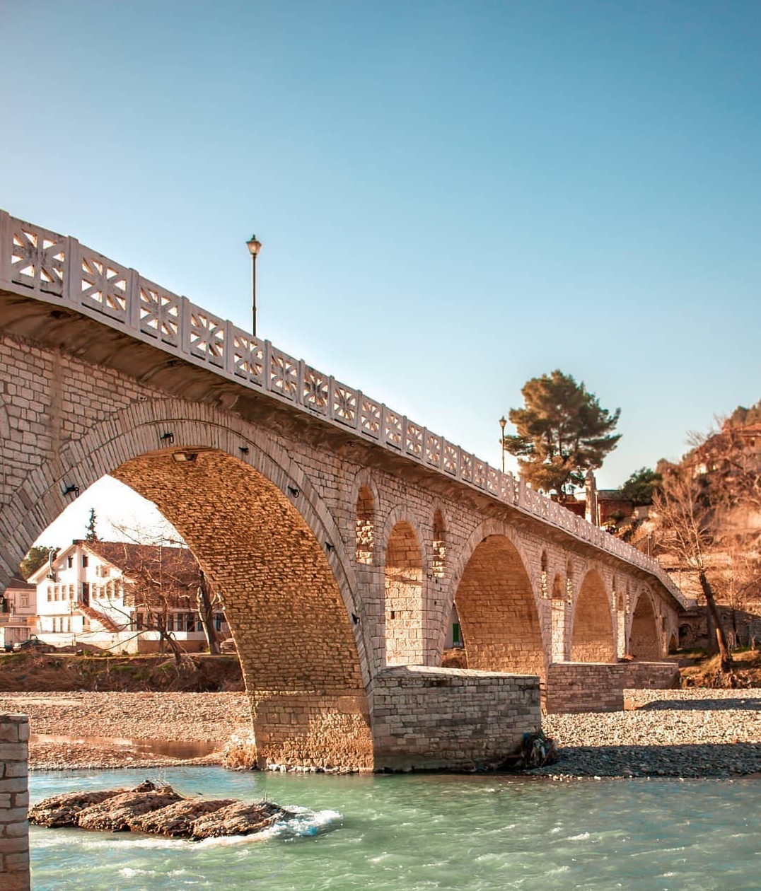
- Bachelors’ Mosque is a first-class monument of culture, boasting many architectural valies and representing a major achievement in terms of construction of religious buildings in the city of Berat. It was built in early 19th century in the Mangalem neighbourhood and was designed to be a place of prayer and reflection for the bachelors of the city workers’ guilds, who also worked as night Bazaar guards. When building the temple, it was decided to apply wall painting on the internal and external facades. Fragments of geometric formations and religious paintings created in the years 1827-1828 have survived to this day. The massive body, low minaret and front arches with stone columns are the hallmarks of the building. The Mosque is a two-storey building to adapt to steep terrain, where the lower floor rises into a portico with columns of gray stone rings.
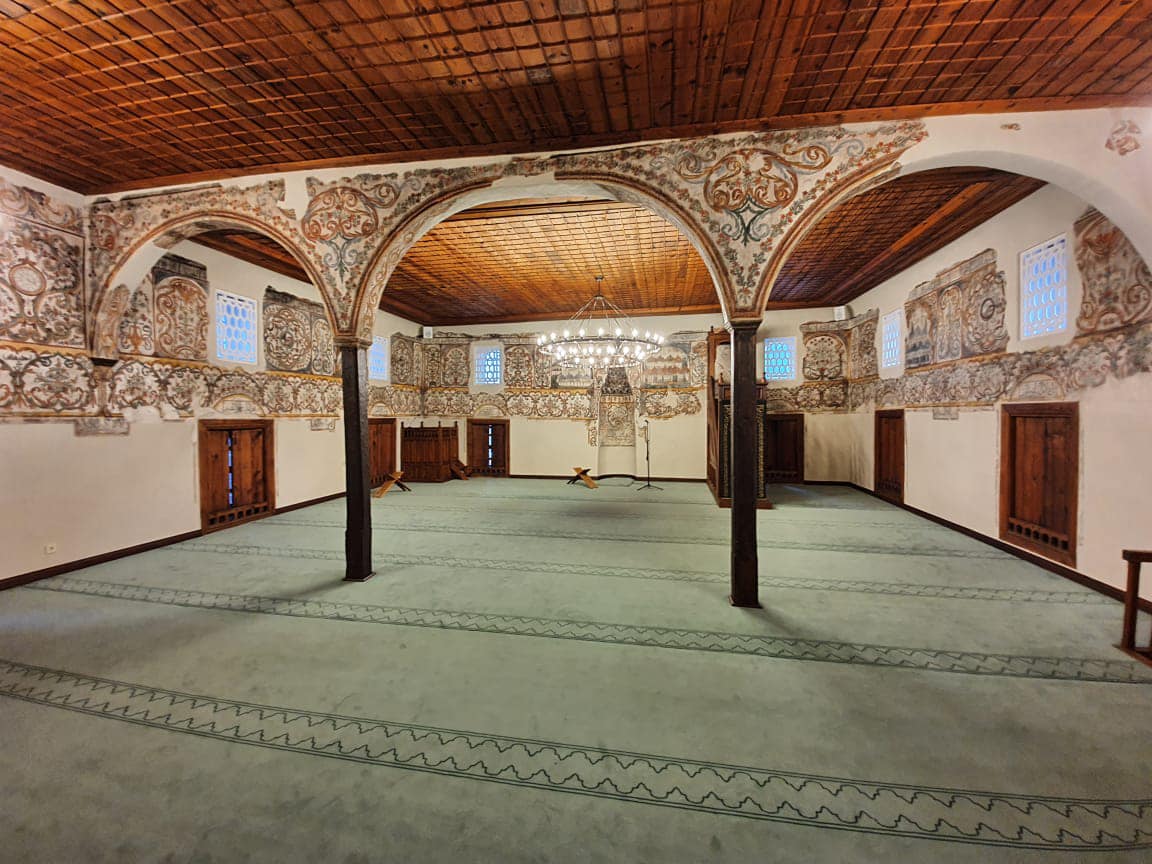
- The King Mosque, also known as the Sultan’s Mosque, was built in the 15th century and is one of the oldest in Albania. The mosque was in danger of collapsing during 1832 and 1833 and underwent a almost complete rebuild according to the then construction techniques and historic conditions. The mosque was part of a socio-religious complex, along with other buildings, such as tekkes, libraries, the inn of the dervishes, etc. Two architecturally masterfully executed tombs (monumental tombs) are found on the Mosque’s northern side. The mosque’s interior is distinguished for the special composition of the constituent parts.
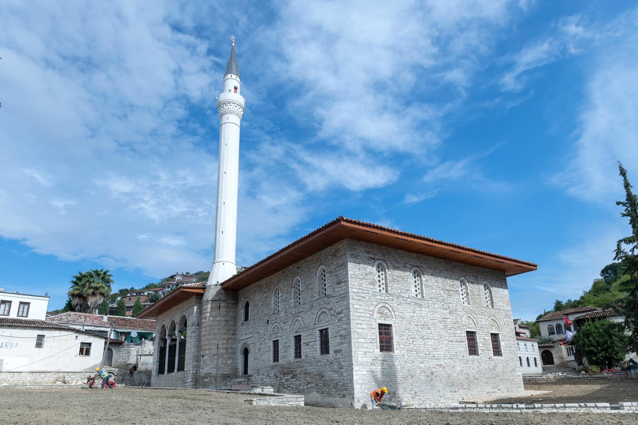
- Halveti Tekke is part of the socio-religious complex that includes the King Mosque, the Inn of the Dervishes and the Sheh Qerim Tekke and it is one of the rare monuments of unparalleled architectural and artistic values. This, fairly small, square building was where the dervishes performed. It has a beautifully painted wood ceiling decorated with gold leaf and was specifically designed to improve the sound quality, and there is a balcony for the musicians. The building dates from the 15th Century although it was rebuilt by Ahmet Kurt Pasha in 1782. There is an inscription above the doorway which is dedicated to him. It has a small square prayer hall with an external portico.
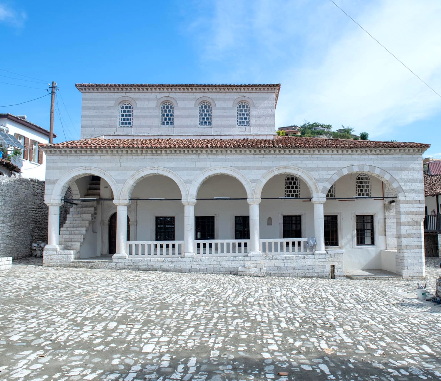
- Saint Kolli Church, Perondi is located near the town of Kuçova. The only available information about the village and the church is a note left by the Bishop of Berat Monastery, Anthimios Aleksudhis by end of 19th According to this note, in 1399, the abbot of Shën Kolli monastery in Pendearhontion gave the library to Theodore III Muzaka, in order to save it from the Ottomans. In another publication, Aleksudhis provides information about the village itself, underlining that the portrait of the Byzantine emperor Andronicus Palaeologus and other members of the royal family were once painted in the portico below the bell tower. The church or the monastery in Perhondi was administrative part of the city of Berat. It is a basilica type with a dome. Images of the Saint Mercurius and the Archangel Michael are presumed to be patrons of the church and have apotropaic function as they are often found at the entrance. The side arcades also feature fragments of holy images. The church is completely covered with lime plaster inside and only a few fragments have been clarified.
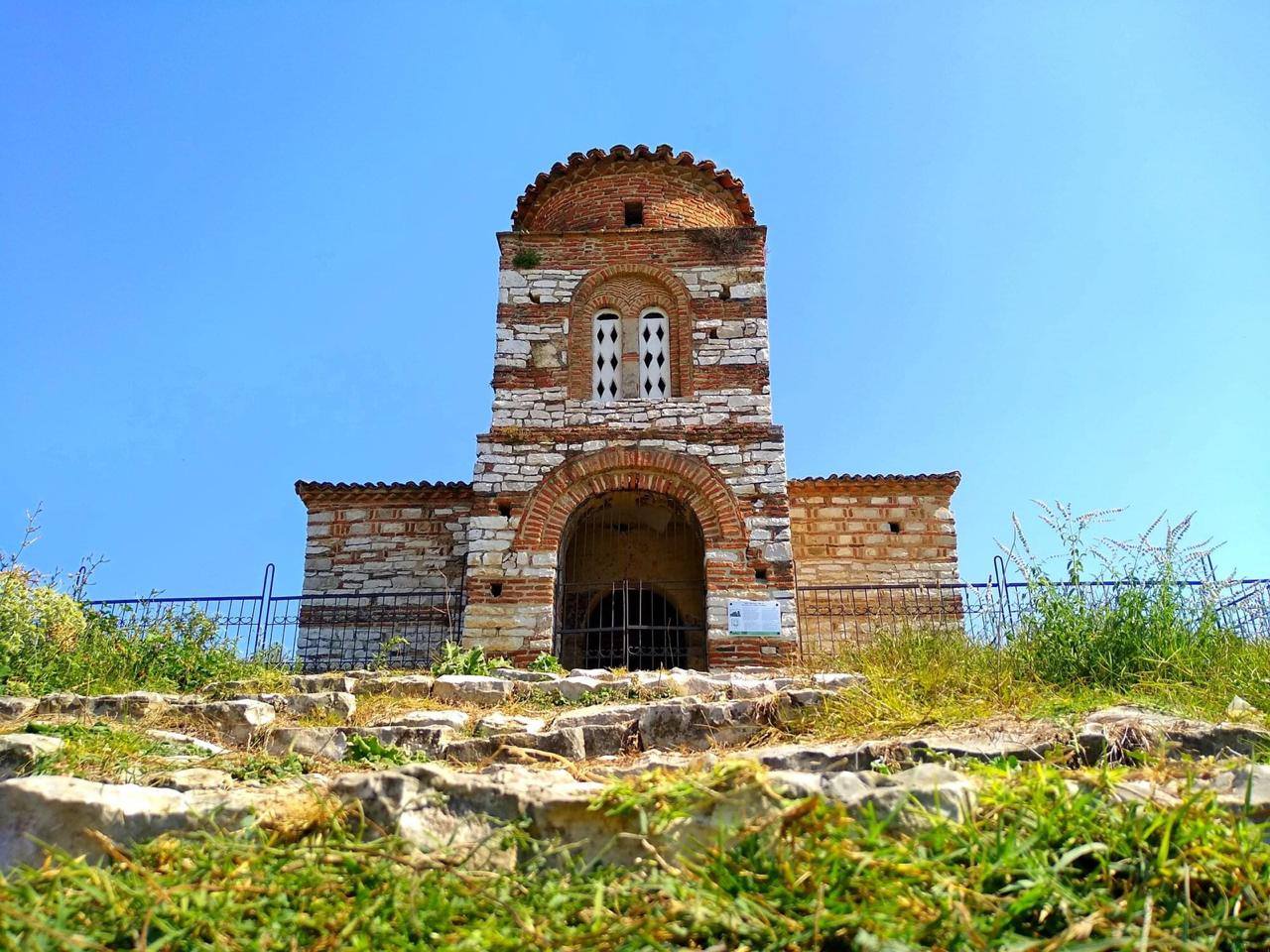
- Onufri Iconographic Museum is housed inside the Assumption of St. Mary Church inside the old Berat castle walls since February 27, 1986. The museum was named after Onufri, an Albanian painting headmaster in the 16th century. According to various inscriptions, the Cathedral was rebuilt in 1797 on the foundations of an older Byzantine-era church. It represents one of the most typical post-Byzantine architectures in the city of Berat. The Museum’s collection features around 200 artefacts selected from the funds of churches and monasteries of the district of Berat. Its collection mostly comprises icons, as well as a set of liturgical artefacts. The artefacts displayed in this museum are thought to be some of the oldest ones. The icons displayed here are created by icon painters such as: Onufri, Nikolla, son of Onufri, Onufër Qiprioti, David Selenica, Kostandin Shpataraku, Adam Kristo and painters with the surname Çetiri (Gjergji, Joani, Nikolla, Naumi and Ndini), as and by many other anonymous painters. The liturgical artefacts here are created by Albanian jewellers over the centuries.
- Ethnographic Museum is located near the city’s historic centre (lMangalem and Kala neighbourhoods). Opened in 1979, the National Ethnographic Museum of Berat is housed in a striking, typical 18th century two-story Berat residence. The ground floor of the building replicates a traditional medieval bazaar lined with embroidery, woodcarving and metalworks shops, all of which were a primary source of life and commerce at the time. The house’s front yard displays an old water well, typical for all the residences in Berat. The museum houses approximately 1200 cultural heritage objects, beautifully placed on window ledges, shelves, or near the white fireplace, all wonderfully decorated by ethnographers.

- Churches and chapels inside Kala quarter, Berat. Kala (Castle) quarter is sits on the highest point of the city’s historic centre and one of the few Albania’s Medieval-era monuments to retain an intense life within its walls. Until 13th century, the medieval city developed mainly within the castle’s territory that housed a significant number of dwellings along with many religious, defence and engineering monuments. The castle and the other two neighbourhoods took today’s look in the 18th and 19th Kala quarter is home to a number of interesting churches and tiny chapels, including Church of St. Constantine and Helena, Church of St. Mary Blachernae, Church of St. Kolli, Church of St. Triadha, Church of St. George, Church of St. Mitre, Church of St. Todr, Church of St. Sophia and Church of St. Evangelista.

